Hayesville in Clay County, North Carolina — The American South (South Atlantic)
The Spikebuck Mound and the Origins of Quanassee

Photographed by Mark Parker, May 10, 2025
1. The Spikebuck Mound and the Origins of Quanassee Marker
Long before Europeans visited Quanassee town, this valley was home to large communities of native farmers who produced crops of corn, beans, pumpkins, sunflowers, and tobacco in the rich riverbottoms along the Hiwassee. The Spikebuck mound and village once served as the ritual, civic and political center for one such community that spread for miles along the river near Hayesville. The mound, constructed more than 700 years ago as a platform for a temple/council house, marks the spread of the Mississippian cultural pattern into the heart of the southern mountains.
This cultural complex, which saw the rise of settled villages and towns supported by large-scale maize agriculture, is a pattern shared by many different societies across much of the southeastern United States. The construction of platform mounds to define special ritual and political precincts within larger towns was a widespread Mississippian practice. Likewise, Mississippian societies shared broad themes and styles of sacred art, an indication of similar belief systems among diverse peoples of the Mississippian world. In many areas of the Southeast, the
this page online
The Spikebuck mound and village was one of a number of ritual/political centers in the upper Hiwassee River basin. Nearby centers with platform temple mounds were located at Hiwassee (Peachtree, NC), Nottely (Culberson, NC), and probably at Konahete (Andrews, NC). These mound centers probably represent distinct, politically independent towns, similar to autonomous Cherokee towns of the historic era. These southern Appalachian Mississippian mound towns were likely the direct (ancestral) antecedents of the Cherokee Valley Towns that Europeans encountered in the seventeenth and eighteenth centuries, and early written accounts of Cherokee villages probably depict lifeways very similar to those of earlier Mississippian societies in the mountains.
(Captions)
Hypothetical reconstruction of the Misssissippian period settlement at Spikebuck Mound, situated in the Hiwasee River Valley, with the Tusquittee Mountains to the west.
Artist's view of a Mississipian town and mound center. Many of these towns were surrounded by wooden stockades for military protection or to mark special social, political, or ritual spaces. Painting by Andy Buttram, Collection of the Illinois State Museum
Detail of the 1721 Barnwell map showing native settlements in the southern mountains. Many large historic era Cherokee towns, including Quanassee, Hiwassee, Knoahete, Nikwasi, Cowee, Estatoe, Nacoochee, and Great Tellico were mound centers during the earlier Mississppian period.
Topics.

Photographed by Mark Parker, May 10, 2025
2. The Spikebuck Mound and the Origins of Quanassee Marker and 2 other markers at mound site
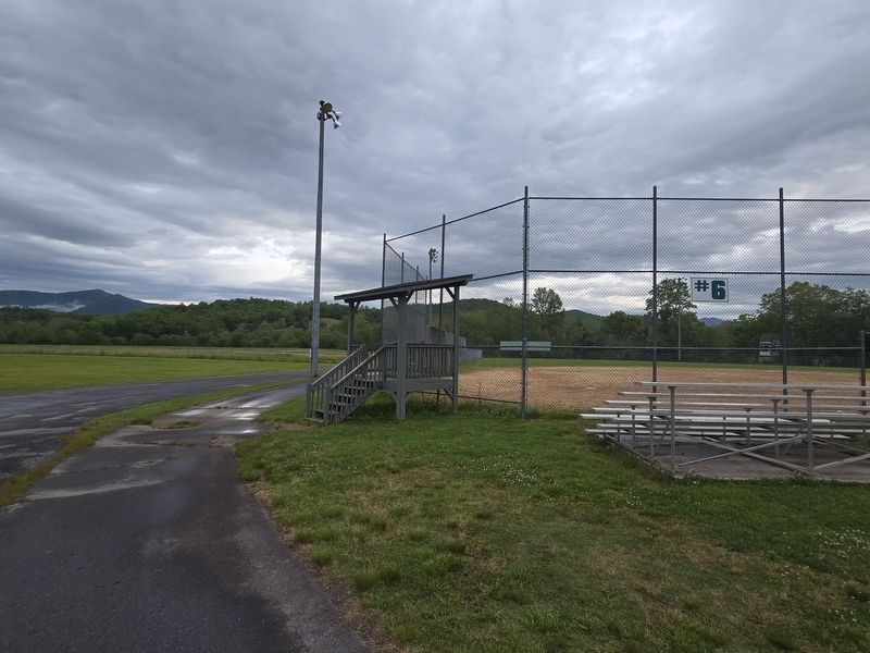
Location. 35° 2.86′ N, 83° 48.517′ W. Marker is in Hayesville, North Carolina, in Clay County. It can be reached from Ball Park Drive 0.4 miles east of Anderson Street when traveling east. Take Ball Park Drive until it ends at Field #6. From the parking lot, take the paved path 1/10 mile past the bridge. The marker is at the end of the path. Touch for map. Marker is at or near this postal address: 384 Ball Pk Dr, Hayesville NC 28904, United States of America. Touch for directions.

Regionally, this marker is in North Carolina’s Mountains. It is also in the American South, specifically in the Upper South, in Appalachia, and specifically in Southern Appalachia. Globally, it is in North America, the Western Hemisphere, the Western World, and the Anglosphere. Historically, it finds itself in what was once the original Cherokee Nation, the territory of the Mississippian Culture, one of the original Thirteen Colonies, one of
Photographed by Mark Parker, May 10, 2025
3. To reach the marker, find the path near field #6
Other nearby markers. At least 8 other markers are within walking distance of this marker: Quanassee Town and the Spikebuck Mound (here, next to this marker); Cherokee Towns Circa 1700-1740 (here, next to this marker); A Tribute to Traditional Music (approx. half a mile away); A Tribute To Our Quilting Heritage (approx. half a mile away); Historic Clay County Courthouse (approx. half a mile away); Fort Hembree (approx. 0.6 miles away); In Memory Our War Dead (approx. 0.6 miles away); George W. Truett (approx. 0.6 miles away). Touch for a list and map of all markers in Hayesville.
Another marker is no longer nearby. Quanassee Town and the Spikebuck Mound (was here, next to this marker but has been replaced with another marker now near it).

Photographed by Mark Parker, May 10, 2025
4. To reach the marker, find the path near field #6

Photographed by Mark Parker, May 10, 2025
5. Continue along the path and cross the bridge. Markers are just past the bridge
Credits. This page was last revised on May 13, 2025. It was originally submitted on May 12, 2025, by Mark Parker of Hickory, North Carolina. This page has been viewed 273 times since then and 64 times this year. Photos: 1, 2, 3, 4, 5. submitted on May 12, 2025, by Mark Parker of Hickory, North Carolina. • Devry Becker Jones was the editor who published this page.
