Mokane in Callaway County, Missouri — The American Midwest (Upper Plains)
Mysteries of Standing Rock
Photographed by John Ridley, April 28, 2023
1. Mysteries of Standing Rock Marker
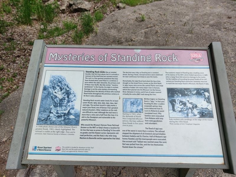
Standing Rock looks like an isolated boulder that fell from above, but it is actually a remnant of the bluff that has resisted erosion. The rock is a fine-grained sandstone that may have formed when sand filled in a sinkhole or joint within the older dolomite, the primary rock of these river bluffs. But like similar "mystery sandstones" in the Ozarks, its origin is unclear. Geology is not the only mystery surrounding Standing Rock: the identity of those who marked flood levels throughout the previous century on its face is also unknown.
Standing rock records water levels for at least seven floods: 1903, 1923, 1935, 1943, 1944, 1947 and 1998. The earliest record in 1903 marks a major June flood, one of Kansas City's greatest natural disasters. Other notations on the rock are difficult to read. Although the trail here is more than a mile and a half from the river, it is still in the floodplain and vulnerable to the powerful Missouri.
Why would the Missouri-Kansas-Texas Railroad (known as the MKT or Katy) choose a location for its line that was so prone to flooding? A line with no grades and the fewest curves represents
this page online
The decision was risky, as flooding was a constant threat. During a flood, railroad workers were mobilized for near-continuous hard duty to save the tracks.
Remarkably, the 1935 flood took palce during a long drought on the Great Plains, known as the Dust Bowl. In 1935, heavy rains across the central Plains sent large volumes of water into every major river in Kansas, which then poured into the Missouri via the Kansas River. Between 6 inches and 6 feet of water covered virtually the entire MKT track along the river.
Written higher on Standing Rock is "1943." In that year, flooding hit after a sudden snowmelt upriver. Katy trains detoured from St. Louis to Moberly to avoid inundated track. Fifty families were evacuated from Mokane with help from state guardsmen and volunteers.
The flood of 1947 was one of the worst in more than a century. The railroad stopped the shipment of all livestock and perishables between Sedalia and St. Charles. Half of Mokane's 550 homes flooded, and the townspeople were evacuated. One account said

Photographed by John Ridley, April 28, 2023
2. Mysteries of Standing Rock Marker
The economic impact of flooding was a leading cause of the demise of the MKT, which folded operations in 1986 when a large flood did extensive damage to the tracks. Yet the tradition of recording the great floods of the 20th century on Standing Rock continued. Someone returned to mark the last major flood in Missouri, the flood of 1993.
Erected by Missouri Department of Natural Resources.
Topics and series. This historical marker is listed in these topic lists: Industry & Commerce • Natural Features • Parks & Recreational Areas • Railroads & Streetcars. In addition, it is included in the Katy Trail State Park series list. A significant historical year for this entry is 1903.
Location. 38° 40.488′ N, 91° 52.232′ W. Marker is in Mokane, Missouri, in Callaway County. It can be reached from Katy Trail north of Fulton Avenue (County Highway C), on the left when traveling north. Marker is on the Katy Trail, not very close to crossroads. Touch for map. Marker is in this post office area: Mokane MO 65059, United States of America. Touch for directions.

Regionally, this marker is in Little Dixie and in the Missouri River Corridor. It is also in the American Midwest, in the Lewis & Clark Corridor, and in the Corn Belt. Globally, it is in North America, the Western Hemisphere, the Western World, and the Anglosphere. Historically, it finds itself in what was once the territory of the Mississippian Culture, the Louisiana Purchase, and the Antebellum South.
Other nearby markers. At least 8 other markers are within 8 miles of this marker, measured as the crow flies: History of Mokane (here, next to this marker); Mokane to Portland (here, next to this marker); Mokane to Tebbetts (a few steps from this marker); Katy Railroad (a few steps from this marker); The Lewis and Clark Expedition Across Missouri (approx. 4½ miles away); Old Jail - 1930 (approx. 5.4 miles away); Fur Trading in Missouri (approx. 6.2 miles away); History of Tebbetts (approx. 7½ miles away). Touch for a list and map of all markers in Mokane.
Credits. This page was last revised on May 13, 2025. It was originally submitted on May 13, 2025, by John Ridley of Chelsea, Michigan. This page has been viewed 214 times since then and 38 times this year. Photos: 1, 2. submitted on May 13, 2025, by John Ridley of Chelsea, Michigan. • Devry Becker Jones was the editor who published this page.
