Near Buena Vista in Marion County, Georgia — The American South (South Atlantic)
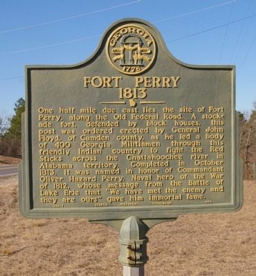
Fort Perry
1813
Erected 1954 by Georgia Historical Commission. (Marker Number 098-1.)
Topics and series. This historical marker is listed in these topic lists: Forts and Castles • Native Americans • War of 1812 • Wars, US Indian. In addition, it is included in the Georgia Historical Society series list. A significant historical month for this entry is October 1813.
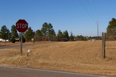
Location. 32° 28.691′ N, 84° 32.647′ W. Marker is near Buena Vista, Georgia, in Marion County. Marker is on Georgia Route 41, 0 miles north of Fort Perry Road (County Route 49), on the right when traveling north. Touch for map. Marker is at or near this postal address: 6185 GA Highway 41, Buena Vista GA 31803, United States of America. Touch for directions.
Other nearby markers. At least 8 other markers are within 14 miles of this marker, measured as the crow flies. Old Federal Road (a few steps from this marker); William Bartram Trail (approx. 0.2 miles away); Old Courthouse – 1848 (approx. 9.1 miles away); New Courthouse - 1850 (approx. 11.1 miles away); Private First Class Luther H. Story (approx. 11.2 miles away); Talbotton United Methodist Church (approx. 13˝ miles away); a different marker also named William Bartram Trail (approx. 13.6 miles away); Zion Episcopal Church (approx. 13.6 miles away). Touch for a list and map of all markers in Buena Vista.
Credits. This page was last revised on January 31, 2020. It was originally submitted on February 7, 2010, by David Seibert of Sandy Springs, Georgia. This page has been viewed 1,984 times since then and 37 times this year. Photos: 1, 2, 3. submitted on February 7, 2010, by David Seibert of Sandy Springs, Georgia. • Craig Swain was the editor who published this page.


