Hartsburg in Boone County, Missouri — The American Midwest (Upper Plains)
The Lewis and Clark Expedition Across Missouri
Photographed by John Ridley, April 27, 2023
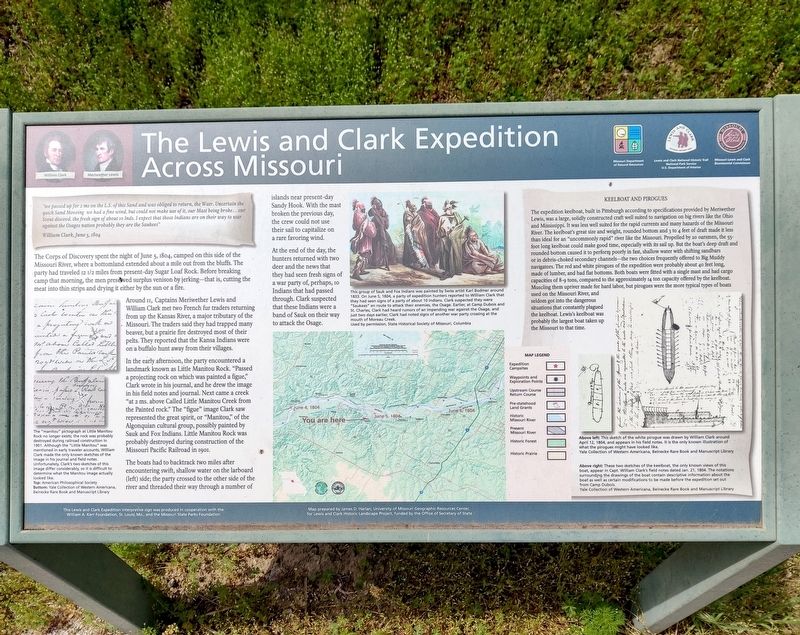
1. The Lewis and Clark Expedition Across Missouri Marker
Inscription.
The Lewis and Clark Expedition Across Missouri. .
"we passed up for 2 ms on the L.S. of this Sand and was obliged to return, the Watr. Uncertain the quick sand Moveing we had a fine wind, but could not make use of it, our Mast being broke… our Scout discovrd. the fresh sign of about 10 Inds. I expect that those Indians are on their way to war against the Osages nation probably they are the Saukees", William Clark, June 5, 1804
, The Corps of Discovery spent the night of June 5, 1804, camped on this side of the Missouri River, where a bottomland extended about a mile out from the bluffs. The party had traveled 12 1/2 miles from present-day Sugar Loaf Rock. Before breaking camp that morning, the men preserved surplus venison by jerking–that is, cutting the meat into thin strips and drying it either by the sun or a fire., Around 11, Captains Meriwether Lewis and William Clark met two French fur traders returning from up the Kansas River, a major tributary of the Missouri. The traders said they had trapped many beaver, but a prairie fire destroyed most of their pelts. They reported that the Kansa Indians were on a buffalo hunt away from their villages., In the early afternoon, the party encountered a landmark known as Little Manitou Rock. "Passed a projecting rock on which was painted a figue," Clark wrote in his journal, and he drew the image in his field notes and a journal. Next came a creek "at 2 ms. above Called Little Manitou Creek from the Painted rock." The "figue" image Clark saw represented the great spirit, or "Manitou," of the Algonquian cultural group, possibly painted by Sauk and Fox Indians. Little Manitou Rock was probably destroyed during construction of the Missouri Pacific Railroad in 1901., The boats had to backtrack two miles after encountering swift, shallow water on the larboard (left) side; the party crossed to the other side of the river and threaded their way through a number of islands near present-day Sandy Hook. With the mast broken the previous day, the ctrew could not use their sail to capitalize on a rare favoring wind., At the end of the day, the hunters returned with two deer and the news that they had seen fresh signs of a war party of, perhaps, 10 Indians that had passed through. Clark suspected that these Indians were a band of Sauk on their way to attack the Osage., [Sidebar:] ,
Seelboat and Pirogues. The expedition keelboat, built in Pittsburgh according to specifications provided by Merriwether Lewis, was a large, solidly constructed craft well suited to navigation on big rivers like the Ohio and Mississippi. It was less well suited for the rapid currents and many hazards of the Missouri River. The keelboat's great size and weight, rounded bottom and 3 to 4 feet of draft made it less than ideal for an "uncommonly rapid" river like the Missouri. Propelled by 20 oarsmen, the 55-foot long keepboat could make good time, especially with its sail up. But the boat's deep draft and rounded bottom caused it to perform poorly in fast, shallow water with shifting sandbars or in debris-choked secondary channels, the two choices frequently offered to Big Muddy navigators. The red and white pirogues of the expedition were probably about 40 feet long, made of lumber, and had flat bottoms. Both boats were fitted with a single mast and had cargo capacities of 8-9 tons, compared to the approximately 14 ton capacity offered by the keelboat. Muscling them upriver made for hard labor, but pirogues were the more typical types of boats used on the Missouri River, and seldom got into the dangerous situations that constantly plagued the keelboat. Lewis's keelboat was probably the largest boat taken up the Missouri to that time.
"we passed up for 2 ms on the L.S. of this Sand and was obliged to return, the Watr. Uncertain the quick sand Moveing we had a fine wind, but could not make use of it, our Mast being broke… our Scout discovrd. the fresh sign of about 10 Inds. I expect that those Indians are on their way to war against the Osages nation probably they are the Saukees"
William Clark, June 5, 1804
The Corps of Discovery spent the night of June 5, 1804, camped on this side of the Missouri River, where a bottomland extended about a mile out from the bluffs. The party had traveled 12 1/2 miles from present-day Sugar Loaf Rock. Before breaking camp that morning, the men preserved surplus venison by jerking–that is, cutting the meat into thin strips and drying it either by the sun or a fire.
Around 11, Captains Meriwether Lewis and William Clark met two French fur traders returning from up the Kansas River, a major tributary of the Missouri. The traders said they had trapped many beaver, but a prairie fire destroyed most of their pelts. They reported that the Kansa Indians were on a buffalo hunt away from their villages.
In the early
Click or scan to see this page online
afternoon, the party encountered a landmark known as Little Manitou Rock. "Passed a projecting rock on which was painted a figue," Clark wrote in his journal, and he drew the image in his field notes and a journal. Next came a creek "at 2 ms. above Called Little Manitou Creek from the Painted rock." The "figue" image Clark saw represented the great spirit, or "Manitou," of the Algonquian cultural group, possibly painted by Sauk and Fox Indians. Little Manitou Rock was probably destroyed during construction of the Missouri Pacific Railroad in 1901.
The boats had to backtrack two miles after encountering swift, shallow water on the larboard (left) side; the party crossed to the other side of the river and threaded their way through a number of islands near present-day Sandy Hook. With the mast broken the previous day, the ctrew could not use their sail to capitalize on a rare favoring wind.
At the end of the day, the hunters returned with two deer and the news that they had seen fresh signs of a war party of, perhaps, 10 Indians that had passed through. Clark suspected that these Indians were a band of Sauk on their way to attack the Osage.
[Sidebar:]
Seelboat and Pirogues
The expedition keelboat, built in Pittsburgh according to specifications provided by Merriwether Lewis, was a large, solidly constructed craft well suited to navigation on big rivers like the Ohio and Mississippi. It was less well suited for the rapid currents and many hazards of the Missouri River. The keelboat's great size and weight, rounded bottom and 3 to 4 feet of draft made it less than ideal for an "uncommonly rapid" river like the Missouri. Propelled by 20 oarsmen, the 55-foot long keepboat could make good time, especially with its sail up. But the boat's deep draft and rounded bottom caused it to perform poorly in fast, shallow water with shifting sandbars or in debris-choked secondary channels—the two choices frequently offered to Big Muddy navigators. The red and white pirogues of the expedition were probably about 40 feet long, made of lumber, and had flat bottoms. Both boats were fitted with a single mast and had cargo capacities of 8-9 tons, compared to the approximately 14 ton capacity offered by the keelboat. Muscling them upriver made for hard labor, but pirogues were the more typical types of boats used on the Missouri River, and seldom got into the dangerous situations that constantly plagued the keelboat. Lewis's keelboat was probably the largest boat taken up the Missouri to that time.
Erected by Missouri Department of Natural Resources; National Park Service, U.S. Department of the Interior; Missouri Lewis and Clark Bicentennial Commission.
Location. 38° 47.004′ N, 92° 22.756′ W. Marker is in Hartsburg, Missouri, in Boone County. It can be reached from Katy Trail south of South River Road, on the right when traveling south. Touch for map. Marker is in this post office area: Columbia MO 65203, United States of America. Touch for directions.
Regionally, this marker is in Little Dixie and in the Missouri River Corridor. It is also in the American Midwest, in the Lewis & Clark Corridor, and in the Corn Belt. Globally, it is in North America, the Western Hemisphere, the Western World, and the Anglosphere. Historically, it finds itself in what was once the territory of the Mississippian Culture, the Louisiana Purchase, and the Antebellum South.
Credits. This page was last revised on May 14, 2025. It was originally submitted on May 14, 2025, by John Ridley of Chelsea, Michigan. This page has been viewed 159 times since then and 26 times this year. Photo1. submitted on May 14, 2025, by John Ridley of Chelsea, Michigan. • Devry Becker Jones was the editor who published this page.
Editor’s want-list for this marker. A wide shot of the marker in context. • Can you help?