Hastings in East Sussex, England, United Kingdom — Northwestern Europe (the British Isles)
Castledown House
Photographed by Ray Gurganus, March 28, 2025
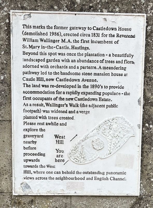
1. Castledown House Marker
Beyond this spot was once the plantation - a beautifully landscaped garden with an abundance of trees and flora, adorned with orchards and a parterre. A meandering pathway led to the handsome stone mansion house at Castle Hill, now Castledown Avenue.
The land was re-developed in the 1890's to provide accommodation for a rapidly expanding populace - the first occupants of the new Castledown Estate. As a result, Wallinger's Walk (the adjacent public footpath) was widened and a verge planted with trees created.
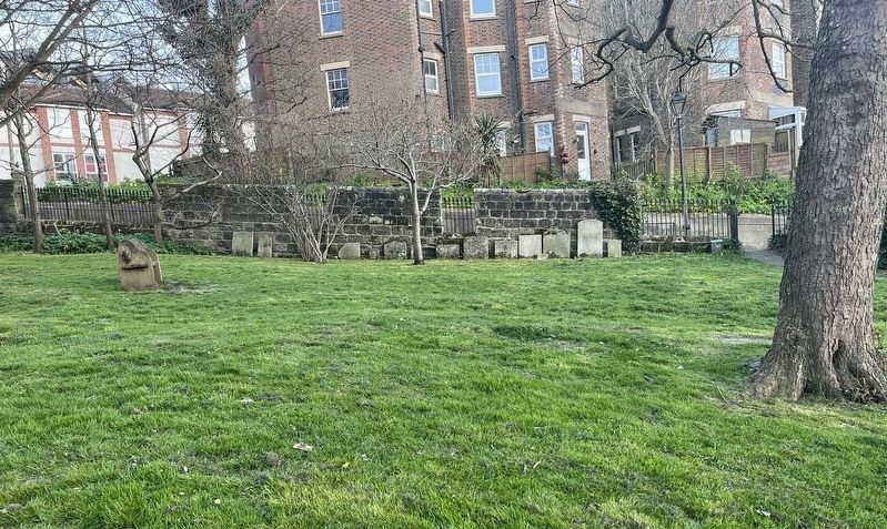
Please rest awhile and explore the graveyard nearby before proceeding upwards towards the West Hill, where one can behold the outstanding panoramic views across the neighbourhood and English Channel.
Topics. This historical marker is listed in these topic lists: Cemeteries & Burial Sites • Parks & Recreational Areas. A significant historical year for this entry is 1831.
Location. 50° 51.429′ N, 0° 35.061′ E. Marker is in Hastings,
this page online

Regionally, this marker is in the Greater South East. Globally, it is on the Atlantic Ocean, in the North Atlantic Region, in Europe, in Atlantic Europe, on one of the British Isles, in the Western World, and in the Anglosphere. Historically, it finds itself in what was once the Roman Empire.
Other nearby markers. At least 8 other markers are within walking distance of this marker: Lewis Carroll (1832-1898) (about 180 meters away, measured in a direct line); The Spirit of Cricket (approx. 0.3 kilometers away); South African War Memorial (approx. 0.9 kilometers away); The Toll Booths (approx. 0.9 kilometers away); Welcome to Hastings Pier! (approx. one kilometer away); The Pier at War (approx. one kilometer away); Oriental Pavilion - Opening Day (approx. one kilometer away); Bands in the Ballroom (approx. one kilometer away). Touch for a list and map of all markers in Hastings.
Photographed by Ray Gurganus, March 28, 2025
2. Adjoining park and cemetery
Credits. This page was last revised on May 28, 2025. It was originally submitted on May 14, 2025, by Ray Gurganus of Washington, District of Columbia. This page has been viewed 143 times since then and 23 times this year. Photos: 1, 2. submitted on May 14, 2025, by Ray Gurganus of Washington, District of Columbia. • Bill Pfingsten was the editor who published this page.
