
Sault Ste. Marie in Algoma District, Ontario — Central Canada (North America)
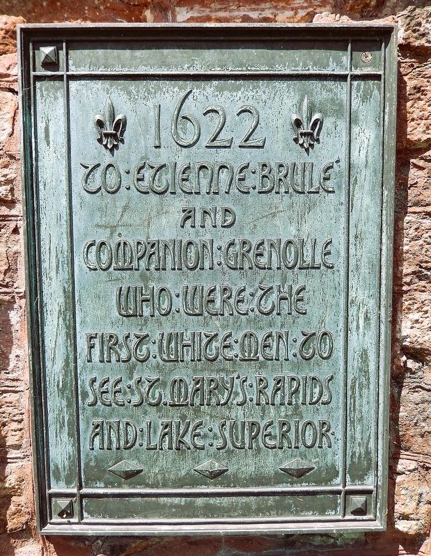
1622
Photographed by Cosmos Mariner, June 11, 2024
1. 1622 Marker
To Étienne Brûlé and companion Grenolle who were the first white men to see St. Mary’s Rapids and Lake Superior.
Topics. This historical marker is listed in these topic lists: Colonial Era • Exploration • Waterways & Vessels. A significant historical year for this entry is 1622.
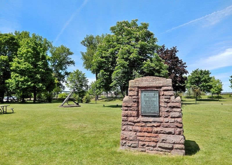
Location. 46° 30.789′ N, 84° 21.085′ W. Marker is in Sault Ste. Marie, Ontario, in Algoma District. It can be reached from Canal Drive 0.8 kilometers south of Huron Street. The marker is located at the Sault Ste. Marie Canal National Historic Site. Touch for map. Marker is at or near this postal address: 1 Canal Drive, Sault Ste Marie ON P6A 6W4, Canada. Touch for directions.

Regionally, this marker is in the Sault Ste. Marie and Algoma Area and in Northern Ontario. It is also in Central Canada. Globally, it is in North America, in the Great North Woods, on the Great Lakes, on Lake Superior’s North Shore, in the Western Hemisphere, in the Western World, and in the Anglosphere. Historically, it finds itself in what was once a British colony, the Viceroyalty of New France, the Haudenosaunee (Iroquois) Confederacy, and
this page online
Other nearby markers. At least 8 other markers are within walking distance of this marker: An Accident at the Canal / Un accident dans le canal (within shouting distance of this marker); The Canal at war, 1914 / Le canal en guerre, 1914 (within shouting distance of this marker); Sault Ste. Marie Ship Canal (within shouting distance of this marker); D-Day/Jour J (within shouting distance of this marker); The Sault Canal / Le canal du Sault (within shouting distance of this marker); Baawaating — the Place of the Rapids / Baawaating — le lieu des rapides (within shouting distance of this marker); The Métis in Sault Ste. Marie / Les Métis de Sault Ste. Marie (within shouting distance of this marker); Sault Ste. Marie Canal / Canal de Sault Ste. Marie (within shouting distance of this marker). Touch for a list and map of all markers in Sault Ste. Marie.
Also see . . . Étienne Brûlé (c. 1592 – c. June 1633) (Wikipedia).
Excerpt: The first European explorer to journey beyond the St. Lawrence River into what is now known as Canada. He spent much of his early adult life among the Wendat (Huron) and mastered(Submitted on May 15, 2025, by Cosmos Mariner of Cape Canaveral, Florida.)their language and learned their culture. Brûlé became an interpreter and guide for Samuel de Champlain, who later sent Brûlé on a number of exploratory missions, among which he is thought to have preceded Champlain to the Great Lakes. Brûlé was joined by another French interpreter by the name of Grenolle. He reported that they had traveled along the north shore of what they called la mer douce (the freshwater sea), now known as Lake Huron, and went as far as the great rapids of Sault Ste. Marie where Lake Superior enters Lake Huron.Photographed by Cosmos Mariner, June 11, 20242. 1622 MarkerLooking north from the Sault Ste. Marie Canal; Canal Drive crosses in the background.
Credits. This page was last revised on May 15, 2025. It was originally submitted on May 14, 2025, by Cosmos Mariner of Cape Canaveral, Florida. This page has been viewed 155 times since then and 28 times this year. Photos: 1, 2. submitted on May 15, 2025, by Cosmos Mariner of Cape Canaveral, Florida.
