
Sault Ste. Marie in Algoma District, Ontario — Central Canada (North America)
Baawaating — the Place of the Rapids
⎯⎯⎯
Baawaating — le lieu des rapides
Photographed by Cosmos Mariner, June 11, 2024
1. Baawaating — the Place of the Rapids / Baawaating — le lieu des rapides Marker

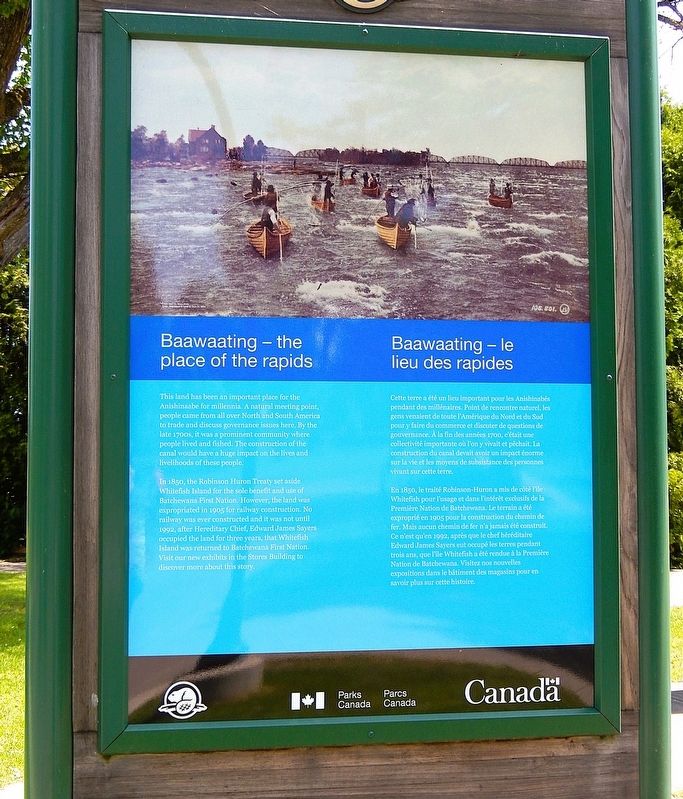
In 1850, the Robinson Huron Treaty set aside Whitefish Island for the sole benefit and use of Batchewana First Nation. However, the land was expropriated in 1905 for railway construction. No railway was ever constructed and it was not until 1992, after Hereditary Chief, Edward James Sayers occupied the land for three years, that Whitefish Island was returned to Batchewana First Nation. Visit our new exhibits in the Stores Building to discover more about this story.
this page online
En 1850, le traité Robinson-Huron a mis de côté l'île Whitefish pour l'usage et dans l'intérêt exclusifs de la Première Nation de Batchewana. Le terrain a été exproprié en 1905 pour la construction du chemin de fer. Mais aucun chemin de fer n'a jamais été construit. Ce n'est qu'en 1992, après que le chef héréditaire Edward James Sayers eut occupé les terres pendant trois ans, que l'île Whitefish a été rendue à la Première Nation de Batchewana. Visitez nos nouvelles expositions dans le bâtiment des magasins pour en savoir plus sur cette histoire.
Erected by Parks Canada / Parcs Canada.
Topics. This historical marker is listed in these topic lists: Indigenous Peoples and Communities • Railroads & Streetcars • Settlements & Settlers • Waterways & Vessels. A significant historical year for this entry is 1850.
Location. 46° 30.799′ N, 84° 21.031′ W. Marker is in Sault Ste. Marie, Ontario, in Algoma District. It can be reached from Canal

Photographed by Cosmos Mariner, June 11, 2024
2. Baawaating — the Place of the Rapids / Baawaating — le lieu des rapides Marker
Looking southeast; the Sault Ste. Marie Canal is visible in the right background.

Regionally, this marker is in the Sault Ste. Marie and Algoma Area and in Northern Ontario. It is also in Central Canada. Globally, it is in North America, in the Great North Woods, on the Great Lakes, on Lake Superior’s North Shore, in the Western Hemisphere, in the Western World, and in the Anglosphere. Historically, it finds itself in what was once a British colony, the Viceroyalty of New France, the Haudenosaunee (Iroquois) Confederacy, and Rupert’s Land.
Other nearby markers. At least 8 other markers are within walking distance of this marker: The Métis in Sault Ste. Marie / Les Métis de Sault Ste. Marie (here, next to this marker); Sault Ste. Marie Canal / Canal de Sault Ste. Marie (here, next to this marker); D-Day/Jour J (here, next to this marker); Equality and Multiculturalism / Égalité et multiculturalisme (here, next to this marker); Celebrating Indigenous History and Heritage / Célébrons l'histoire et le patrimoine autochtones (here, next to this marker); The Canal at war, 1914 / Le canal en guerre, 1914 (a few steps from this marker); The Sault's Industrial Heritage / Le patrimoine industriel du Sault (within shouting distance of this marker); Waterfront / Les Rives (within shouting distance of this marker). Touch for a list and map of all markers in Sault Ste. Marie.
Also see . . . Batchewana First Nation (Wikipedia).
Excerpt: The Batchewana First Nation is an Ojibwe First Nation in northern Ontario. Their traditional lands run along the eastern shore of Lake Superior, from Batchawana Bay to Whitefish Island. The abundant lake whitefish found in eastern Lake Superior and especially the St. Marys Rapids have attracted anglers and trade since time immemorial. Archaeological evidence shows occupation of Whitefish Island since about 200 BCE. The first European record is from French explorers in 1621, who documented natives living on Whitefish Island.(Submitted on May 15, 2025, by Cosmos Mariner of Cape Canaveral, Florida.)
The Robinson Huron Treaty of 1850 was signed at Sault Ste. Marie by representatives of the Ojibways along the eastern and northern shores of Lake Huron. The bands ceded their territories to the Crown, except for "reserves" set aside, along with other concessions in exchange for a one-time payment of £2,165, with an annual payment of £600 to be paid to each band.
The Pennefather Treaty was signed on 9 June 1859 at Gros Cap between the "Chiefs and Warriors of Batchewananny Bay and Goulais Bay Band of Indians", and the Crown. The chiefs and warriors agreed to relinquish to the Crown the reserved lands set aside in the Robinson Treaty, save for Whitefish Island.
The Railway Act Expropriation, 1902. After the construction of the Sault Ste. Marie International Railroad Bridge began in 1887, a legal battle between railroads (Algoma Central Railway, Pacific and Atlantic Railroad Company and Hudson Bay Railway Company) resulted in Whitefish Island being expropriated under the Railway Act. Although the land was expropriated for railroad construction, no railway was ever constructed on the island.
Whitefish Island became a National Historic Site due to its history and archaeological artefacts in 1981. A land claim was filed the next year, and the island was returned to reserve status in 1997.
Credits. This page was last revised on May 15, 2025. It was originally submitted on May 14, 2025, by Cosmos Mariner of Cape Canaveral, Florida. This page has been viewed 240 times since then and 64 times this year. Photos: 1, 2. submitted on May 15, 2025, by Cosmos Mariner of Cape Canaveral, Florida.
