Cumberland Township near Gettysburg in Adams County, Pennsylvania — The American Northeast (Mid-Atlantic)
McAllister's Mill
A Generational Story

April 14, 2025
1. McAllister's Mill A Generational Story Marker
A few hundred yards in front of you, on private property along Rock Creek, are the ruins of a stone grist mill purchased in 1822 by James McAllister. There, McAllister, and his family operated a stop along the Underground Railroad, providing temporary shelter to hundreds of the enslaved seeking freedom in the North. Freedom seekers were rested, fed, and guided away from bounty hunters who patrolled this area above the Mason-Dixon Line.
Part of a network of secret locations around Adams County, the mill was the site of a meeting of local abolitionists on July 4, 1836. The attendees, sons and grandsons of Revolutionary War soldiers, unanimously adopted 14 anti-slavery resolutions, one of which proclaimed: "If liberty is the right of all men, no human being can be rightfully held in slavery." The mill fell into disrepair soon after the war and was eventually dismantled. Today, the site is part of The National Underground Railroad Network to Freedom.
During the Battle of Gettysburg Union artillery was placed on Powers Hill behind you. On the afternoon of July 2, Union reinforcements rested here before moved to the other
this page online
In the decades after the war, the area surrounding the McAllister's Mill site became the Gettysburg borough dump. Later, a miniature golf course opened here. The site was restored in 2024 by the American Battlefield Trust.
Erected by American Battlefield Trust.
Topics. This historical marker is listed in these topic lists: Abolition & Underground RR • Industry & Commerce • War, US Civil. A significant historical date for this entry is July 4, 1836.
Location. 39° 48.442′ N, 77° 12.997′ W. Marker is near Gettysburg, Pennsylvania, in Adams County. It is in Cumberland Township. It can be reached from the intersection of Baltimore Pike and McAllister Mill Road when traveling north. Near the McAllister's Mill Underground Railroad Historical Marker. Touch for map. Marker is at or near this postal address: 1360 Baltimore Pike, Gettysburg PA 17325, United States of America. Touch for directions.

Regionally, this marker is in South-Central Pennsylvania. It is also in the American Northeast,
Photographed by Larry Gertner, July 26, 2025
2. McAllister's Mill wayside
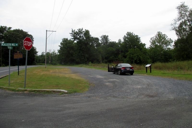
The location of the former miniature golf course. The PHMC marker is also visible.
Other nearby markers. At least 8 other markers are within walking distance of this marker: A different marker also named McAllister's Mill (a few steps from this marker); 12th Corps Headquarters (about 400 feet away, measured in a direct line); 21st Pennsylvania Cavalry (about 700 feet away); Battery A, Maryland Light Artillery (approx. 0.2 miles away); Battery E, Pennsylvania Light Artillery (approx. 0.2 miles away); a different marker also named 21st Pennsylvania Cavalry (approx. 0.2 miles away); Battery M, 1st New York Light Artillery (approx. 0.2 miles away); 4th New Jersey Volunteers (approx. 0.2 miles away). Touch for a list and map of all markers in Gettysburg.

Photographed by Bill Coughlin, April 10, 2013
3. Power's Hill, mentioned on the wayside, can be seen across the road.
Credits. This page was last revised on July 29, 2025. It was originally submitted on May 15, 2025. This page has been viewed 1,194 times since then and 63 times this year. Photos: 1. submitted on May 15, 2025. 2, 3. submitted on July 29, 2025, by Larry Gertner of New York, New York. • Bill Pfingsten was the editor who published this page.
