Old City in Philadelphia in Philadelphia County, Pennsylvania — The American Northeast (Mid-Atlantic)
Where is Benjamin Franklin's House?
Independence National Historical Park
| — | National Park Service, U.S. Department of the Interior | — |
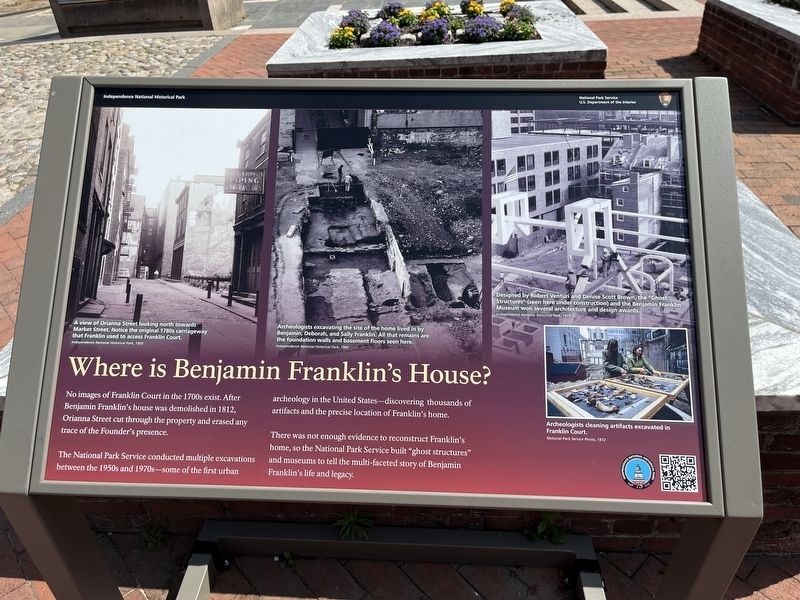
No images of Franklin Court in the 1700s exist. After Benjamin Franklin's house was demolished in 1812, Orianna Street cut through the property and erased any trace of the Founder's presence.
The National Park Service conducted multiple excavations between the 1950s and 1970s — some of the first urban archeology in the United States — discovering thousands of artifacts and the precise location of Franklin's home.
There was not enough evidence to reconstruct Franklin's home, so the National Park Service built "ghost structures" and museums to tell the multi-faceted story of Benjamin Franklin's life and legacy.
[Captions:]
A view of Orianna Street looking north towards Market Street. Notice the original 1780s carriageway that Franklin used to access Franklin Court.
Independence National Historical Park, 1950
Archeologists excavating the site of the home lived in by Benjamin, Deborah, and Sally Franklin. All that remains are the foundation walls and basement floors seen here.
Independence National Historical Park, 1960
Designed by Robert Venturi and Denise Scott Brown, the "Ghost Structures" (seen here under construction) and the Benjamin Franklin Museum won several architecture and design awards.
Independence National Historical Park, 1975
Archeologists cleaning artifacts excavated in Franklin Court.
National Park Service Photo, 1972
Erected 2023
this page online
Topics. This historical marker is listed in these topic lists: Anthropology & Archaeology • Parks & Recreational Areas. A significant historical year for this entry is 1950.
Location. 39° 56.98′ N, 75° 8.802′ W. Marker is in Philadelphia, Pennsylvania, in Philadelphia County. It is in Old City. It can be reached from Market Street (County Road 2004) east of South 4th Street, on the right when traveling east. The marker stands on the grounds of Franklin Court. Touch for map. Marker is in this post office area: Philadelphia PA 19106, United States of America. Touch for directions.

Regionally, this marker is in Southeast Pennsylvania. It is also in the American Northeast and in the Mid-Atlantic. Globally, it is in North America, the Western Hemisphere, the Western World, and the Anglosphere. Historically, it finds itself in what was once the Haudenosaunee (Iroquois) Confederacy, New Netherland, and one of the original Thirteen Colonies.
Other nearby markers. At least 8 other markers are within walking distance of this marker: In 1812 (here, next to this marker);

Credits. This page was last revised on May 20, 2025. It was originally submitted on July 4, 2023, by Devry Becker Jones of Washington, District of Columbia. This page has been viewed 867 times since then and 135 times this year. Last updated on May 20, 2025, by Jane Quinn of Burholme, Philadelphia, Pennsylvania, USA. Photos: 1, 2. submitted on July 4, 2023, by Devry Becker Jones of Washington, District of Columbia.
