Pikeville in Pike County, Kentucky — The American South (East South Central)
Timeline to Transformation
Photographed by J. J. Prats, May 16, 2025
1. Timeline to Transformation Marker
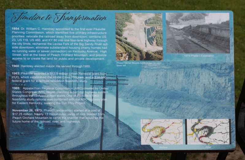
1954: Dr. William C. Hambley appointed to the first ever Pikeville Planning Commission, which identified five primary infrastructure priorities: relocate the railroad away from downtown; combine US 23, US 119, US 460, and KY 80 into one four-lane highway through the city limits; rechannel the Levisa Fork of the Big Sandy River outside downtown; eliminate substandard housing (many homes had no running water or sewer connection) on Kentucky Avenue, High Street, and at the base of Peach Orchard Mountain; and provide access to or create flat land for public and private development.
1960: Hambley elected mayor. He served through 1989.
1963: Pikeville awarded a $12.5 million Urban Renewal grant from HUD, which established the Model Cities Program, and a $38,000 federal grant for a railroad relocation feasibility study.
1965: Appalachian Regional Commission (ARC) created by United States Congress. ARC began planning a corridor highway system throughout the 13 Appalachian states. One of Pikeville's 1963 feasibility study options was combined with the ARC highway plan for Eastern Kentucky, creating the Cut-Thru Project.
November 26, 1973:
this page online
Topics. This historical marker is listed in these topic lists: Government & Politics • Railroads & Streetcars • Roads & Vehicles • Waterways & Vessels. A significant historical date for this entry is November 26, 1973.
Location. 37° 28.351′ N, 82° 32.31′ W. Marker is in Pikeville, Kentucky, in Pike County. It is on Bob Amos Drive 1.6 miles south of Cedar Creek Road, on the right. It it at the end of Bob Amos Drive, at the summit. Touch for map. Marker is at or near this postal address: 9 Bob Amos Dr, Pikeville KY 41501, United States of America. Touch for directions.

Regionally, this marker is in Eastern Kentucky. It is also in the American South, specifically in the Upper South, in Appalachia, and specifically in Southern Appalachia. Globally, it is in North America, the Western Hemisphere, the Western World, and the Anglosphere. Historically, it finds itself in what was once the territory of the Mississippian

Photographed by J. J. Prats, May 16, 2025
2. Timeline to Transformation Marker (left)
Other nearby markers. At least 8 other markers are within walking distance of this marker: Mayor Hambley: Cut-Thru was ‘an act of God’ (a few steps from this marker); a different marker also named Timeline to Transformation (a few steps from this marker); Revolutionary Revitalization (a few steps from this marker); Pikeville Cut-Through Project (a few steps from this marker); Trail of Fame (approx. half a mile away); a different marker also named Pikeville Cut-Through Project (approx. half a mile away); Pikeville Veterans Memorial Park (approx. half a mile away); Chair of Honor (approx. half a mile away). Touch for a list and map of all markers in Pikeville.
More about this marker. This interpretive panel includes two photographs and two maps. One is an aerial image of the Bowels Addition. The other image is a 1974 view of the excavation. The maps are reproduced on this page in Photo. No. 3.

3. Inset: Before and After
Credits. This page was last revised on May 24, 2025. It was originally submitted on May 21, 2025, by J. J. Prats of Powell, Ohio. This page has been viewed 192 times since then and 29 times this year. Photos: 1, 2, 3. submitted on May 21, 2025, by J. J. Prats of Powell, Ohio.
