Frankford in Quinte West in Hastings County, Ontario — Central Canada (North America)
The Trent River: Home to Species at Risk
Riviere Trent: Habitat des especes en peril
Photographed by William Fischer, Jr., May 12, 2025
1. The Trent River: Home to Species at Risk Marker

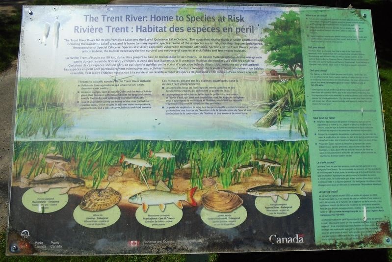
The Trent River flows for 90 km from Rice Lake into the Bay of Quinte on Lake Ontario. The watershed drains much of south-central Ontario, including the Kawartha Lakes area, and is home to many aquatic species. Some of these species are at risk, meaning they are Endangered, Threatened or of Special Concern. Species at risk are especially vulnerable to human activities. Sections of the Trent River contain critical habitat, the habitat necessary for the survival and recovery of species at risk fishes and freshwater mussels.
Threats to aquatic species in the Trent River include:
■ Pollutants from agricultural and urban run-off, which decrease water quality.
■ Invasive species, such as Round Goby and the Water Solider plant that compete with native species for food and shelter, modify foodwebs, and potentially introduce diseases.
■ Loss of vegetation along the banks of the river (called the riparian zone), which results in warmer water temperature, more erosion, and a loss of cover, habitat and food sources.
What can be done?
■ Employ best management practices on lands adjacent to
this page online
■ Stop the spread of invasive species. Do not empty bait buckets or release aquarium species into rivers, lakes or other natural water systems.
■ Keep shorelines natural with deeply rooting native trees, shrubs and wildflowers to reduce erosion, filter runoff, and provide shade and food sources for various local species.
Did you know?
The Trent River is a historic river that is part of the Trent-Severn Waterway. It has an abundant fish community that includes Walleye, Muskellunge and Northern Pike, as well as aquatic species at risk such as River Redhorse, Pugnose Shiner, Channel Darter and freshwater mussels such as the Rainbow and Eastern Pondmussel. From Walleye to Rainbow, each species plays a role in this diverse aquatic ecosystem.
Did you know?
The Species at Risk Act (SARA) became law in 2003. Under this act, it is an offence to kill, harm, harass, capture or take a species at risk, or to destroy their residence or critical habitat. For more information, please visit
Photographed by William Fischer, Jr., May 12, 2025
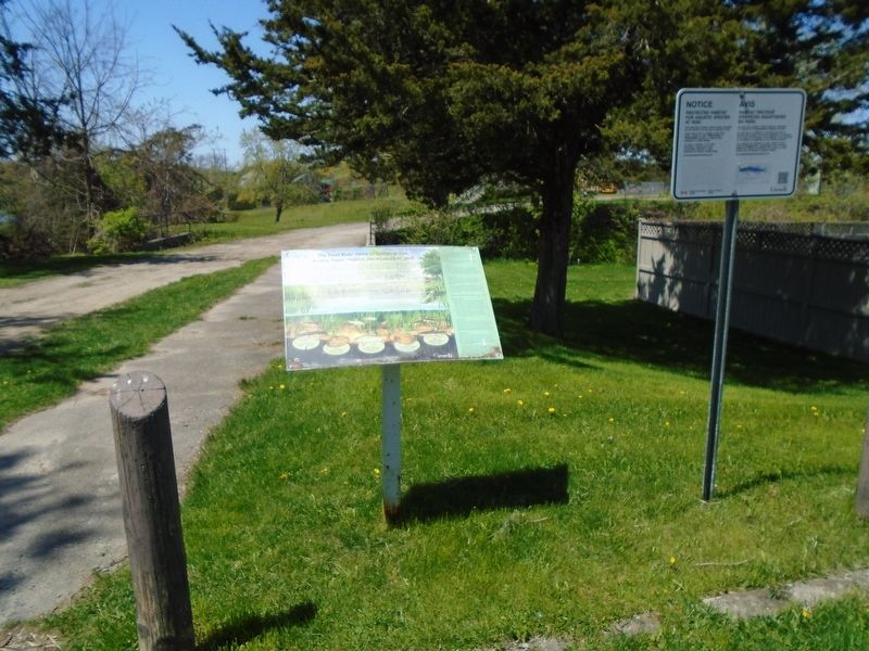
2. The Trent River: Home to Species at Risk Marker
"Some species at risk are the last of their kind in the world, and all of them have an essential role to play in the ecosystems where they live. It is important that we do what we can today to protect and restore these species for future generations. You can help ensure that these species will remain part of our natural heritage and legacy by making the right choices for your land."
[Endangered, Threatened and Special Concern species at bottom are not transcribed]
La rivière Trent s'écoule sur 90 km, du lac Rice jusqu'à la baie de Quinte dans le lac Ontario. Le bassin hydrographique draine une grande partie du centre-sud de l'Ontario, y compris la zone des lacs Kawartha, et il constitue l'habitat de nombreuses espèces en péril. Certaines de ces espèces sont en péril, ce qui signifie qu'elles ont le statut d'espèce en voie de disparition, menacée ou préoccupante. Les espèces en péril sont particulièrement vulnérables aux activités humaines. Certains tronçons de la rivière Trent contiennent un habitat essentiel, c'est-à-dire l'habitat nécessaire à la survie
Photographed by William Fischer, Jr., May 12, 2025
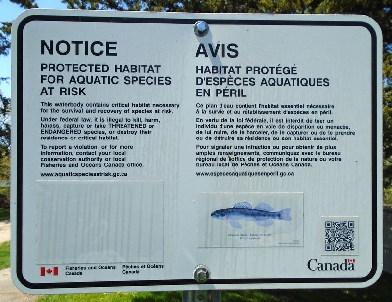
3. Nearby Trent River Protected Habitat Notice Marker
Les menaces pesant sur les espèces aquatiques dans la rivière Trent comprennent:
■ Les polluants issus du lessivage des terres cultivées et des écoulements urbains, qui diminuent la qualité de l'eau.
■ Les espèces envahissantes telles que le gobie à taches noires et l'aloès d'eau, qui sont en compétition avec les espèces indigènes pour s'approprier la nourriture et l'habitat, modifient les réseaux trophiques et peuvent introduire des maladies.
■ La perte de végétation le long des berges (appelée « zone riveraine »), qui entraîne une hausse de l'érosion et de la température de l'eau et une diminution de la couverture, de l'habitat et des sources de nourriture.
Que peut-on faire?
■ Employer des pratiques de gestion exemplaires dans les terres adjacentes à la rivière (p. ex., séparer le bétail au moyen d'une clôture, s'assurer que le fumier est entreposé de façon adéquate et utiliser les engrais et les pesticides de manière responsable).
■ Stopper la propagation des espèces envahissantes. Ne pas vider les seaux à appâts dans les rivières, les lacs et les autres systèmes d'eau naturels et ne pas jeter d'espèces d'aquarium dans ces cours d'eau.
■ Préserver l'aspect naturel du littoral en y plantant des arbres indigènes aux racines profondes, des arbustes et des fleurs sauvages, ce qui a pour effet de réduire l'érosion, de filtrer les eaux de ruissellement et de fournir de l'ombre et des sources de nourriture à diverses espèces locales.
Le saviez-vous?
La rivière Trent est une très ancienne rivière qui fait partie de la voie navigable Trent-Severn. Sa communauté de poissons est très abondante et elle comprend le doré jaune, le maskinongé et le grand brochet, ainsi que des espèces aquatiques en péril comme le chevalier de rivière, le méné camus, le fouille-roche gris et des moules d'eau douce comme la villeuse irisée et la ligumie pointue. Du doré jaune à la villeuse irisée, chaque espèce joue un rôle dans la diversité de l'écosystème aquatique.
Le saviez-vous?
La Loi sur les espèces en péril (LEP) est entrée en vigueur en 2003. En vertu de cette loi, il est interdit de tuer un individu d'une espèce en péril, de lui nuire, de le harceler, de le capturer ou de le prendre. Il est également interdit de détruire sa résidence ou son habitat essentiel. Pour de plus amples renseignements, veuillez consulter le site Web de la LEP à l'adresse www.sararegistry.gc.ca ou contactez l'Agence Parcs Canada au 705-750-4900.
« Certaines espèces en péril figurent parmi les dernières du genre au monde elles jouent toutes un rôle essentiel dans leur écosystème respectif. Il est important que nous fassions de notre mieux pour protéger ces espèces dès aujourd'hui et assurer leur rétablissement pour les générations à venir. Vous pouvez nous aider à faire en sorte que ces espèces continuent de faire partie de notre patrimoine et de notre héritage naturels en faisant les bons choix pour votre pays ».
[Les espèces en voie de disparition, menacées et préoccupantes en bas ne sont pas transcrites]
Erected by Parks Canada and Fisheries and Oceans Canada.
Topics. This historical marker is listed in these topic lists: Animals • Education • Environment • Waterways & Vessels. A significant historical year for this entry is 2003.
Location. 44° 11.844′ N, 77° 35.431′ W. Marker is in Quinte West, Ontario, in Hastings County. It is in Frankford. It can be reached from Riverside Parkway. Marker is adjacent to the Lock 6 parking lot. Touch for map. Marker is at or near this postal address: 207 Riverside Parkway (County Road 4), Quinte West ON K0K 2C0, Canada. Touch for directions.

Regionally, this marker is in Eastern Ontario and specifically in Southeastern Ontario. It is also in Central Canada. Globally, it is in North America, on the Great Lakes, in the Western Hemisphere, in the Western World, and in the Anglosphere. Historically, it finds itself in what was once a British colony, the Viceroyalty of New France, the Haudenosaunee (Iroquois) Confederacy, and Rupert’s Land.
Other nearby markers. At least 8 other markers are within 10 kilometers of this marker, measured as the crow flies: How a lock works/
Also see . . . Trent-Severn Waterway National Historic Site. (Submitted on May 22, 2025, by William Fischer, Jr. of Reynoldsburg, Ohio.)
Credits. This page was last revised on May 22, 2025. It was originally submitted on May 22, 2025, by William Fischer, Jr. of Reynoldsburg, Ohio. This page has been viewed 140 times since then and 53 times this year. Photos: 1, 2, 3. submitted on May 22, 2025, by William Fischer, Jr. of Reynoldsburg, Ohio.
