Frankford in Quinte West in Hastings County, Ontario — Central Canada (North America)
How a lock works/Comment fonctionne une écluse
Photographed by William Fischer, Jr., May 12, 2025
1. How a lock works/Comment fonctionne une écluse Marker

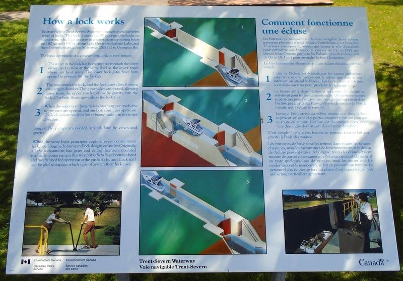
Boats travel the Trent-Severn Waterway through several different types of locks. This lock is one of the 37 conventional locks on the systems, which act as steps in a water staircase raising boats up 182 metres (597) from Lake Ontario to Balsam Lake, and then lowering them down 80 metres (263 ft.) to Georgian Bay.
The basic operation of a conventional lock is very simple:
1 The water in the lock has been emptied through the lower valves, and is now at the same level as the lower reach where our host waits. The lower lock gates have been opened to prepare for the lockage.
2 The boat enters the lock, and the lock gates close forming a watertight chamber. The upper valves are opened, allowing water from the upper reach to flow by gravity into the lock. Our boat floats upwards as the lock fills.
3 When the water is at the same level as the upper reach, the upper gates are opened, and our boat upstream. The lock is now ready to lower boats heading in the other direction.
Simple! No pumps are needed, it's all done by valves and gravity.
While the same basic principles apply at every conventional lock, operating
this page online
[Français]
Les bâteaux qui naviguent sur la voie navigable Trent-Severn traversent plusieurs types d'écluses. Cette écluse-ci est l'une des 37 écluses classiques du réseau qui jouent le rôle d'escaliers pour permettre aux bâteaux de s'élever de 182 m (597 pi.) depuis le lac Ontario jusqu'au lac Balsam, puis de redescendre de 80 m (263 pi.) pour atteindre la baie Georgienne.
Le fonctionnement élémentaire d'une écluse classique est très simple:
1 L'eau de l'écluse est évacuée par les vannes inférieures jusqu'à ce que le niveau soit le même que dans le bief inférieur où attend le bâteau. Les portes aval de l'écluse sont alors ouvertes pour procéder à l'échusage.
2 Le b[â]teau entre dans l'écluse et les portes de l'écluse se referment pour former un sas étanche. On ouvre les vannes supérieures pour faire tomber l'eau du bief supérieur dans l'écluse
Photographed by William Fischer, Jr., May 12, 2025
2. How a lock works/Comment fonctionne une écluse Marker
3 Lorsque l'eau arrive au même niveau que dans le bief supérieur, on ouvre les portes amont et le bâteau poursuit sa route en amont. L'écluse est maintenant prête pour faire descendre des bâteaux dans l'autre direction.
C'est simple! Il n'y a pas besoin de pompe, tout se fait par gravité, à l'aide des vannes.
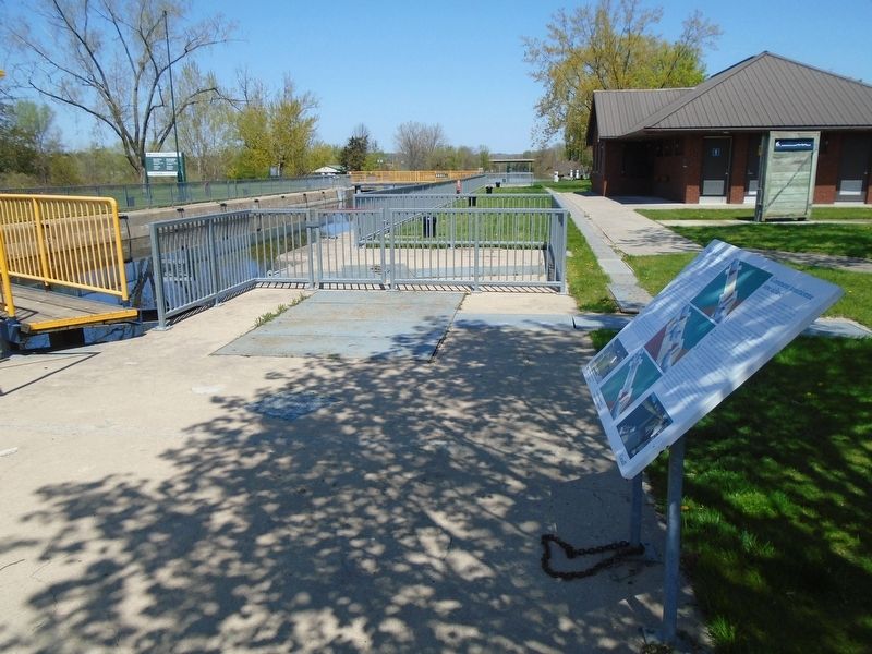
Les principes de base sont les mêmes dans toutes les écluses classiques, mais les mécanismes de fonctionnement et le dessin de l'écluse peuvent varier. A l'origine, toutes les écluses étaient munies de portes et de vannes que l'on manoeuvrait à la main. Il en reste quelques-unes de ce type, mais les autres ont été modernisées et la manoeuvre se fait en poussant un bouton. Le personnel des écluses se fera un plaisir d'expliquer à quel type une écluse particulière appartient.
Erected by Parks Canada.
Topics. This historical marker is listed in these topic lists: Architecture • Industry & Commerce • Parks & Recreational Areas • Waterways & Vessels.
Location. 44° 11.853′ N, 77° 35.47′ W.
Photographed by William Fischer, Jr., May 12, 2025
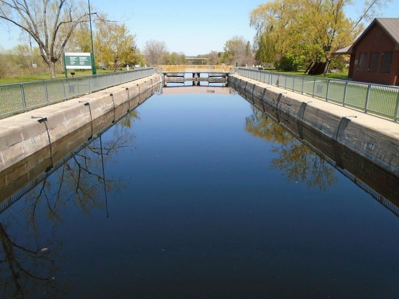
3. Trent-Severn Waterway Lock 6 (Filled)

Regionally, this marker is in Eastern Ontario and specifically in Southeastern Ontario. It is also in Central Canada. Globally, it is in North America, on the Great Lakes, in the Western Hemisphere, in the Western World, and in the Anglosphere. Historically, it finds itself in what was once a British colony, the Viceroyalty of New France, the Haudenosaunee (Iroquois) Confederacy, and Rupert’s Land.
Other nearby markers. At least 8 other markers are within 10 kilometers of this marker, measured as the crow flies: The Trent River: Home to Species at Risk (within shouting distance of this marker); World Wars Memorial (approx. 0.6 kilometers away); a different marker also named The Trent River: Home to Species at Risk (approx. 5.3 kilometers away); a different marker also named How a lock works/
Photographed by William Fischer, Jr., May 12, 2025
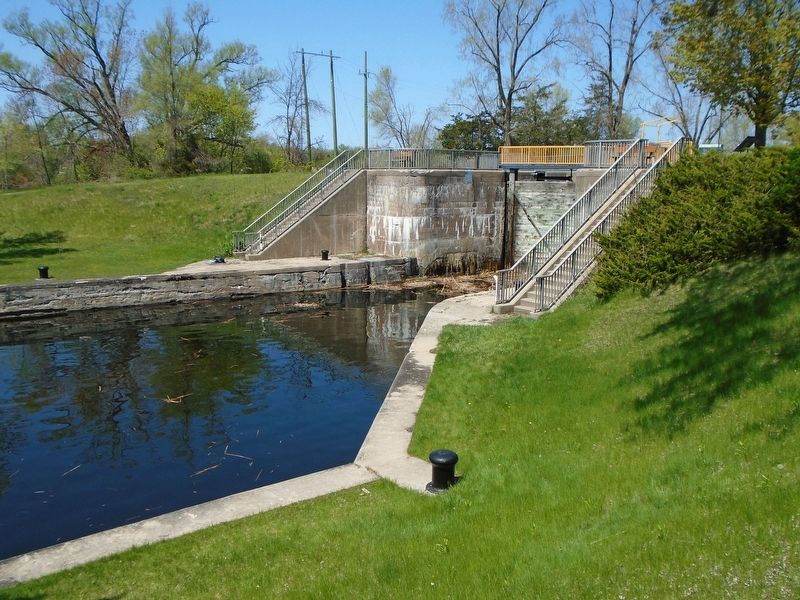
4. Trent-Severn Waterway Lock 6
Regarding How a lock works/
Also see . . . Trent-Severn Waterway National Historic Site. (Submitted on May 22, 2025, by William Fischer, Jr. of Reynoldsburg, Ohio.)
Credits. This page was last revised on May 22, 2025. It was originally submitted on May 22, 2025, by William Fischer, Jr. of Reynoldsburg, Ohio. This page has been viewed 97 times since then and 11 times this year. Photos: 1, 2, 3, 4. submitted on May 22, 2025, by William Fischer, Jr. of Reynoldsburg, Ohio.
