Pikeville in Pike County, Kentucky — The American South (East South Central)
Timeline to Transformation
(continued)
Photographed by J. J. Prats, May 16, 2025
1. Timeline to Transformation Marker
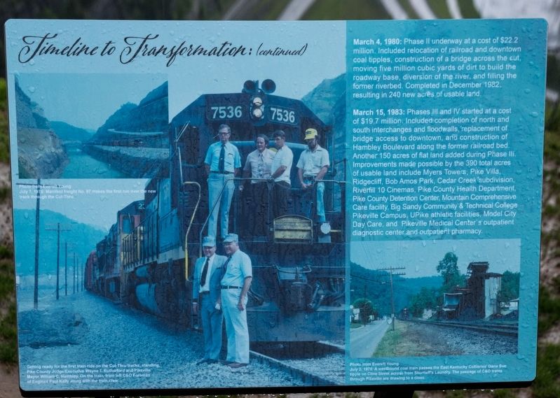
March 4, 1980: Phase II underway at a cost of $22.2 million. Included relocation of railroad and downtown coal tipples, construction of a bridge across the cut, moving five million cubic yards of dirt to build the roadway base, diversion of the river, and filling the former riverbed. Completed in December 1982, resulting in 240 new acres of usable land.
March 15, 1983: Phases Ill and IV started at a cost of $19.7 million. Included completion of north and south interchanges and floodwalls, replacement of bridge access to downtown, and construction of Hambley Boulevard along the former railroad bed. Another 150 acres of flat land added during Phase III. Improvements made possible by the 390 total acres of usable land include Myers Towers, Pike Villa, Ridgecliff, Bob Amos Park, Cedar Creek subdivision, Riverfill 10 Cinemas, Pike County Health Department, Pike County Detention Center, Mountain Comprehensive Care facility, Big Sandy Community & Technical College Pikeville Campus, UPike athletic facilities, Model City Day Care, and Pikeville Medical Center’s outpatient diagnostic center and outpatient pharmacy.
Topics.
this page online
Location. 37° 28.346′ N, 82° 32.307′ W. Marker is in Pikeville, Kentucky, in Pike County. It is on Bob Amos Drive, on the right. It is at the end of Bob Amos Drive, at the summit. Touch for map. Marker is at or near this postal address: 9 Bob Amos Dr, Pikeville KY 41501, United States of America. Touch for directions.

Regionally, this marker is in Eastern Kentucky. It is also in the American South, specifically in the Upper South, in Appalachia, and specifically in Southern Appalachia. Globally, it is in North America, the Western Hemisphere, the Western World, and the Anglosphere. Historically, it finds itself in what was once the territory of the Mississippian Culture and also the Antebellum South.
Other nearby markers. At least 8 other markers are within walking distance of this marker: Revolutionary Revitalization (here, next to this marker); Mayor Hambley: Cut-Thru was ‘an act of God’ (a few steps from this marker);
Photographed by J. J. Prats, May 16, 2025
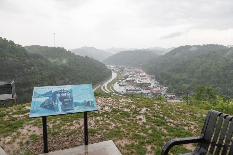
2. Marker with Pikeville in the background
More about this marker. This interpretive panel includes three photographs. The largest has this caption:
Getting ready for the first train ride on the Cut-Thru tracks, standing,In the upper left is a photograph from Everett Young taken July 7, 1978, is captioned
Pike County Judge/Executive Wayne T. Rutherford and Pikeville Major William C. Hambley. On the train, from left C&O Foreman of Engines Paul Kelly along with the train crew.
Manifest freight No. 97 makes the first run over the new track through the Cut-Thru.The photograph on the lower right, also by Everett Young but dated July 2, 1978, is captioned
A westbound coal train passes the East Kentucky Collieries’ Dana Sue tipple on Cline Street across from Shurtleff’s Laundry. The passage of C&O trains through Pikeville are drawing to a close.
Credits. This page was last revised on May 24, 2025. It was originally submitted on May 23, 2025, by J. J. Prats of Powell, Ohio. This page has been viewed 122 times since then and 21 times this year. Photos: 1, 2. submitted on May 23, 2025, by J. J. Prats of Powell, Ohio.
