Kells in County Meath, Leinster, Ireland — Mid-East (and Dublin)
Market Cross
Kells Heritage Trail
September 22, 2009
1. Market Cross Marker
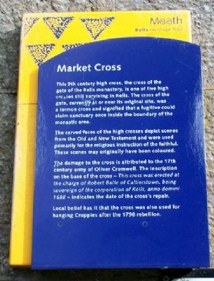
This 9th century high cross, the cross of the gate of the Kells monastery, is one of five high crosses still surviving in Kells. The cross of the gate, currently at or near its original site, was a termon cross and signified that a fugitive could claim sanctuary once inside the boundary of the monastic area.
The carved faces of the high crosses depict scenes from the Old and New Testament and were used primarily for the religious instruction of the faithful. These scenes may originally have been coloured.
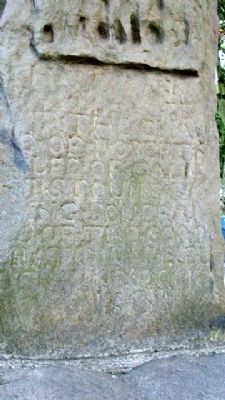
The damage to the cross is attributed to the 17th century army of Oliver Cromwell. The inscription on the base of the cross - This cross was erected at the charge of Robert Balfe of Callierstown, being sovereign of the corporation of Kells, anno domini 1688 - indicates the date of the cross's repair.
Local belief has it that the cross was also used for hanging Croppies after the 1798 rebellion.
Erected by Meath Tourism.
Topics. This historical marker is listed in these topic lists: Education • Patriots & Patriotism • Religion & Religious Structures • Settlements & Settlers • Wars, Non-US. A significant historical year for this entry is 1688.
Location. 53° 43.6′ N,
this page online

Regionally, this marker is in the Boyne Valley. It is also in the Ancient East. Globally, it is on the Atlantic Ocean, in the North Atlantic Region, in Europe, on the Island of Ireland, on the Celtic Fringe, in the European Union, in Atlantic Europe, on one of the British Isles, in the Western World, and in the Anglosphere.
Other nearby markers. At least 8 other markers are within 3 kilometers of this marker, measured as the crow flies: Kells Courthouse (here, next to this marker); Headfort Place (within shouting distance of this marker); St Columba's Church (approx. half a kilometer away); Suffolk Street (approx. half a kilometer away); The Churchyard Wall (approx. half a kilometer away); Catherine Dempsey (approx. 0.6 kilometers away); Kells Round Tower (approx. 0.6 kilometers away); Spire of Loyd (approx.
September 22, 2009
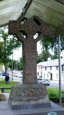
2. Market Cross East Face
Also see . . .
1. 1798 Irish Rebellion. (Submitted on February 9, 2010.)
2. Kells High Crosses. (Submitted on February 10, 2010.)
September 22, 2009
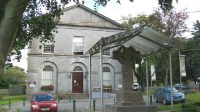
3. Market Cross and Marker
Looking east, showing west face of the Market Cross.
September 22, 2009
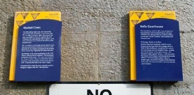
4. Market Cross and Courthouse Markers
September 22, 2009
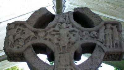
5. Market Cross East Face
Center is Daniel in Lions' Den; to left is Sacrifice of Isaac; and to right is Temptation of St. Anthony.
September 22, 2009
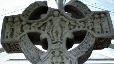
6. Market Cross West Face
Center is Crucifixion of Christ; to left is possibly St. Anthony being tempted; to right is possibly SS Paul and Anthony tempted by the devil.
September 22, 2009
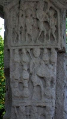
7. Market Cross East Face
Top left is Adam & Eve; top right Cain slaying Abel. Other panel possibly showing the Acclamation of David.
September 22, 2009
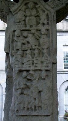
8. Market Cross West Face
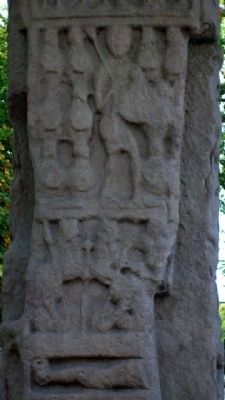
Top is Loaves and Fishes; center is Centurion's servant being healed; bottom is Christ with children.
September 22, 2009
9. Market Cross East Face
Top is Acclamation of David; bottom is Christ in the Tomb.
September 22, 2009
10. Market Cross West Face
1688 Inscription.
September 22, 2009
11. Market Cross East Face Base
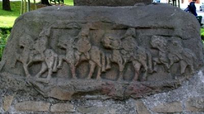
Horsemen.
September 22, 2009
12. Market Cross West Face
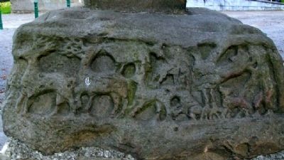
Stags and other animals; possibly a hunt.
September 22, 2009
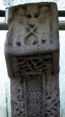
13. Market Cross North Face
SS Paul and Anthony with crossed staffs being fed by a raven.
September 22, 2009
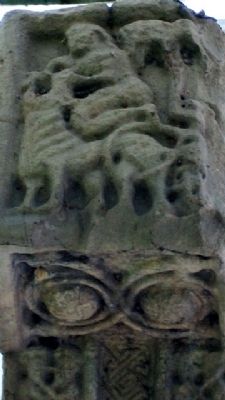
14. Market Cross South Face
Daniel Slaying a Lion.
September 22, 2009
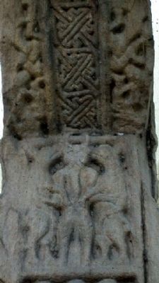
15. Market Cross North Face
Central horned figure, possibly Cernunnos/Antichrist flanked by standing dogs.
September 22, 2009
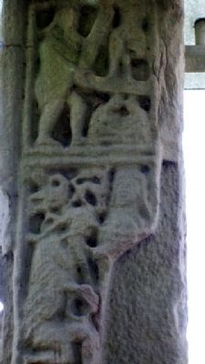
16. Market Cross South Face
Top is God showing Moses the way or receiving the Law; bottom is possibly Samuel annointing David.
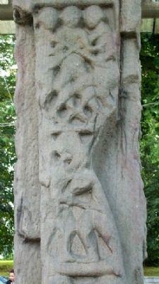
September 22, 2009
17. Market Cross North Face
Top is the Arrest of Christ; bottom panel damaged, with meaning unclear.
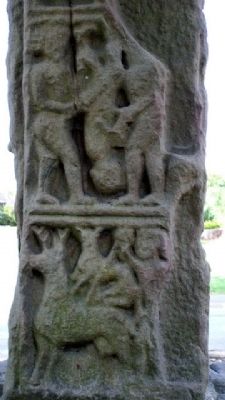
September 22, 2009
18. Market Cross Marker
Top is possibly Judgement of Solomon; bottom a man hunts stag with spear and dog.
September 22, 2009
19. Market Cross North Face
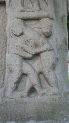
Possibly John the Baptist embracing Christ, Judas embracing Christ, or Jacob wrestling with the angel.
September 22, 2009
20. Market Cross South Face Base
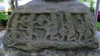
Soldiers Fighting.
September 22, 2009
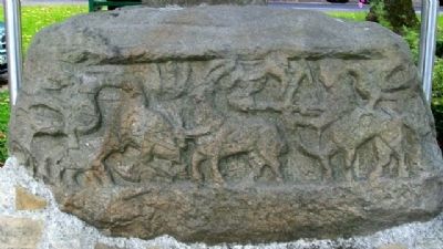
21. Market Cross North Face Base
Centaurs and animals.
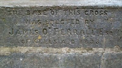
September 22, 2009
22. Market Cross Newer Base
was erected by
James O'Ferrall Esq
of Kells A.D 1893
Credits. This page was last revised on October 13, 2024. It was originally submitted on February 9, 2010, by William Fischer, Jr. of Reynoldsburg, Ohio. This page has been viewed 1,826 times since then and 44 times this year. Photos: 1, 2, 3, 4, 5, 6, 7, 8, 9, 10, 11, 12, 13, 14, 15, 16, 17, 18, 19, 20, 21, 22. submitted on February 10, 2010.
