
Dawlish in Devon, England, United Kingdom — Northwestern Europe (the British Isles)
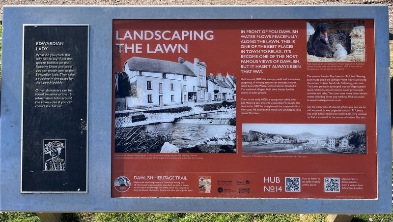
Landscaping the Lawn
| — | Dawlish Heritage Trail | — |
Photographed by Ray Gurganus, April 6, 2025
1. Landscaping the Lawn Marker
Until around 1800 this area was wild, and sometimes dangerous. A winding stream ran through a marsh called Tunnicliffe Waste, and sometimes flooded it. The medieval villagers built their homes further inland, on safer ground.
Then, in the early 1800s, a young man called John Ede Manning saw this area's potential. He bought the land, and in 1807 he straightened the stream within a new canal. He drained the marsh and landscaped it to create The Lawn.
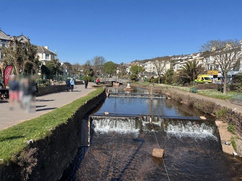
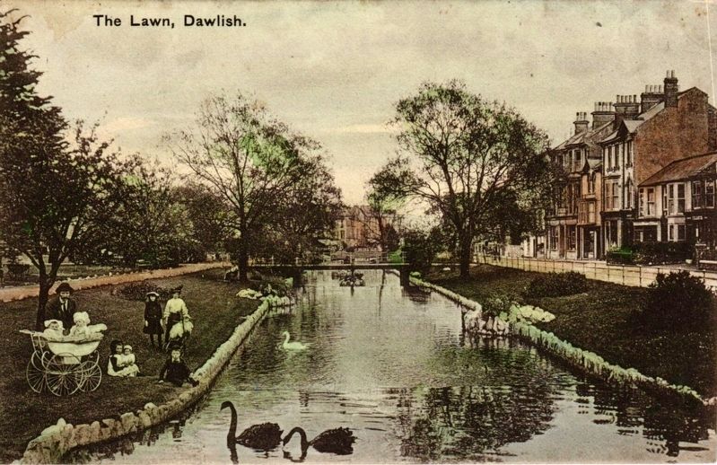
The stream flooded The Lawn in 1810, but Manning soon made good the damage. Weirs were built along the stream to limit flood risk. Following years saw The Lawn gradually developed into an elegant green space, where locals and visitors could promenade, socialise and relax. The Lawn now hosts many vibrant events including fayres and markets. Find out more at www.loveteignmouth.co.uk
On the other side of Dawlish Water, you can see an old watermill. It was originally built
this page online
Erected by Teignbridge District Council. (Marker Number 14.)
Topics. This historical marker is listed in these topic lists: Parks & Recreational Areas • Waterways & Vessels. A significant historical year for this entry is 1800.
Location. 50° 34.837′ N, 3° 28.011′ W. Marker is in Dawlish, England, in Devon. It is on Brunswick Place. Touch for map. Marker is at or near this postal address: 7 Brunswick Place, Dawlish, England EX7 9PH, United Kingdom. Touch for directions.

Regionally, this marker is in South West England. Globally, it is on the Atlantic Ocean, in the North Atlantic Region, in Europe, in Atlantic Europe, on one of the British Isles, in the Western World, and in the Anglosphere. Historically, it finds itself in what was once the Roman Empire.
Other nearby markers. At least 8 other markers are within 18 kilometers of this marker, measured as the crow flies: The Origin of the Black Swans (about 90 meters away, measured in a direct line); The Heart of Old Dawlish (approx. 0.9
Photographed by Ray Gurganus, April 6, 2025
2. The Lawn and Dawlish Water
Photographed by Chapman and Sons, Publishers, Dawlish, circa 1907
3. The Lawn, Dawlish
Credits. This page was last revised on May 28, 2025. It was originally submitted on May 24, 2025, by Ray Gurganus of Washington, District of Columbia. This page has been viewed 95 times since then and 8 times this year. Photos: 1, 2. submitted on May 24, 2025, by Ray Gurganus of Washington, District of Columbia. 3. submitted on May 28, 2025. • Andrew Ruppenstein was the editor who published this page.
Editor’s want-list for this marker. photo of the marker within its surroundings • Can you help?
