Granville Township in Licking County, Ohio — The American Midwest (Great Lakes)
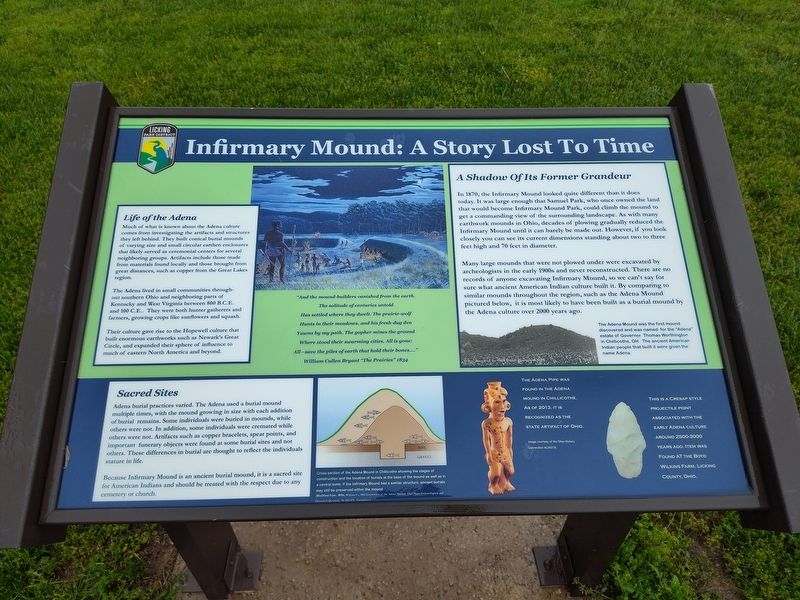
Infirmary Mound: A Stry Lost In Time
Photographed by Craig Doda, May 3, 2025
1. Infirmary Mound - A Stry Lost In Time Marker
Life of the Adena
Much of what is known about the Adena culture comes from investigating the artifacts and structures they left behind. They built conical burial mounds of varying size and small circular earthen enclosures that likely served as ceremonial centers for several neighboring groups. Artifacts include those made from materials found locally and those brought from great distances, such as copper from the Great Lakes region.
The Adena lived in small communities through- out southern Ohio and neighboring parts of Kentucky and West Virginia between 800 B.C.E. and 100 C.E.. They were both hunter gatherers and farmers, growing crops like sunflowers and squash.
Their culture gave rise to the Hopewell culture that built enormous earthworks such as Newark's Great Circle, and expanded their sphere of influence to much of eastern North America and beyond.
A Shadow Of Its Former Grandeur
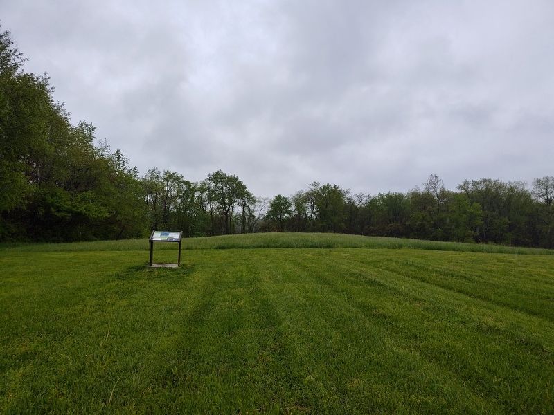
In 1870, the Infirmary Mound looked quite different than it does today. It was large enough that Samuel Park, who once owned the land that would become Infirmary Mound Park, could climb the mound to get a commanding view of the surrounding
this page online
Many large mounds that were not plowed under were excavated by archeologists in the early 1900s and never reconstructed. There are no records of anyone excavating Infirmary Mound, so we can't say for sure what ancient American Indian culture built it. By comparing to similar mounds throughout the region, such as the Adena Mound pictured below, it is most likely to have been built as a burial mound by the Adena culture over 2000 years ago.
[Captions:]
The Adena Mound was the first mound discovered and was named for the "Adena" estate of Governor Thomas Worthington in Chillicothe, OH. The ancient American Indian people that built it were given the name Adena.
Sacred Sites
Adena burial practices varied. The Adena used a burial mound multiple times, with the mound growing in size with each addition of burial remains. Some individuals were buried in mounds, while others
Photographed by Craig Doda, May 3, 2025
2. Infirmary Mound: A Stry Lost In Time Marker
Because Infirmary Mound is an ancient burial mound, it is a sacred site for American Indians and should be treated with the respect due to any cemetery or church.
Cross-section of the Adena Mound in Chillicothe showing the stages of construction and the location of burials at the base of the mound as well as in a central tomb. If the Infirmary Mound had a similar structure, ancient burials may still be preserved within the mound.
(Modified from: Mills, William C., 1902 Excavation of the Adena Mound, Ohio State Archaeological and Historical Quarterly, 10: 452-479, Columbus)
The Adena Pipe was found in the Adena Mound in Chillicothe. As of 2013, it is recognized as the State Artifact of Ohio.
Image courtesy of the Ohio History Connection AL00218.
This is a Cresap Style Projectile Point associated with the early Adena Culture around 2500-3000 years ago. Item was found at the Boyd Wilkins Farm, Licking County, Ohio.
"And the mound-builders vanished from the earth.
The solitude of centuries untold
Has settled where they dwelt. The prairie-wolf
Hunts in their meadows, and his fresh-dug den
Yawns by my path. The gopher mines the ground
Where stood their swarming cities. All is gone;
All-save the piles of earth that hold their bones...."
William Cullen Bryant "The Prairies" 1834
Erected by Licking Park District.
Topics. This historical marker is listed in these topic lists: Anthropology & Archaeology • Indigenous Peoples and Communities. A significant historical year for this entry is 1870.
Location. 40° 1.417′ N, 82° 30.847′ W. Marker is near Granville, Ohio, in Licking County. It is in Granville Township. It can be reached from Lancaster Road one mile north of Union Station Road, on the right when traveling north. Touch for map. Marker is at or near this postal address: 1229 Union Station Rd, Granville OH 43023, United States of America. Touch for directions.

Regionally, this marker is in the Columbus Metropolitan Area. It is also in the American Midwest, in the Corn Belt, in Appalachia, and specifically in Northern Appalachia. Globally, it is in North America, the Western Hemisphere, the Western World, and the Anglosphere. Historically, it finds itself in what was once the Haudenosaunee (Iroquois) Confederacy, the territory of the Mississippian Culture, and the Northwest Territory.
Other nearby markers. At least 8 other markers are within 3 miles of this marker, measured as the crow flies: What is a Chimney Swift Tower? (approx. 0.4 miles away); A Glimpse Into Ohio's Prairie Past (approx. 0.4 miles away); Vietnam Memorial (approx. 0.4 miles away); The Toledo and Ohio Central Railroad (approx. 2.6 miles away); Granville (approx. 2.7 miles away); Old Colony Burying Ground (approx. 2.9 miles away); Old Colony Burying Ground, 1805 (approx. 2.9 miles away); Utter House (approx. 3 miles away). Touch for a list and map of all markers in Granville.
Credits. This page was last revised on May 27, 2025. It was originally submitted on May 25, 2025, by Craig Doda of Napoleon, Ohio. This page has been viewed 524 times since then and 192 times this year. Photos: 1, 2. submitted on May 25, 2025, by Craig Doda of Napoleon, Ohio. • Devry Becker Jones was the editor who published this page.
