Fork Branch Nature Preserve & East Dover Hundred in Kent County, Delaware — The American Northeast (Mid-Atlantic)
Fork Branch Nature Preserve
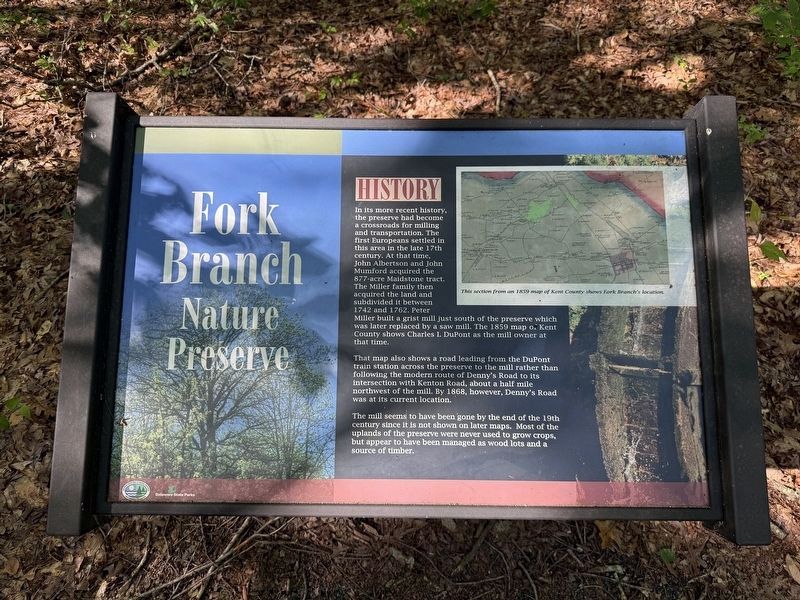
That map also shows a road leading from the DuPont train station across the preserve to the mill rather than following the modern route of Denny's Road to its intersection with Kenton Road, about half a mile northwest of the mill. By 1868, however, Denny's Road was at its current location.
The mill seems to have been gone by the end of the 19th century since it is not shown on later maps. Most of the uplands of the preserve were never used to grow crops, but appear to have been managed as wood lots and a source of timber.
Erected by Delaware State Parks.
Topics and series. This historical marker
this page online
Location. 39° 10.938′ N, 75° 34.641′ W. Marker is in Dover, Delaware, in Kent County. It is in Fork Branch Nature Preserve & East Dover Hundred. It can be reached from Kenton Road (County Road 104) north of Baltray Road, on the right when traveling north. Touch for map. Marker is at or near this postal address: 236 Kenton Rd, Dover DE 19904, United States of America. Touch for directions.

Regionally, this marker is in the American Mid-Atlantic, on the Delmarva Peninsula, and on the Eastern Seaboard. Globally, it is in the North Atlantic Region, North America, the Western Hemisphere, the Western World, and the Anglosphere. Historically, it finds itself in what was once New Netherland, one of the original Thirteen Colonies, and the Antebellum South.
Other nearby markers. At least 8 other markers are within 2 miles of this marker, measured as the crow flies: A different marker
![A Mass of Mast [signage along the trail] image. Click for full size.](Photos8/867/Photo867674.jpg?525202564600PM "A Mass of Mast [signage along the trail]. Click for full size.")
![A Forest Cake [signage along the trail] image. Click for full size.](Photos8/867/Photo867675.jpg?525202564800PM "A Forest Cake [signage along the trail]. Click for full size.")
Credits. This page was last revised on May 15, 2026. It was originally submitted on May 25, 2025, by Devry Becker Jones of Washington, District of Columbia. This page has been viewed 132 times since then and 26 times this year. Photos: 1, 2, 3, 4. submitted on May 25, 2025, by Devry Becker Jones of Washington, District of Columbia.
