Delaware Airpark & Kenton Hundred near Cheswold in Kent County, Delaware — The American Northeast (Mid-Atlantic)
Lenape Indian Tribe of Delaware
The People Who Stayed Behind
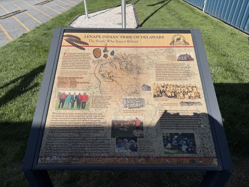
For more than 12,000 years before the first Europeans arrived, the Lenape people and their predecessors lived in the Cheswold area. They fished, hunted deer and other animals, and gathered nuts, seeds, and other plant products for food, medicines, and raw materials. At different times of the year, Lenape families camped in places where certain resources were most abundant.
When the first European settlers arrived in the early 1600s, this traditional way of life changed dramatically. Over the next century, thousands of Lenape people throughout the Lenape homeland died from smallpox and other less-devastating European diseases. The Europeans, who depended on cultivated crops and domesticated animals regarded much of Lenape territory as unused. By the 1660s, English settlers flooded into the area, dividing up the land, clearing the forests, and leaving little room for the people who had lived here for millennia.
Many Lenape families chose to leave Delaware and other parts of their homeland, eventually settling in Oklahoma and western Ontario, Canada. Some families, the descendants of the Sicconese people, recorded
this page online
The Lenape people of Kent County have maintained an identity separate from their Euro-American and African-American neighbors while "hiding in plain sight" by wearing European clothes, living in European houses, accepting Christianity, and adopting other European cultural practices. They used the framework of family, church, and schools to regulate their community outside the governing structures of the wider society.
The Cheswold Lenape community, once known as Moors, has been acknowledged by the state of Delaware for more than 130 years. Today, the Lenape Indian Tribe of Delaware is represented by a constitutional government that seeks to protect the cultural identity of the Lenape people of Delaware, to promote the physical and economic health of their citizens, and to advocate for the civil and human rights of their community.
[Captions:]
By 1629, Dutch map makers identified at least 13 native groups along the Delaware, including the Great Siconese on the west side of Delaware Bay and the Little Siconese on the east side.
2009 Fall Gathering - Left to Right: Co-Chief Lewis Pierce (Nanticoke Lenni Lenape), Assistant Chief William Daisey (Nanticoke), State of Delaware Governor Jack Markell, Chief Mark Gould (Nanticoke Lenni Lenape), Chief Dennis Coker (Lenape)
The Cheswold Tigers, the community's semi-pro baseball team
Top, 2011 Lenape Youth Campers learn about their heritage.
Left, Community members share a meal, 2011 Lenape gathering
Immanuel Union-United Methodist Church is one of the tribe's traditional churches.
Students from Cheswold School, ca 1960-1964
"New" Cheswold School (three-room) ca. 1922-1964
Erected by Lenape
Topics. This historical marker is listed in these topic lists: Anthropology & Archaeology • Indigenous Peoples and Communities. A significant historical year for this entry is 1629.
Location. 39° 13.056′ N, 75° 35.766′ W. Marker is near Cheswold, Delaware, in Kent County. It is in Delaware Airpark & Kenton Hundred. It is on Durham Lane north of 7 Hickories Road (Delaware Route 42), on the right when traveling north. Touch for map. Marker is at or near this postal address: 127 Durham Ln, Dover DE 19904, United States of America. Touch for directions.

Regionally, this marker is in the American Mid-Atlantic, on the Delmarva Peninsula, and on the Eastern Seaboard. Globally, it is in the North Atlantic Region, North America, the Western Hemisphere, the Western World, and the Anglosphere. Historically, it finds itself in what was once New Netherland, one of the original Thirteen Colonies, and the Antebellum South.
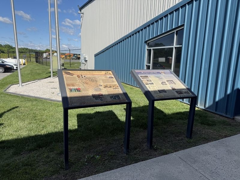
Other nearby markers. At least 8 other markers are within 3 miles of this marker, measured as the crow flies: Floyd Durham (1918-2010) (here, next to this marker); Kenton Hundred (approx. half a mile away); Little Creek Hundred (approx. 0.6 miles away); Cheswold Volunteer Fire Company (approx. 0.7 miles away); a different marker also named Little Creek Hundred (approx. 1.8 miles away); Fork Branch Nature Preserve (approx. 2.6 miles away); a different marker also named Fork Branch Nature Preserve (approx. 2.7 miles away); Welcome to Fork Branch Nature Preserve (approx. 2.9 miles away). Touch for a list and map of all markers in Cheswold.
Credits. This page was last revised on May 15, 2026. It was originally submitted on May 25, 2025, by Devry Becker Jones of Washington, District of Columbia. This page has been viewed 634 times since then and 111 times this year. Photos: 1, 2. submitted on May 25, 2025, by Devry Becker Jones of Washington, District of Columbia.
