Bernalillo in Sandoval County, New Mexico — The American Mountains (Southwest)
Rio Grande River
Photographed by James Hulse, April 9, 2025
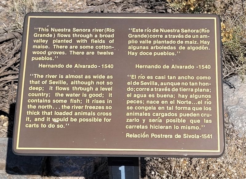
1. Rio Grande River Marker
 "This Nuestra Senora river (Rio Grande) flows through a broad valley planted with fields of maise. There are some cottonwood groves. There are twelve pueblos."
Hernando de Alvarado - 1540
"The river is almost as wide as that of Seville, although not so deep; it flows through a level country; the water is good; it contains some fish; it rises in the north... the river freezes so thick that loaded animals cross it, and it would be possible for carts to do so."
"Este río de Nuestra Señora (Río Grande) corre a través de un amplio valle plantado de maiz. Hay algunas arboledas de algodón. Hay doce pueblos."
Hernando de Alvarado -1540
"El río es casi tan ancho como el de Sevilla, aunque no tan hondo; corre a través de tierra plana; el agua es buena; hay algunos peces; nace en el Norte...el río se congela en tal forma que los animales cargados pueden cruzarlo y sería posible que las carretas hicieran lo mismo."
Relación Postrera de Sivola-1541
Topics. This historical marker is listed in these topic lists: Anthropology & Archaeology • Indigenous Peoples and Communities • Settlements & Settlers. A significant historical year for this entry is 1540.
Location. 35° 19.822′ N,
this page online

Regionally, this marker is in the San Juan Basin and in Greater Albuquerque. It is also in the American Southwest and at the Four Corners. Globally, it is in North America, the Western Hemisphere, the Western World, and the Anglosphere. Historically, it finds itself in what was once New Spain, the territory of the Ancestral Puebloans, and the Republic of Texas.
Other nearby markers. At least 8 other markers are within walking distance of this marker: El Bosque / The Bosque (here, next to this marker); Las Montañas Sandía / The Sandia Mountains (a few steps from this marker); Coronado's Expedition (about 300 feet away, measured in a direct line); Successful Agriculture (about 300 feet away); Another Smaller Square Kiva at Kuaua (about 300 feet away); The Siege of Kuaua (about

Photographed by James Hulse, April 9, 2025
2. The Rio Grande River and Marker
More about this marker. There is a small fee to visit the Kuaua Ruins (Coronado Historic Site).
Also see . . .
1. Coronado Historic Site. New Mexico Historic Sites
Coronado Historic Site and the ancient Kuaua Pueblo are located just minutes north of Albuquerque (off of I-25, Exit 242) in Bernalillo. In 1540, Francisco Vásquez de Coronado—with 500 soldiers and 2,000 Indigenous allies from New Spain—entered the Rio Grande valley somewhere near this site. Coronado was searching for the fabled Seven Cities of Gold.(Submitted on May 26, 2025, by James Hulse of Medina, Texas.)
2. Hernando de Alvarado. Wikipedia
Hernando de Alvarado (d. 1540s), was a Spanish conquistador and explorer, lieutenant under Francisco Vázquez de Coronado and artillery officer in his army. In fall of 1540, shortly ahead of Tiguex War, he led a small exploratory military unit into the American Southwest, visiting several pueblos.(Submitted on May 27, 2025, by James Hulse of Medina, Texas.)

Photographed by James Hulse, April 9, 2025
3. The view of the Rio Grande River and the Sandia Mountains
Credits. This page was last revised on May 27, 2025. It was originally submitted on May 26, 2025, by James Hulse of Medina, Texas. This page has been viewed 86 times since then and 14 times this year. Photos: 1, 2, 3. submitted on May 27, 2025, by James Hulse of Medina, Texas.
