
St Ives in Cornwall, England, United Kingdom — Northwestern Europe (the British Isles)
The Island or St. Ives Head
Photographed by Ray Gurganus, April 7, 2025
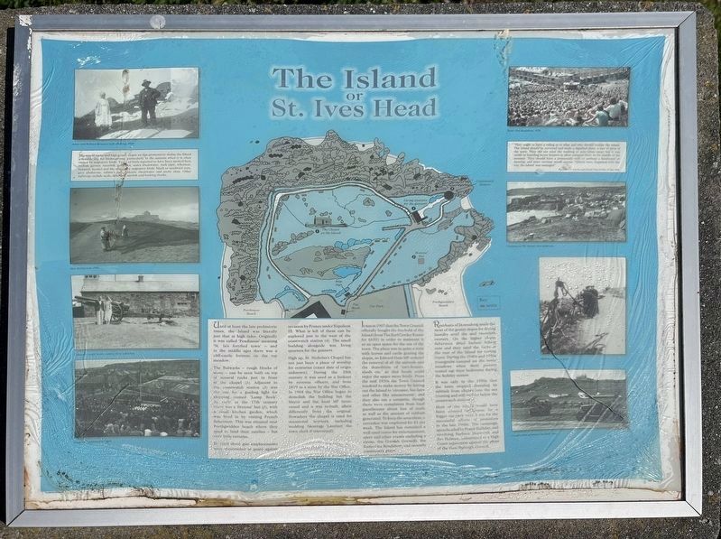
1. The Island or St. Ives Head Marker
The Bulwarks - rough blocks of stone - can he seen built on top rocks just in front of the chapel (1). Adjacent to coastwatch station (3) was the site for a guiding light for shipping, named 'Lamp Rock'. As early as the 17th century there was a Bretons' hut (2), with a small kitchen garden, which was lived in by visiting French fishermen. This was situated near Porthgwidden beach where they used to land their catches - but very little remains.
In 1860 three gun emplacements were constructed to guard against invasion by France under Napoleon III. What is left of these can be explored just to the west of the coastwatch station (4). The small building alongside was living quarters for the gunners.
High up, St. Nicholas's Chapel has not just been a place of worship for centuries (exact date of origin unknown). During the 18th century it was used as a lookout by revenue officers,
this page online
It was in 1907 that the Town Council officially bought the freehold of the Island (from The Earl Cowley Estate for £650) in order to maintain it as an open space for the use of the town. The place was in quite a state with horses and cattle grazing the slopes, so Edward Hain MP ordered the removal of all the animals and the demolition of 'cart-houses, sheds etc' so that locals could enjoy the space more freely. From the mid 1930s the Town Council resolved to make money by letting out the Island to 'circuses, fun fairs and other like amusements'; and they also ran a campsite, though there were complaints from local guesthouses about loss of trade as well as the amount of rubbish generated. To keep the area clean, a caretaker was employed for £1 per week. The Island has remained a well-used venue for entertainment, sport
Photographed by Ray Gurganus, April 7, 2025
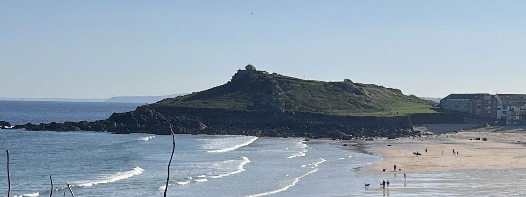
2. The Island, as seen from a distance
Residents of Downalong made the most of the grassy slopes for drying laundry until the mid-twentieth century. On the higher slopes fishermen dried barked fishing nets and the used the rocks at the rear of the island for tearing ropes. During the 1940s and 1950s youngsters camped on the meadows when their parents rented out their bedrooms during the holiday season.
It was only in the 1950s that the town stopped dumping its rubbish from chutes into the sea (rusting and still visible) below the coastwatch station.
Most of the island would have been covered in tarmac for a bigger car park were it not for the successful efforts of protestors in the late 1960s. The campaign, spearheaded by Frank Halliday, and involving Barbara Hepworth and Jim Holman, culminated at a High Court injunction against the plans of the then Borough Council.
Topics. This historical marker is listed in these topic lists: Parks & Recreational Areas • Waterways & Vessels.
Location. 50° 13.033′ N, 5° 28.67′ W. Marker is in St Ives, England, in Cornwall. It is on Porthmeor Road. Touch for map. Marker is at or near this postal address: Porthmeor Road, St Ives, England TR26 1PL, United Kingdom. Touch for directions.

Regionally, this marker is in South West England. Globally, it is on the Atlantic Ocean, in the North Atlantic Region, on the Atlantic Arc, in Europe, on the Celtic Fringe, in Atlantic Europe, on one of the British Isles, in the Western World, and in the Anglosphere. Historically, it finds itself in what was once the Roman Empire.
Other nearby markers. At least 8 other markers are within 11 kilometers of this marker, measured as the crow flies: St Nicholas Chapel (about 120 meters away, measured in a direct line); The Coastal Community (about 210 meters away); Shared Viewpoints (about 210 meters away); Pier & Now (about 210 meters away); St Ives War Memorial (approx. 0.6 kilometers away); King Edward Landing (approx. 10.5 kilometers away); Victoria & Albert Visit (approx. 10.9 kilometers away); Footprints of HM the Queen (approx. 11 kilometers away). Touch for a list and map of all markers in St Ives.
Credits. This page was last revised on June 4, 2025. It was originally submitted on May 26, 2025, by Ray Gurganus of Washington, District of Columbia. This page has been viewed 169 times since then and 85 times this year. Photos: 1, 2. submitted on May 26, 2025, by Ray Gurganus of Washington, District of Columbia. • Andrew Ruppenstein was the editor who published this page.
