Near Sharpsburg in Washington County, Maryland — The American Northeast (Mid-Atlantic)
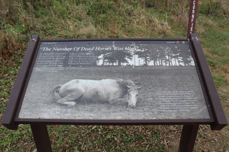
"The Number Of Dead Horses Was High"
Antietam National Battlefield
| — | National Park Service, U.S. Department of the Interior | — |
Photographed by Evan Dwyer, November 4, 2024
1. "The Number of Dead Horses Was High" Marker
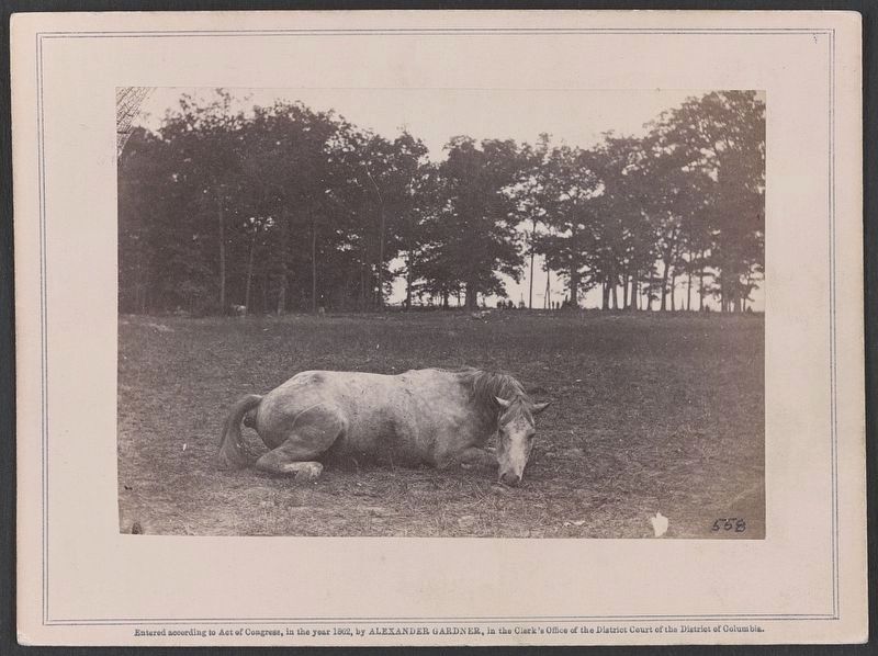
Gen. Alpheus Williams, who commanded the US Twelfth Corps after General Mansfield was mortally wounded, rode the battlefield after the fighting had ceased. He wrote to his daughters on September 22, 1862 about what he saw in this field. "The number of dead horses was high. They lay, like the men, in all attitudes. One beautiful milk-white animal had died in so graceful a position that I wished for its photograph. Its legs were doubled under and its arched neck gracefully turned to one side, as if looking back to the ball-hole in its side. Until you got to it, it was hard to believe the horse was dead." Alexander Gardner stood here and captured the photograph that Williams wanted.
The officer who rode this mount into combat was Colonel Henry B. Strong, commander of the 6th Louisiana Infantry. Col. Strong was killed in this field and buried "in a hollow south of the Dunker Church" where his men marked his grave with a wooden headboard. In the 1870s, Col. Strong's remains were reinterred in Washington Confederate Cemetery, ten miles north in Hagerstown, Maryland.
Erected by National Park Service, U.S. Department
this page online
Topics. This historical marker is listed in these topic lists: Animals • Cemeteries & Burial Sites • War, US Civil. A significant historical date for this entry is September 17, 1862.
Location. 39° 28.767′ N, 77° 44.743′ W. Marker is near Sharpsburg, Maryland, in Washington County. It can be reached from Dunker Church Road south of The Cornfield Avenue, on the right when traveling north. The marker is located along a walking trail southeast of "The Cornfield" driving tour stop. Touch for map. Marker is in this post office area: Sharpsburg MD 21782, United States of America. Touch for directions.

Regionally, this marker is in Western Maryland. It is also in the American Mid-Atlantic, in Appalachia, and specifically in Northern Appalachia. Globally, it is in North America, the Western Hemisphere, the Western World, and the Anglosphere. Historically, it finds itself in what was once one of the original Thirteen Colonies.
Other nearby markers. At least 8 other markers are within walking distance of this marker: A Contrast! (within shouting distance of this marker); Georgia Confederate Soldiers (about 500 feet away,
Photographed by Alexander Gardner, circa 1862
2. Confederate colonel and horse, both killed at the Battle of Antietam
Library of Congress (LC-DIG-ppmsca-34150)
Also see . . . Antietam National Battlefield. National Park Service (Submitted on May 29, 2025.)
Credits. This page was last revised on June 25, 2025. It was originally submitted on May 27, 2025, by Evan Dwyer of Richmond, Virginia. This page has been viewed 201 times since then and 43 times this year. Photos: 1. submitted on May 27, 2025, by Evan Dwyer of Richmond, Virginia. 2. submitted on May 29, 2025. • Bernard Fisher was the editor who published this page.
Editor’s want-list for this marker. Wide shot of marker and its surroundings. • Can you help?
