Sharbot Lake in Central Frontenac in Frontenac County, Ontario — Central Canada (North America)
Iris versicolor
More than a pretty flower/Plus qu'une jolie fleur
| — | Trans Canada Trail/ | — |

Photographed by William Fischer, Jr., May 12, 2025
1. Iris versicolor Marker

More than a pretty flower
The blue flag is a native herb, found in marshes, swamps, moist fields, and meadows from southern Saskatchewan to the Maritimes. In 1999, this large member of the iris family was adopted as the floral emblem of Quebec. It is closely related to the wild iris of France - a flower long associated with French heraldry known as the "fleur de lis."
Its striking blue colour is very attractive to bees - the only insects that pollinate this flower. The long, downward-curving sepals act as "runways" for incoming bees, leading them to the nectar-filled base. As the bee enters the flower pollen collected from other flowers is scraped off its back by the plant's sticky stigma. Upon departure the bee is dusted anew with fresh cargo for the next flower.
The blue flag is a highly toxic plant, sometimes mistaken for sweet, edible calamus - with disastrous results. The root of the blue flag is an official drug of the United States Pharmacopoeia.
L'iris versicolore est une plante indigène qui pousse dans les marais, les étangs, les champs humides et les prés du sud de la Saskatchewan
this page online
D'un bleu éclatant, l'iris versicolore attire particulièrement les abeilles - les seuls insectes à polliniser cette fleur. Ses sépales longs et courbés vers le sol agissent comme des voies d'atterrissage à l'intention des abeilles visiteuses, les dirigeant directement vers le fond rempli de nectar. En pénétrant dans la fleur, l'abeille est délestée du pollen recueilli dans d'autres fleurs par les stigmates rigides lui râpant le dos. À son départ, l'abeille est à nouveau balayée par ceux-ci et reçoit cette fois une nouvelle cargaison à destination de sa prochaine fleur.
L'iris versicolore est une plante très toxique, qu'on confond parfois avec l'acore odorant, une fleur sucrée et comestible. L'erreur est lourde de conséquences. La racine de l'iris versicolore entre dans la composition d'un médicament officiellement reconnu par la pharmacopée des États-Unis.
Erected by Government
Photographed by William Fischer, Jr., May 12, 2025
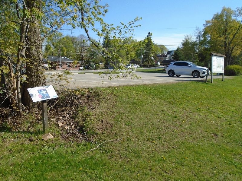
2. Iris versicolor Marker
Topics and series. This historical marker is listed in these topic lists: Horticulture & Forestry • Parks & Recreational Areas • Roads & Vehicles. In addition, it is included in the Canada, Historic Sites and Monuments Board series list. A significant historical year for this entry is 1999.
Location. 44° 46.392′ N, 76° 41.371′ W. Marker is in Central Frontenac, Ontario, in Frontenac County. It is in Sharbot Lake. It is at the intersection of Elizabeth Street and Robert Street, on the left when traveling north on Elizabeth Street. Marker is adjacent to the parking lot. Touch for map. Marker is at or near this postal address: 1037 Robert Street, Central Frontenac ON K0H 2P0, Canada. Touch for directions.

Regionally, this marker is in Eastern Ontario and specifically in Southeastern Ontario. It is also in Central Canada. Globally, it is in North America, on the Great Lakes, in the Western Hemisphere, in the Western World, and in the Anglosphere. Historically, it finds itself in what was once a British colony, the Viceroyalty of New France, the Haudenosaunee (Iroquois) Confederacy, and Rupert’s Land.
Other nearby markers. At least 8 other markers are within walking distance of this marker: Site of the Former Sharbot Lake Railway Station (a few steps from this marker); Pump House (a few steps from this marker); The Station (within shouting distance of this marker); The Sharbot Lake Hotel (within shouting distance of this marker); The K&P (within shouting distance of this marker); The Union Hotel (within shouting distance of this marker); Section Car (within shouting distance of this marker); Track Dolly (within shouting distance of this marker). Touch for a list and map of all markers in Central Frontenac.
More about this marker. The Central Frontenac Trailway, on the former Canadian Pacific Railway grade, is part of the Trans Canada Trail.
Also see . . .
1. Blue Flag Iris. (Submitted on May 27, 2025, by William Fischer, Jr. of Reynoldsburg, Ohio.)
2. Trans Canada Trail. (Submitted on May 27, 2025, by William Fischer, Jr. of Reynoldsburg, Ohio.)
Credits. This page was last revised on May 27, 2025. It was originally submitted on May 27, 2025, by William Fischer, Jr. of Reynoldsburg, Ohio. This page has been viewed 109 times since then and 26 times this year. Photos: 1, 2. submitted on May 27, 2025, by William Fischer, Jr. of Reynoldsburg, Ohio.
