Elkin in Surry County, North Carolina — The American South (South Atlantic)
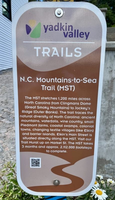
N.C. Mountains-to-Sea Trail (MST)
Yadkin Valley Trails
Photographed by Brandon D Cross
1. N.C. Mountains-to-Sea Trail (MST) Marker
Erected by Yadkin Valley Trails.
Topics. This historical marker is listed in these topic lists: Environment • Natural Resources • Parks & Recreational Areas.
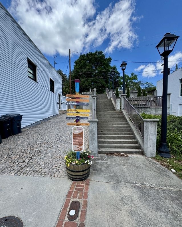
Location. 36° 14.688′ N, 80° 50.932′ W. Marker is in Elkin, North Carolina, in Surry County. It is at the intersection of East Main Street and Gwyn Avenue, on the left when traveling east on East Main Street. The marker is located across Main Street from Angry Troll Brewing. Touch for map. Marker is at or near this postal address: 222 East Main St, Elkin NC 28621, United States of America. Touch for directions.

Regionally, this marker is in the Piedmont. It is also in the American South, specifically in the Upper South, in Appalachia, and specifically in Southern Appalachia. Globally, it is in North America, the Western Hemisphere, the Western World, and the Anglosphere. Historically, it finds itself in what was once the territory of the Mississippian Culture, one of the original Thirteen Colonies, one of the Confederate States of America, and the Antebellum South.
Other nearby markers. At least 8 other markers are within walking distance of this marker: Bank of Elkin (about 500 feet away, measured in a direct line); Daniel Boone Highway Marker (about 600 feet away); Boone Trail Highway
this page online
Also see . . .
1. Mountains-to-Sea Trail. (Submitted on May 28, 2025, by Brandon D Cross of Flagler Beach, Florida.)
2. N.C. Mountains-to-Sea Trail. (Submitted on May 28, 2025, by Brandon D Cross of Flagler Beach, Florida.)
3. Yadkin River State Trail. (Submitted on May 28, 2025, by Brandon D Cross of Flagler Beach, Florida.)
Photographed by Brandon D Cross
2. N.C. Mountains-to-Sea Trail (MST) Marker
Credits. This page was last revised on June 3, 2025. It was originally submitted on May 28, 2025, by Brandon D Cross of Flagler Beach, Florida. This page has been viewed 132 times since then and 26 times this year. Photos: 1, 2. submitted on May 28, 2025, by Brandon D Cross of Flagler Beach, Florida. • J. J. Prats was the editor who published this page.
