Mackinaw City in Emmet County, Michigan — The American Midwest (Great Lakes)
Native American Waganogan
Photographed by Craig Doda, May 25, 2025
1. Native American Waganogan Marker
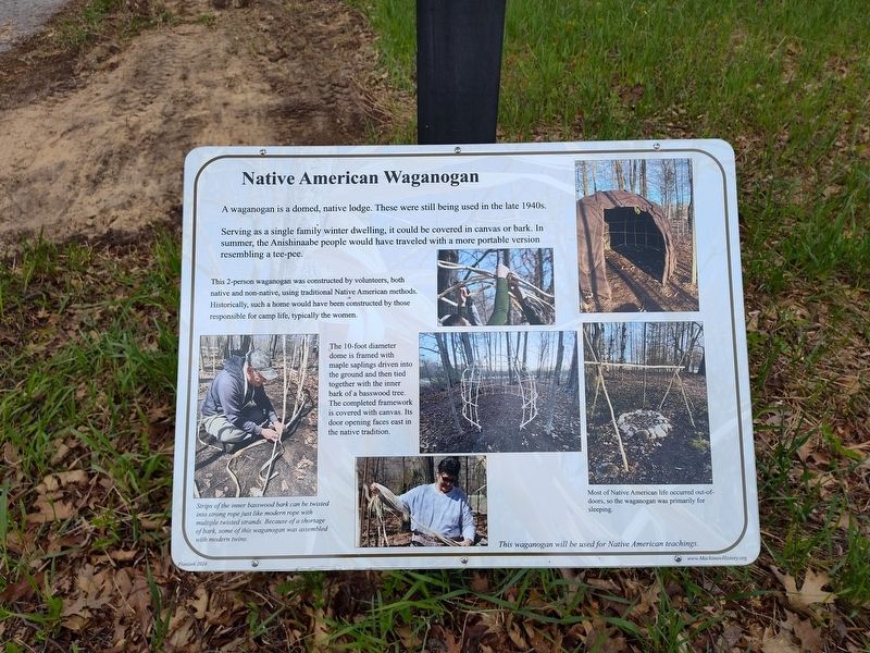
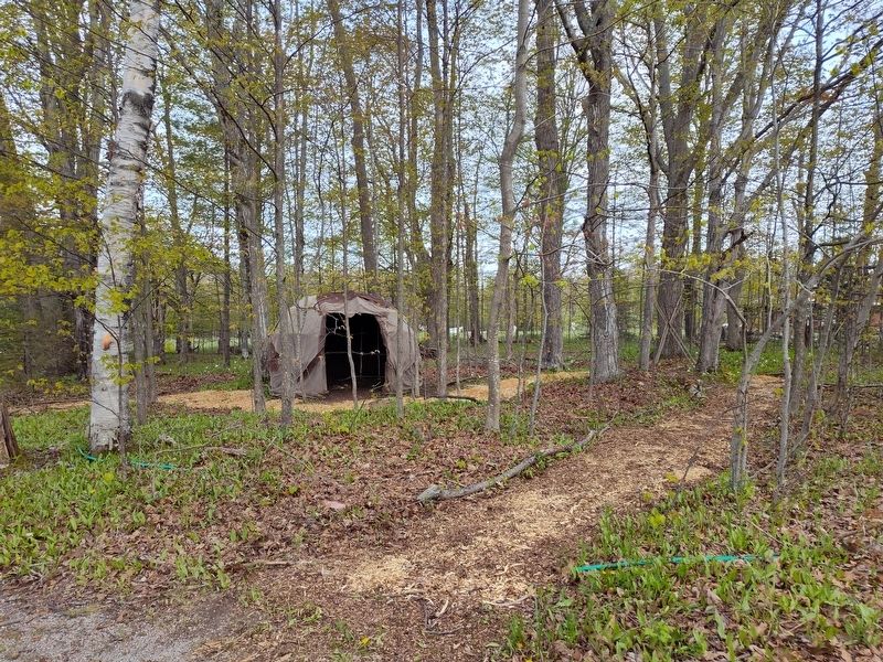
A waganogan is a domed, native lodge. These were still being used in the late 1940s.
Serving as a single family winter dwelling, it could be covered in canvas or bark. In summer, the Anishinaabe people would have traveled with a more portable version resembling a tee-pee.
This 2-person waganogan was constructed by volunteers, both native and non-native, using traditional Native American methods. Historically, such a home would have been constructed by those responsible for camp life, typically the women.
[Captions:]
The 10-foot diameter dome is framed with maple saplings driven into the ground and then tied together with the inner bark of a basswood tree. The completed framework is covered with canvas. Its door opening faces east in the native tradition.
Strips of the inner basswood bark can be twisted into strong rope just like modern rope with multiple twisted strands. Because of a shortage of bark, some of this waganogan was assembled with modern twine.
Most of Native American life occurred out-of- doors, so the waganogan was primarily for sleeping.
This waganogan will be used for Native American teachings.
Erected 2024
this page online
Topics. This historical marker is listed in these topic lists: Anthropology & Archaeology • Architecture • Indigenous Peoples and Communities.
Location. 45° 46.595′ N, 84° 46.276′ W. Marker is in Mackinaw City, Michigan, in Emmet County. It is at the intersection of Headlands Road and Wilderness Park Drive, on the right when traveling east on Headlands Road. Touch for map. Marker is at or near this postal address: 1425 W Central Ave, Mackinaw City MI 49701, United States of America. Touch for directions.

Regionally, this marker is in Northern Michigan Lower Peninsula, on the Straits of Mackinac, and in one of the Lake Michigan Shore counties. It is also in the American Midwest. Globally, it is in North America, in the Great North Woods, on the Great Lakes, in the Western Hemisphere, in the Western World, and in the Anglosphere. Historically, it finds itself in what was once the Viceroyalty of New France and also the Northwest Territory.
Other nearby markers. At least 8 other markers are within walking
Photographed by Craig Doda, May 25, 2025
2. Native American Waganogan Marker
Photographed by Craig Doda, May 25, 2025
3. Native American Waganogan Marker
Credits. This page was last revised on June 2, 2025. It was originally submitted on May 30, 2025, by Craig Doda of Napoleon, Ohio. This page has been viewed 104 times since then and 25 times this year. Photos: 1, 2, 3. submitted on May 30, 2025, by Craig Doda of Napoleon, Ohio. • Devry Becker Jones was the editor who published this page.
