Peterboro in Madison County, New York — The American Northeast (Mid-Atlantic)
The Barn
Photographed by Susan A. Dalaba, April 25, 2022
1. The Barn Marker
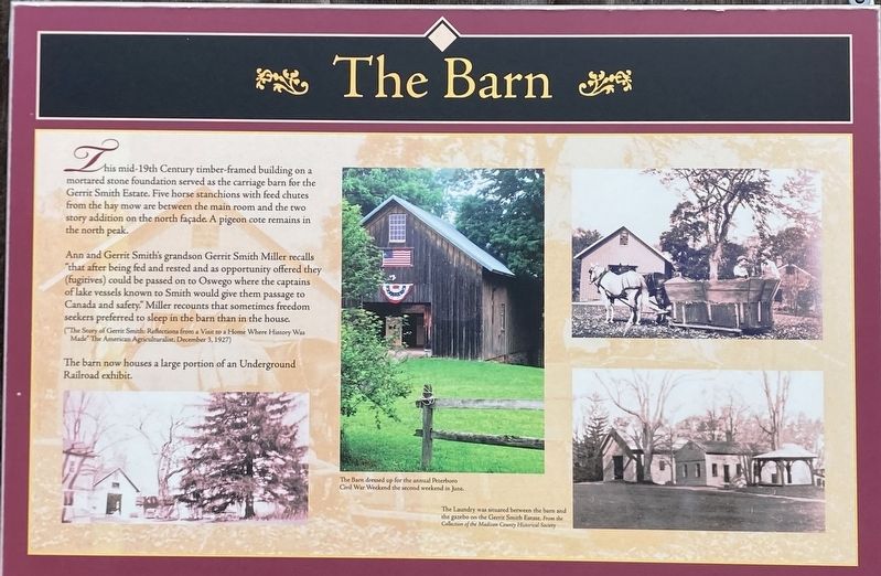
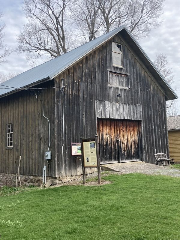
This mid-19th century timber-framed building on a mortar stone foundation served as the carriage barn for the Gerrit Smith Estate. Five horse stanchions with feed chutes from the hay mow are between the main room and the two story addition on the north facade a pigeon cote remains in the north peak.
Ann and Gerrit Smith’s grandson Gerrit Smith Miller recalls “that after being fed and rested and as opportunity offered they (fugitives) could be passed on to Oswego where the captains of the lake vessels known to Smith would give them passage to Canada and safety.” Miller recounts that sometimes freedom seekers preferred to sleep in the barn than in the house.
(“The Story of Gerrit Smith: Reflections from a Visit to a Home Where History was Made” The American Agriculture, December 3, 1927)
The barn now houses a large portion of an Underground Railroad exhibit.
Topics. This historical marker is listed in these topic lists: Abolition & Underground RR • African Americans • Agriculture. A significant day of the year for for this entry is December 3.
Location. 42° 58.091′ N, 75° 41.231′ W. Marker is in Peterboro, New York,
this page online

Regionally, this marker is in Upstate New York, specifically in Central New York, and in the Syracuse Metropolitan Area. It is also in the American Northeast and in the Mid-Atlantic. Globally, it is in North America, the Western Hemisphere, the Western World, and the Anglosphere. Historically, it finds itself in what was once the Haudenosaunee (Iroquois) Confederacy, New Netherland, and one of the original Thirteen Colonies.
Other nearby markers. At least 8 other markers are within walking distance of this marker: Designations (here, next to this marker); Myths of The Underground Railroad (here, next to this marker); The Lodge (a few steps from this marker); The Laundry (a few steps from this marker); To Work In The Abolition Movement (within
Photographed by Susan A. Dalaba, April 25, 2022
2. The Barn Marker
Photographed by Susan A. Dalaba, April 25, 2022
3. The Barn Marker
Credits. This page was last revised on June 1, 2025. It was originally submitted on April 6, 2025, by Susan A. Dalaba of Cortland, New York. This page has been viewed 139 times since then and 17 times this year. Last updated on May 30, 2025, by Susan A. Dalaba of Cortland, New York. Photos: 1, 2, 3. submitted on April 6, 2025, by Susan A. Dalaba of Cortland, New York. • Devry Becker Jones was the editor who published this page.
