Port Dalhousie in St. Catharines in Niagara Region, Ontario — Central Canada (North America)
Quakers and Conscientious Objection

Photographed by Kevin Westell, May 15, 2025
1. Quakers Marker
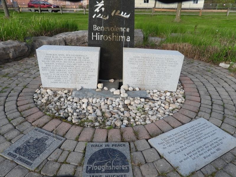
Since 1660 Quakers have been guided by their Peace Testimony to reject war and practise nonviolence. In 1793 the government of Upper Canada recognized the right of Quakers, Mennonites and Brethren in Christ to conscientious objection. During the war of 1812 many Quakers refused to serve in the armed forces or provide material support.
"A good end cannot sanctify evil means; nor must we ever do evil, that good may come of it… Let us then try what Love will do." William Penn, 1693
Topics and series. This historical marker is listed in these topic lists: Civil Rights • Colonial Era • Peace • Religion & Religious Structures. In addition, it is included in the Quakerism series list. A significant historical year for this entry is 1660.
Location. 43° 11.972′ N, 79° 15.99′ W. Marker is in St. Catharines, Ontario, in Niagara Region. It is in Port Dalhousie. It is on Lakeport Road south of Harbour Walkway Trail, on the right when traveling south. Touch for map. Marker is at or near this postal address: 60 Lakeport Road, St Catharines ON L2N 4P6, Canada. Touch for directions.

Regionally, this marker is
this page online
Other nearby markers. At least 8 other markers are within walking distance of this marker: St. Catharines Horticultural Society (within shouting distance of this marker); Restoring the Henley Rowing Course at Martindale Pond (about 90 meters away, measured in a direct line); Lock One of the Third Welland Canal (about 120 meters away); Lockkeeper's Shanty 1887 (about 120 meters away); Howes Park (about 120 meters away); First Women Rowers In The Royal Canadian Henley Regatta 1948 (about 120 meters away); The Muir Brother's Dry Docks (about 150 meters away); Lock 1, Third Welland Canal (about 150 meters away). Touch for a list and map of all markers in St. Catharines.
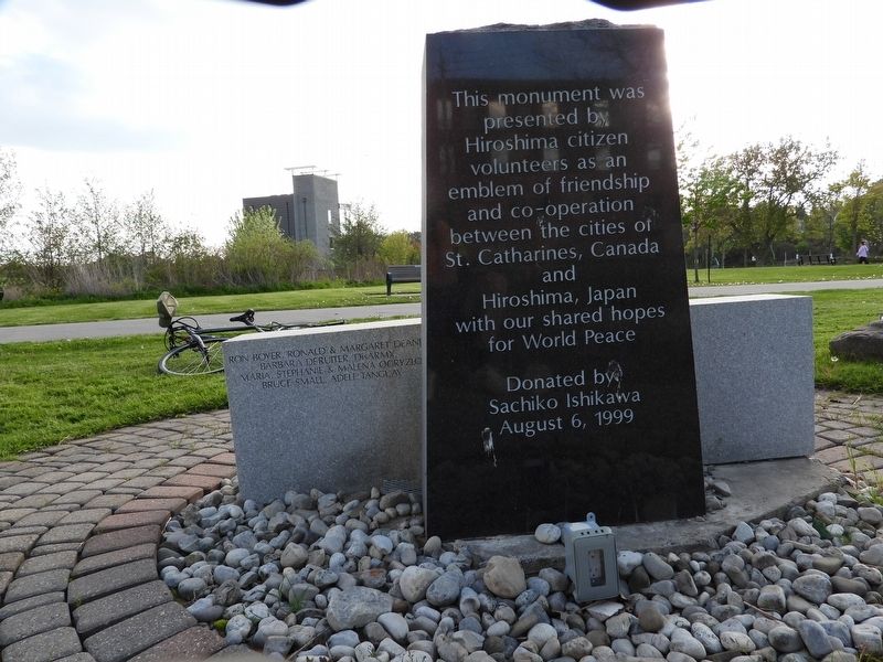
More about this marker. This is one component of the Peace Garden monument within Rennie Park.
Photographed by Kevin Westell, May 15, 2025
2. Peace Garden monument within Rennie Park
Photographed by Kevin Westell, May 15, 2025
3. Reverse - Peace Garden monument within Rennie Park
Credits. This page was last revised on June 1, 2025. It was originally submitted on May 16, 2025, by Kevin Westell of St. Catharines, Ontario. This page has been viewed 97 times since then and 19 times this year. Last updated on June 1, 2025, by Kevin Westell of St. Catharines, Ontario. Photos: 1, 2, 3. submitted on May 16, 2025, by Kevin Westell of St. Catharines, Ontario. • Devry Becker Jones was the editor who published this page.
