Near Auburn in Nemaha County, Nebraska — The American Midwest (Upper Plains)
Half-Breed Tract
| — | Nebraska Historical Marker | — |
Photographed by William Fischer, Jr., May 30, 2011
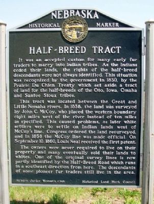
1. Half-Breed Tract Marker
It was an accepted custom for many early fur traders to marry into Indian tribes. As the Indians ceded their lands, the rights of the half-breed descendants were not always identified. This situation was recognized by the government in 1830, byt the Prairie Du Chien Treaty which set aside a tract of land for the half-breeds of the Oto, Iowa, Omaha and Santee Sioux tribes.
This tract was located between the Great and Little Nemaha rivers. In 1838, the land was surveyed by John C. McCoy, who placed the western boundary as specified. This caused problems, as later white settlers were to settle on Indian lands west of McCoy's line. Congress ordered the land resurveyed, and in 1858 the McCoy line was made official. On September 10, 1860, Louis Neal received the first patent.
The owners were never required to live on their property and many eventually sold their lands to whites. One of the original survey lines is now partly identified by the Half-Breed Road which runs in a southeast direction from here. The descendants of some pioneer fur traders still live in the area.
Erected by Auburn Junior Woman's Club and Historical
this page online
Topics and series. This historical marker is listed in these topic lists: Indigenous Peoples and Communities • Settlements & Settlers • Women. In addition, it is included in the Nebraska State Historical Society series list. A significant historical month for this entry is September 1848.
Location. 40° 23.576′ N, 95° 49.306′ W. Marker is near Auburn, Nebraska, in Nemaha County. It is on Central Avenue (U.S. 136) near Half-Breed Road, on the right when traveling west. Marker is at a roadside pullout. Touch for map. Marker is in this post office area: Auburn NE 68305, United States of America. Touch for directions.

Regionally, this marker is in Eastern Nebraska. It is also in the American Midwest, in the Lewis & Clark Corridor, in the Corn Belt, and on the prairies. Globally, it is in North America, the Western Hemisphere, the Western World, and the Anglosphere. Historically, it finds itself in what was once the Louisiana Purchase.
Other nearby markers. At least 8 other markers are within 8 miles of this marker, measured as the crow flies: Legion Memorial Park Lily Pond (approx. 0.8 miles
Photographed by William Fischer, Jr., May 30, 2011
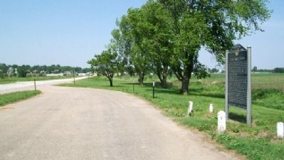
2. Half-Breed Tract Marker
Looking west along US Hwy 136 toward Auburn
More about this marker. The marker had been struck by a car and damaged but has since been restored and returned to the site.
Also see . . . Half-Breed Tract. Wikipedia entry (Submitted on May 20, 2022, by Larry Gertner of New York, New York.)
Photographed by William Fischer, Jr., May 30, 2011
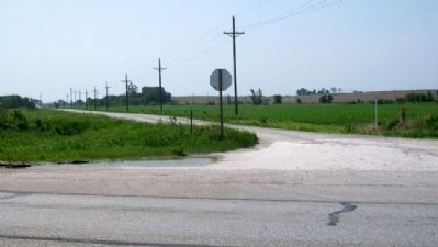
3. Half-Breed Road
Looking south across US Hwy 136, with Half-Breed Road running off to the left distance (southeast)
Credits. This page was last revised on June 4, 2025. It was originally submitted on October 10, 2011, by William Fischer, Jr. of Reynoldsburg, Ohio. This page has been viewed 2,089 times since then and 118 times this year. Last updated on June 4, 2025, by Jeff Barnes of Omaha, Nebraska. Photos: 1, 2, 3. submitted on October 10, 2011, by William Fischer, Jr. of Reynoldsburg, Ohio. • Devry Becker Jones was the editor who published this page.
Editor’s want-list for this marker. Photo at pull-off showing former location of marker. • Can you help?
