
Fort Valley near Luray in Page County, Virginia — The American South (Mid-Atlantic)
Pump House
| — | Camp Roosevelt Interpretive Trail | — |
Photographed by Linda Walcroft, May 31, 2025
1. Camp Roosevelt Pump House Marker
captions)
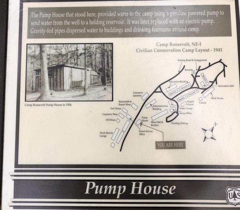
Camp Roosevelt Pump House in 1936.
Camp Roosevelt, NF-1
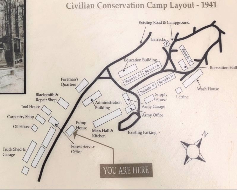
Civilian Conservation Camp Layout - 1941
Erected by US Forest Service.
Topics. This historical marker is listed in these topic lists: Charity & Public Work • Parks & Recreational Areas. A significant historical year for this entry is 1936.
Location. 38° 43.75′ N, 78° 31.055′ W. Marker is near Luray, Virginia, in Page County. It is in Fort Valley. It is on Camp Roosevelt Road (Virginia Route 675) south of Crisman Hollow Road, on the left when traveling south. Marker is barely visible from Camp Roosevelt Road. See the map on the marker. Touch for map. Marker is in this post office area: Fort Valley VA 22652, United States of America. Touch for directions.

Regionally, this marker is in Virginia’s Shenandoah Valley. It is also in the American South and specifically in the
this page online
Other nearby markers. At least 8 other markers are within 5 miles of this marker, measured as the crow flies: Blacksmith Shop (within shouting distance of this marker); Mess Hall (within shouting distance of this marker); Birthplace of the CCC (about 300 feet away, measured in a direct line); Robert Fechner Memorial Forest (about 300 feet away); Camp Barracks (about 400 feet away); Elk Run Meeting House (approx. 4.7 miles away); Corn Crib (approx. 4.7 miles away); Burner Barn (approx. 4.7 miles away). Touch for a list and map of all markers in Luray.
More about this marker. The map lists the location of buildings that no longer stand. It also shows the roads through the recreation area, which are open in the summer.
Additional keywords. CCC
Photographed by Linda Walcroft, May 31, 2025
2. Wide View of Pump House Marker
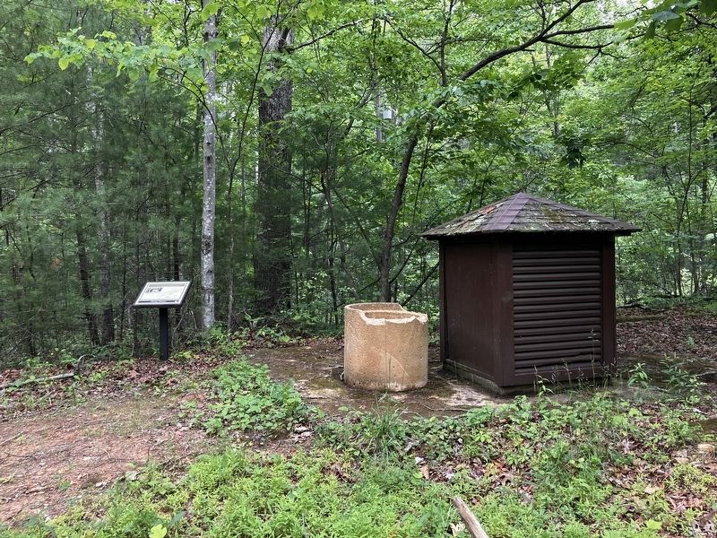
The building next to it appears to be a later pump house. At the present time, there is no running water at Camp Roosevelt.
Photographed by Linda Walcroft
3. Map of Camp Roosevelt in 1941
Barracks E, F
Blacksmith & Repair Shop
Tool House
Carpentry Shop
Oil House,
Foreman's Quarters
Education Building
Barracks A
Barracks B
Administration Building
Barracks C
Recreation Hall
Wash House
Latrine
Barracks D
Supply House
Army Garage
Army Office
Pump House
Mess Hall & Kitchen
Existing Parking
Truck Shed & Garage
Forest Service Office
Credits. This page was last revised on June 6, 2025. It was originally submitted on June 5, 2025, by Linda Walcroft of Woodstock, Virginia. This page has been viewed 125 times since then and 16 times this year. Photos: 1, 2, 3. submitted on June 5, 2025, by Linda Walcroft of Woodstock, Virginia. • Bernard Fisher was the editor who published this page.
