
Hunts Point in the Bronx in Bronx County, New York — The American Northeast (Mid-Atlantic)
Joseph Rodman Drake Park
Cemetery and Enslaved African Burial Ground
| — | 2.49 acres | — |
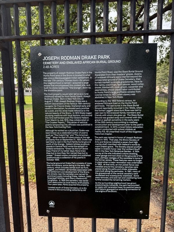
The Hunt property would later serve as a rural childhood retreat for Hunt family friend, Joseph Rodman Drake. Born in New York City on August 7, 1795, Joseph Rodman Drake was a distant descendant of the famous 16th-century navigator Sir Francis Drake. Orphaned early and raised in Manhattan, he showed early promise as a poet, and his verse made reference to the natural beauty of the Bronx. In 1813 Drake began studying beauty of the Bronx. In 1813 Drake began studying medicine with local doctors, and around this time befriended poet Fitz-Greene Halleck. From March to July 1819, they collaborated on "The Croaker Papers." This series of satirical poems lampooning City officials was published in the New York Evening Post.
Although he worked as a physician, Drake was best known as
this page online
The burial ground at Drake Park consists of more than 40 markers, some dating to the early 18th century, which includes names such as Hunt, Leggett, and Willett--all families associated with the settlement and development of the Bronx. The streets near the cemetery are named for prominent poets including Drake, Halleck, (John Greenleaf) Whittier, and (Henry Wadsworth) Longfellow. In 1905 the cemetery was saved from destruction by local literary enthusiasts. Four years later, Parks acquired the property.
Located south of Drake Cemetery, on a dry mound in the surrounding wetlands by old Hunts Point
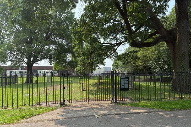
According to the 1800 federal census, 44 enslaved Africans lived on the Hunts Point peninsula. The last burial in the Slave Burial Ground reportedly occurred in the 1840s, when the former Leggett slave Aunt Rose was laid to rest next to the enslaved family members and friends with whom she grew up. The Slave Burial Ground was graded away and covered with dirt, gravel or asphalt sometime in the early years of the 20th century succumbing to roadway construction and developed prior to the park's establishment. In 2013, a locally history education project conducted with school children at nearby P.S. 48 unearthed much of this forgotten historical chapter.
The park was
As the surrounding neighborhood has ground predominantly industrial, the park has provided an oasis with venerable trees; its pastoral beauty and historic graveyard an enduring connection to the origins of the Bronx.
Erected by NYC Parks. (Marker Number 302.)
Topics and series. This historical marker is listed in these topic lists: African Americans • Cemeteries & Burial Sites • Parks & Recreational Areas • Settlements & Settlers. In addition, it is included in the NYC Parks series list. A significant historical month for this entry is July 1819.
Location. 40° 48.63′ N, 73° 52.957′ W. Marker is in Bronx, New York, in Bronx County. It is in Hunts Point. It is on Oak Point Avenue just west of Hunts Point Avenue, on the right when traveling east. Touch for map. Marker is at or near this postal address: 501 Hunts Point Ave, Bronx NY 10474, United States of America. Touch for directions.

Regionally, this marker is in New York City. It is also in the American Northeast, in the Mid-Atlantic, and on the Eastern Seaboard. Globally, it is in the North Atlantic Region, North America, the Western Hemisphere, the Western World, and the Anglosphere. Historically, it finds itself in what was once New Netherland and also one of the original Thirteen Colonies.
Other nearby markers. At least 8 other markers are within walking distance of this marker: Barretto Point Park (approx. 0.4 miles away); The Bronx River (approx. half a mile away); The Islands of "Barretto Bay" (approx. half a mile away); General Slocum Disaster (approx. half a mile away); Fufidio Triangle War Memorial (approx. half a mile away); Fufidio Triangle (approx. half a mile away); what's that box doing over there? (approx. half a mile away); Willis Avenue Bridge Stones (approx. 0.8 miles away). Touch for a list and map of all markers in Bronx.
Credits. This page was last revised on June 8, 2025. It was originally submitted on June 8, 2025, by Devry Becker Jones of Washington, District of Columbia. This page has been viewed 206 times since then and 30 times this year. Photos: 1, 2, 3. submitted on June 8, 2025, by Devry Becker Jones of Washington, District of Columbia.
