
Springdale in Washington County, Utah — The American Mountains (Southwest)
Canyon or Cathedral
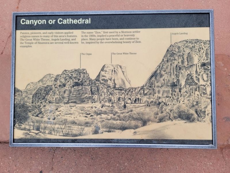
Photographed by Jeremy Snow, June 2, 2025
1. Canyon or Cathedral Marker
The name "Zion," first used by a Mormon settler in the 1860s, implied a peaceful or heavenly place. Many people have been, and continue to be, inspired by the overwhelming beauty of Zion.
Topics. This historical marker is listed in these topic lists: Natural Features • Parks & Recreational Areas. A significant historical year for this entry is 1860.
Location. 37° 16.358′ N, 112° 56.797′ W. Marker is in Springdale, Utah, in Washington County. It is on Zion Canyon Road, on the right when traveling south. The marker is located at the Big Bend Viewpoint. Touch for map. Marker is at or near this postal address: Zion Canyon Road, Springdale UT 84767, United States of America. Touch for directions.

Regionally, this marker is in Utah’s Color Country. It is also in the American Southwest, in the Mountain West, and on the Colorado Plateau. Globally, it is in North America, the Rocky Mountains, the Western Hemisphere,
this page online
Other nearby markers. At least 8 other markers are within 5 miles of this marker, measured as the crow flies: Cables from the Rim (approx. half a mile away); Zion Lodge (approx. 1.6 miles away); Tourists in the Canyon (approx. 1.6 miles away); Sentinel Slide (approx. 2.6 miles away); Court of the Patriarchs (approx. 2.6 miles away); Zion Mt. Carmel Tunnel and Highway, Utah (approx. 4.1 miles away); Impassable Barrier (approx. 4.2 miles away); Stephen Tyng Mather (approx. 4.7 miles away). Touch for a list and map of all markers in Springdale.
Credits. This page was last revised on June 9, 2025. It was originally submitted on June 9, 2025, by Jeremy Snow of Cedar City, Utah. This page has been viewed 120 times since then and 30 times this year. Photo 1. submitted on June 9, 2025, by Jeremy Snow of Cedar City, Utah. • Andrew Ruppenstein was the editor who published this page.
Editor’s want-list for this marker. photo of the marker in context • Can you help?
