Hunts Point in the Bronx in Bronx County, New York — The American Northeast (Mid-Atlantic)
General Slocum Disaster
| — | City of New York Parks & Recreation | — |
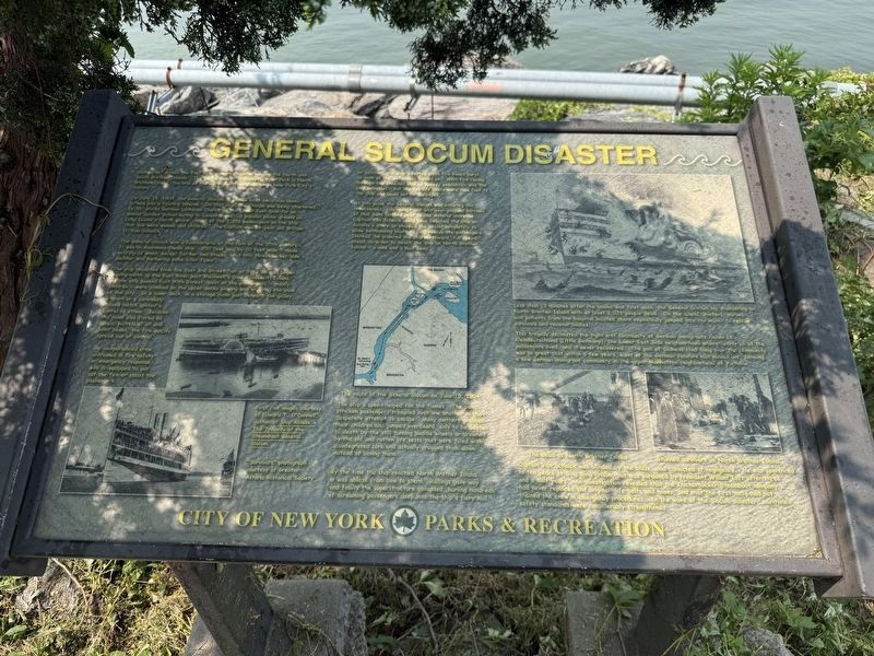
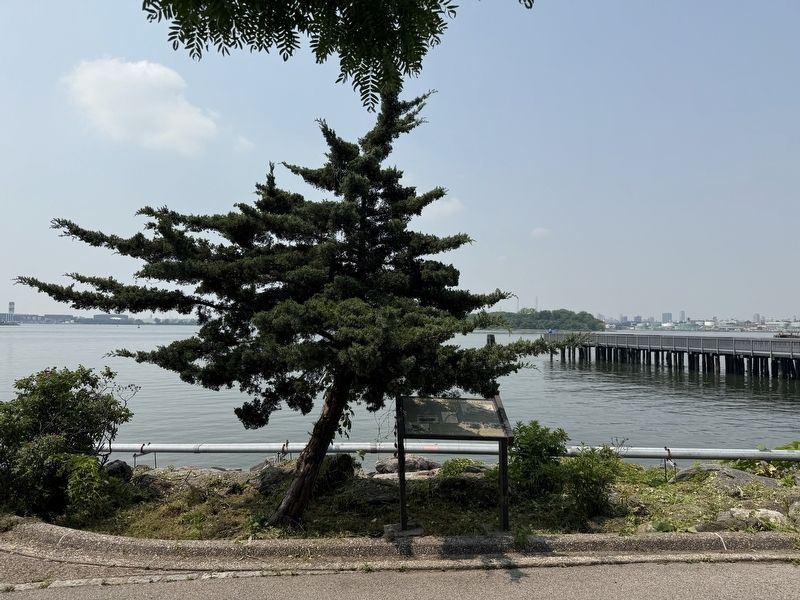
Looking out across the East River towards Manhattan are the North and South Brother Islands. The island closest to Barretto Point Park is North Brother Island, the site of the worst maritime disaster in New York City's history.
On June 15, 1904, the General Slocum, a paddle boat excursion vessel, turned into a floating inferno. On that day, the Slocum was being chartered by St. Marks German Lutheran Church on the Lower East Side for an annual Sunday School outing to Locust Grove, a popular picnic ground on Long Island's North Shore. Most of the 1,358 passengers on the ship that day were women and children. The Captain was 68-year old William H. Van Schaick.
The General Slocum was a familiar site at the turn of the 20th century. It was an enormous steam ship — 250 feet long by 70 feet wide — made entirely of wood, except for her two stacks. But this three-decker side paddler was harboring some killer flaws.
The ship departed from the East 3rd Street Pier at 9:40 am and began moving north up the East River past Blackwell's (now Roosevelt) Island. As the ship passed East 90th Street, most of the passengers — mostly
this page online
An inexperienced crew, untrained in fire safety or emergency response, was ill-equipped to put out the fire or assist the passengers.
In addition, the ship's rotted cloth fire hoses burst as soon as the water was turned on. With the fire racing through the crowded ship, a speedy evacuation was the only salvation. But the ten life boats were tied fast to the ship and could not be dislodged.
At this point the General Slocum was entering the treacherous, tide-swept and whirlpool-plagued narrows of Hell Gate located next to the Astoria shoreline. Captain Van Schaick could have beached the ship on Astoria's shore or stopped the vessel completely to allow surrounding boats to help rescue the passengers. Instead, he ordered the ship northward, full speed ahead, in order to beach the ship on North Brother Island — a
The ship's speed helped fan the flames. The panic stricken passengers trampled over one another in their desperate attempt to escape. Many mothers grabbed their children and jumped overboard, only to be beaten to death by the still turning paddle wheels or drowned by the old and rotten life vests that were filled with disintegrated cork and actually dragged them down instead of saving them.
By the time the ship reached North Brother Island it was ablaze from bow to stern. Railings gave way and finally the superstructure collapsed, hurling hundreds of screaming passengers deep into the fiery hull.
Less than 15 minutes after the smoke was first seen, the General Slocum lay smoldering on North Brother Island with at least 1,021 people dead. On the island, doctors, nurses, and patients from the hospital located there repeatedly jumped into the water to rescue survivors and recover bodies.
This tragedy decimated the tight knit community of German immigrants known as Kleindeutschland (Little Germany), the Lower East Side neighborhood where nearly all of the passengers lived, and it never recovered. The pall of sadness that hung over the community was so great that within a few years, most of the German families had moved out, forming a new German immigrant community in the upper Manhattan neighborhood of Yorkville.
Captain Van Schaick was blinded by the blaze, and convicted of negligence. He was sentenced to ten years at Sing Sing Prison, but was pardoned by President William Taft after three and a half years. An investigation revealed that the Knickerbocker Steamboat company had never replaced the original life belts and hoses, and that the first mate had not trained the crew in emergency procedures. In the wake of the Slocum disaster, maritime safety standards were considerably stengthened.
Erected by City of New York Parks & Recreation (NYC Parks).
Topics and series. This historical marker is listed in these topic lists: Disasters • Immigration • Industry & Commerce • Waterways & Vessels. In addition, it is included in the Lost at Sea, and the NYC Parks series lists. A significant historical date for this entry is June 15, 1904.
Location. 40° 48.314′ N, 73° 53.35′ W. Marker is in Bronx, New York, in Bronx County. It is in Hunts Point. It can be reached from the intersection of Viele Avenue and Tiffany Street, on the left when traveling west. Touch for map. Marker is at or near this postal address: 1121 Viele Ave, Bronx NY 10474, United States of America. Touch for directions.

Regionally, this marker is in New York City. It is also in the American Northeast, in the Mid-Atlantic, and on the Eastern Seaboard. Globally, it is in the North Atlantic Region, North America, the Western Hemisphere, the Western World, and the Anglosphere. Historically, it finds itself in what was once New Netherland and also one of the original Thirteen Colonies.
Other nearby markers. At least 8 other markers are within walking distance of this marker: The Islands of "Barretto Bay" (within shouting distance of this marker); Barretto Point Park (about 500 feet away, measured in a direct line); Joseph Rodman Drake Park (approx. half a mile away); Fufidio Triangle War Memorial (approx. 0.6 miles away); Fufidio Triangle (approx. 0.6 miles away); Willis Avenue Bridge Stones (approx. 0.9 miles away); The Bronx River (approx. 0.9 miles away); what's that box doing over there? (approx. one mile away). Touch for a list and map of all markers in Bronx.
Credits. This page was last revised on June 9, 2025. It was originally submitted on June 9, 2025, by Devry Becker Jones of Washington, District of Columbia. This page has been viewed 263 times since then and 65 times this year. Photos: 1, 2. submitted on June 9, 2025, by Devry Becker Jones of Washington, District of Columbia.
