Near Richmond in Henrico County, Virginia — The American South (Mid-Atlantic)
Battle of Glendale
Preservation Corridor
Photographed by Bernard Fisher, June 13, 2025
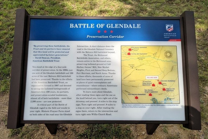
1. Battle Of Glendale Marker
"By preserving these battlefields, the Trust and its partners have ensured that this land will be protected and appreciated by future generations"
- David Duncan, President, American Battlefield Trust
You stand at the edge of a four-mile corridor of preservation. In the 1990s just one acre of the Glendale battlefield and 130 acres of the vast Malvern Hill battlefield had been preserved. Thanks to the efforts of the American Battlefield Trust, an organization formed in 1987 and devoted to saving the hallowed battlegrounds of America's first 100 years, its partners, and preservation-minded landowners, almost all of both battlefields—more than 2,100 acres—are now protected.
A critical part of the Battle of Glendale raged in the field and woods to your right. Historic Frayser Farm stood on both sides of the road near the Glendale Intersection. A short distance down the road is the Glendale National Cemetery with the Malvern Hill battlefield beyond.
The Trust, the Richmond Battlefields Association, and others, remain active in the Richmond area, preserving hallowed ground at Cold Harbor, Gaines' Mill, New Market
this page online
To learn more about Glendale, after reading these signs and the one on the knoll behind you, turn right out of the driveway and proceed .4 miles to the stop sign. Turn right and proceed .9 miles to a stop on your right. After reading the signs there, return to the intersection and turn right onto Willis Church Road.
(captions) This map depicts battlefields in the area you may visit. Interpretation is coming at the First and Second Deep Bottom battlefields.
Erected 2025 by American Battlefield Trust.
Topics. This historical marker is listed in this topic list: War, US Civil.
Location. 37° 26.951′ N, 77° 14.407′ W. Marker is near Richmond, Virginia, in Henrico County. It can be reached from Charles City Road 0.4 miles north of Darbytown Road, on the left when traveling north. Touch for map. Marker is at or near this
Photographed by Bernard Fisher, June 13, 2025
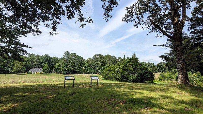
2. Battle Of Glendale Markers

Regionally, this marker is in the Piedmont and in Central Virginia. It is also in the American South, specifically in the Upper South, and on the Eastern Seaboard. Globally, it is in the North Atlantic Region, North America, the Western Hemisphere, the Western World, and the Anglosphere. Historically, it finds itself in what was once the territory of the Mississippian Culture, one of the original Thirteen Colonies, one of the Confederate States of America, and the Antebellum South.
Other nearby markers. At least 8 other markers are within walking distance of this marker: A different marker also named Battle of Glendale (here, next to this marker); a different marker also named Battle of Glendale (about 300 feet away, measured in a direct line); Frazier's Farm (about 600 feet away); Seven Days Battles (approx. 0.2 miles away); a different marker also named Frazier's Farm (approx. ¼ mile away); Pvt. Benjamin B. Levy (approx. ¼ mile away); a different marker also named Seven Days’ Battles (approx. 0.4 miles away); Glendale (Frayser’s Farm)
Photographed by Bernard Fisher, June 13, 2025
3. American Battlefield Trust (entrance sign)
Also see . . .
1. Glendale (Frazier's Farm). American Battlefield Trust (ABT) (Submitted on June 14, 2025.)
2. Glendale (Frayser's Farm). Richmond Battlefields Association (RBA) (Submitted on June 14, 2025.)
Credits. This page was last revised on July 24, 2025. It was originally submitted on June 14, 2025, by Bernard Fisher of Richmond, Virginia. This page has been viewed 269 times since then and 44 times this year. Photos: 1, 2, 3. submitted on June 14, 2025, by Bernard Fisher of Richmond, Virginia.
