
Winchester in Frederick County, Virginia — The American South (Mid-Atlantic)
The Second Battle of Kernstown
The Last Confederate Victory in the Valley
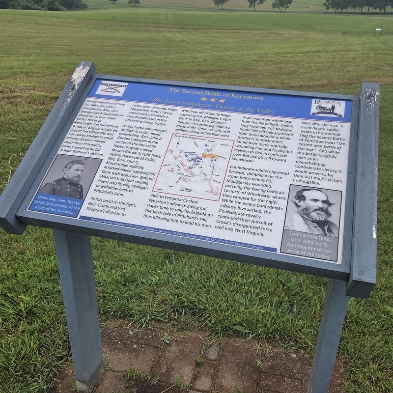
Photographed by Mike McKeown, June 14, 2025
1. The Second Battle of Kernstown Marker
As the battle commenced Mulligan's units moved toward Maj. Gen. John Gordon's division in the center of the line while Hayes' brigade moved toward Gordon's right flan Before Hayes could strike, Maj. Gen. John C. 8reckinridge skillfully attacked Hayes' exposed left flank with Brig. Gen. Gabriel Wharton's division routing Hayes and forcing Mulligan to withdraw back to Pritchard's Lane.
At this point in the fight, Gen. Crook ordered Thoburn's division to able to temporarily slow Wharton's advance giving Hayes time to rally his brigade on the back side of Pritchard 's Hill, thus allowing him to lead his men in an organized withdrawal from the battlefield. Before long however,
this page online
Confederate soldiers sprinted forward, climbing over the stone fence where Co! Mulligan lay wounded, pursuing the fleeing Federals to the north of Winchester where they camped for the night. While the weary Confederate infantry bivouacked, the Confederate cavalry continued their pursuit of Crook's disorganized force well into West Virginia.
Well after the war, a Confederate soldier wrote in his memoir that the Second Battle of Kernstown was "the easiest won battle of the war." And while this battle is rightly seen as an overwhelming Confederate victory, it would prove to be in their last major victory in the Valley.
(captions)
Union Maj. Gen. George Crook, Commander of the Army of the Kanawha
Confederate Lieut. Gen. Jubal Early, Commander of the Army of the Valley
Donated to the People of the United States in Memory of Chris- Dudley, Deputy Director of US Marshals Service
Erected by Kernstown Battlefield Association and the Blue & Gray Education Society.
Topics. This historical marker is listed in this topic list: War, US Civil. A significant historical date for this entry is July 24, 1864.
Location. 39° 8.727′ N, 78° 11.963′ W. Marker is in Winchester, Virginia, in Frederick County. It can be reached from Battle Park Drive half a mile west of Valley Avenue (U.S. 11), on the right when traveling west. Located atop Pritchard's Hill on the Kernstown battlefield. Touch for map. Marker is at or near this postal address: 610 Battle Park Dr, Winchester VA 22601, United States of America. Touch for directions.

Regionally, this marker is in Virginia’s Shenandoah Valley. It is also in the American South, specifically in the Upper South, and in the Mid-Atlantic. Globally, it is in North America, the Western Hemisphere, the Western World, and the Anglosphere. Historically, it finds itself in what was once the territory of the Mississippian Culture, one of the original Thirteen Colonies, one of the Confederate States of America, and the Antebellum South.
Other nearby markers. At least 8 other markers are within walking distance of this marker: Battle of First Kernstown (about 700 feet away, measured in a direct line); The First Battle of Kernstown (about 700 feet away); Pettus Cousins in the Battle of First Kernstown (about 800 feet away); Second Battle of Winchester (about 800 feet away); Ely's Brigade Actions in the Valley (approx. 0.2 miles away); a different marker also named The Second Battle of Kernstown (approx. 0.2 miles away); Pritchard Family Cemetery (approx. 0.2 miles away); Site of the Original Pritchard Barn (approx. 0.2 miles away). Touch for a list and map of all markers in Winchester.
Also see . . .
1. Second Kernstown. American Battlefield Trust (Submitted on June 15, 2025.)
2. Kernstown Battlefield. Shenandoah Valley Battlefields Foundation (Submitted on June 15, 2025.)
Credits. This page was last revised on June 15, 2025. It was originally submitted on June 14, 2025, by Mike McKeown of Baltimore, Maryland. This page has been viewed 181 times since then and 33 times this year. Photo 1. submitted on June 14, 2025, by Mike McKeown of Baltimore, Maryland. • Bernard Fisher was the editor who published this page.
