
Homer in Niagara-on-the-Lake in Niagara Region, Ontario — Central Canada (North America)
At Or Near This Spot In The Year 1795
Photographed by Kevin Westell, June 16, 2025
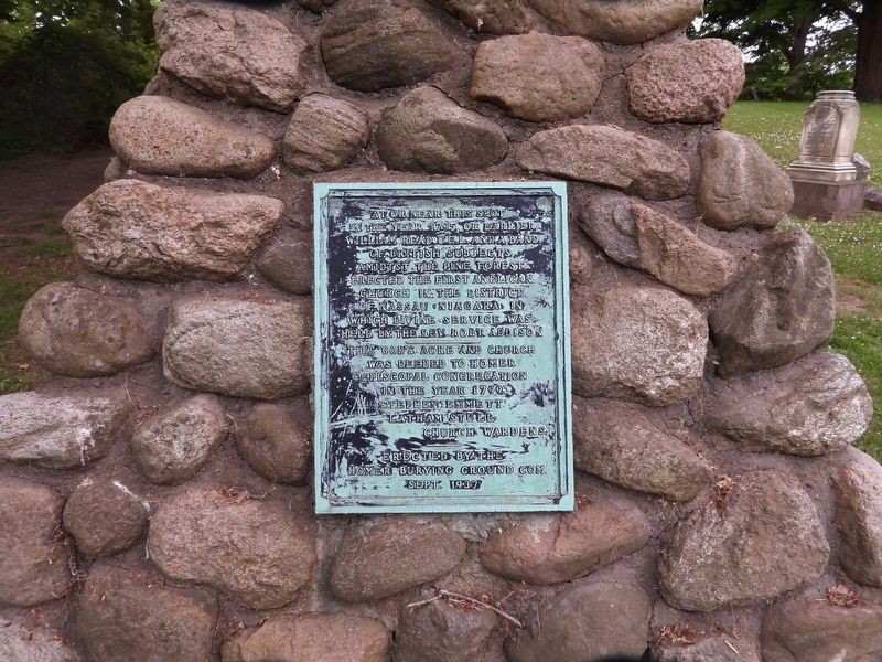
1. At Or Near This Spot In The Year 1795 Marker
William Read UEL and a band of British subjects amidtst the pine forest erected the first Anglican chuch in the district of Nassau (Niagara) in which divine service was held by the rev Robt. Addison
This God's acre and church was deeded to Homer Episcopal Congregation in the year 1799.
Stephen Emmett
Latham Stull
Church Wardens.
Erected 1937 by Homer Burying Ground Committee.
Topics and series. This historical marker is listed in these topic lists: Cemeteries & Burial Sites • Colonial Era • Religion & Religious Structures • Settlements & Settlers. In addition, it is included in the The Welland Canals series list. A significant historical year for this entry is 1795.
Location. 43° 9.963′ N, 79° 11.504′ W. Marker is in Niagara-on-the-Lake, Ontario, in Niagara Region. It is in Homer. It is on Queenston Road, on the right when traveling east. Touch for map. Marker is at or near this postal address: 34 Queenston Road, Niagara-on-the-Lake ON L0S 1J0, Canada. Touch for directions.

Regionally, this marker is on Ontario’s Golden Horseshoe
this page online
Other nearby markers. At least 8 other markers are within walking distance of this marker: Private Alexander Watson (approx. one kilometer away); Rev. Anthony Burns (approx. one kilometer away); Victoria Lawn Cemetery (approx. one kilometer away); Welland Canal Fallen Workers Memorial (approx. one kilometer away); 10th (St. Catharines) Field Battery R. C. A. 1939-1945 / 10th Field Battery (approx. 1.1 kilometers away); Grantham Township War Memorial (approx. 1.1 kilometers away); Cannon Barrel (approx. 1.1 kilometers away); The Fourth Welland Canal (approx. 1.1 kilometers away).
More about this marker. UEL stands for United Empire Loyalists.
Regarding At Or Near This Spot In The Year 1795. The hamlet of Homer existed here. It was mostly swallowed by progress, when land for the
Photographed by Kevin Westell, June 16, 2025
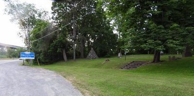
2. At Or Near This Spot In The Year 1795 - Marker in context
Photo is facing east along Queenston Street's shoulder and shoulder parking. The marker is on the stone cairn, which is at the north-east corner of this small pioneer cemetery.
Credits. This page was last revised on June 16, 2025. It was originally submitted on June 16, 2025, by Kevin Westell of St. Catharines, Ontario. This page has been viewed 104 times since then and 15 times this year. Photos: 1, 2. submitted on June 16, 2025, by Kevin Westell of St. Catharines, Ontario. • Andrew Ruppenstein was the editor who published this page.
