Brighton in Northumberland County, Ontario — Central Canada (North America)
Van Sicklen Cemetery
Photographed by Tim Boyd, June 8, 2025
1. Van Sicklen Cemetery Marker
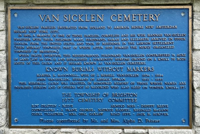
Van Sicklen families emigrated from Holland to America before New Amsterdam became New York City.
In 1805, a branch of one of those families, Cornelius and his wife Hannah van Sicklen together with their children Mary, Ferdinand, Sarah and Elizabeth arrived in Upper Canada from the United States and took up residence in the Lawson Settlement (then Murray Township, part of which after 1850 formed the newly organized Township of Brighton.)
When death overtook this neighborhood, Ferdinand van Sicklen contributed 1/2 acre of land (Lot 28 Con.B) and established a community burying ground on a knoll 70 rods south of this cairn and it became known as Van Sicklen cemetery.
Known burials without markers
Martha S. McConnell, wife of Russell van Sicklen 1854 - 1884
John van Sicklen, husband of Abigail Pitman 1811 - 1891
This memorial cairn was erected, in honoured memory of those whose names are inscribed hereon and of others not so recorded who also sleep on yonder knoll, by:
The Township of Brighton
1972 Cemetery Committee
Roy Chatten - Reeve
Arnold Boes - Deputy Reeve
Councillors - Frank George, Maurice Harvey, Reginald
this page online
Clerk Treasurer - Mrs. Oral Carlaw
Road Supt. -Jack E. Scriver
Plaque contributed by Mr. and Mrs. Alpha D. Peister
Topics. This historical marker is listed in these topic lists: Cemeteries & Burial Sites • Immigration • Settlements & Settlers. A significant historical year for this entry is 1805.
Location. 44° 2.258′ N, 77° 41.809′ W. Marker is in Brighton, Ontario, in Northumberland County. It is at the intersection of County Road 64 and Boes Road, on the right when traveling west on County Road 64. Touch for map. Marker is at or near this postal address: 316 County Rd 64, Brighton ON K0K 1H0, Canada. Touch for directions.

Regionally, this marker is in the Kawarthas Northumberland Area and in Eastern Ontario. It is also in Central Canada. Globally, it is in North America, on the Great Lakes, in the Western Hemisphere, in the Western World, and in the Anglosphere. Historically, it finds itself in what was once a British colony, the Viceroyalty of New France, the Haudenosaunee (Iroquois) Confederacy, and Rupert’s Land.
Other nearby markers. At least 8 other markers are within 5 kilometers of this
Photographed by Tim Boyd, June 8, 2025
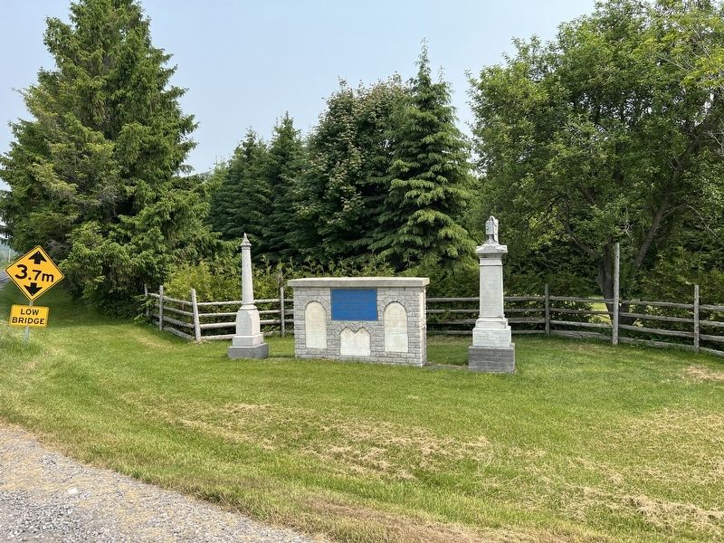
2. Van Sicklen Cemetery Marker
Credits. This page was last revised on June 16, 2025. It was originally submitted on June 16, 2025, by Tim Boyd of Hamilton, Ontario. This page has been viewed 105 times since then and 25 times this year. Photos: 1, 2. submitted on June 16, 2025, by Tim Boyd of Hamilton, Ontario. • Andrew Ruppenstein was the editor who published this page.
