Speckmannshof in Amberg, Bavaria, Germany — Central Europe
Schiffgasse
⎯⎯⎯
Ship Lane
Amberg
Photographed by James Hulse, May 30, 2025
1. Schiffgasse / Ship Lane Marker

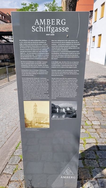
Die Schiffgasse, als solche nachweisbar schon im 14. Jh., wurde nicht nur durch die Schifffahrt geprägt, sondern auch durch die Bewohner. In ihren Häusern entlang des Flusses lebten sie zumeist von der Fischerei. Der Fang und Verkauf von Fischen und Krebsen erweiterte den Speisezettel der Amberger und gab den Fischern Arbeit und Lohn. Schon früh legten sie - wie eine kolorierte Zeichnung des Malers Hans Kannlpaldung zeigt - Fischkästen an, in denen sich die lebende Ware tummelte, bis sie zu den vom Rat festgesetzten Preisen verkauft werden konnte.
Die Vils war im Mittelalter ein wichtiger Transportweg. Erz und Salz wurden auf speziellen Kähnen transportiert. Die Fahrt mit der Vilsplätte, die diesen Transportkähnen nachempfunden ist, erinnert daran.
Entlang dieser einst so wichtigen Verkehrsroute laufen heute auch beliebte Rad- und Wanderrouten wie der Fünf-Flüsse-Radweg, die Bayerische Eisenstraße und der Erzweg.
Der im Volksmund als „Stadtbrille“ bezeichnete Wassertorbau, der mit einer Länge von 46 m die Vils überspannt, ist 1454 als „Gang über die Vils“ erstmals nachweisbar. Er dürfte sich damals bereits als eingeschossige Anlage mit Türmen über den beiden Mittelpfeilern präsentiert haben. Im Zuge eines Umbaus, der unter der Leitung des Trierer Hofbaumeisters Hans Hauck 1580 erfolgte, wurde der linke und der rechte Bogen des Wassertorbaus um je ein Geschoss erhöht, der mittlere um zwei Geschosse, die von zwei Turmaufbauten „bekrönt“ waren. 1698 erhielt die Stadtbrille ihr heutiges Aussehen, mit Ausnahme des westlichen Bogens, der vor 1600 aufgefüllt worden war und erst vor einigen Jahren wieder geöffnet wurde.
Bildunterschriften
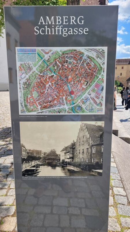
(Foto #1) Partie an der Vils: die St. Martinskirche mit dem Martinsteg, einigen Häusern der Schiffgasse sowie den Fischkästen im Fluss (Stadtarchiv Amberg Fotosammlung 101-459-004).
(Foto #2) Die überdachte Schiffbrücke mit der Bebauung am rechten Ufer der Vils (Stadtarchiv Amberg Abgabe Georg Birner 18).
Ship
this page online
As depicted on a coloured drawing by painter Hans Kannlpaldung, the fishmongers would set up corves early in the morning in which the live fish darted about till they could be sold at prices determined by the council.
In the Middle Ages, the River Vils was an important transport route. Iron ore and salt were transported on special barges, commemorated today by trips along the river in replicas of the original vessels.
Nowadays, popular cycle and hiking paths run along what were once such important transport routes, such as the Five Rivers Cycle Track, the Bavarian Iron Road and Iron Ore Way.
The gate which spans the river, popularly known as the "Town Spectacles", is 46 m long and was first documented in 1454 as the "Pathway over the Vils". At that time, it was most probably a single-storey construction with towers on the two central pillars. In 1580,
Photographed by James Hulse, May 30, 2025
2. Schiffgasse / Ship Lane Marker - Reverse Side
Captions
(Photo #1) Part of the Vils River: St. Martin's Church with the Martin Bridge, some houses on the Schiffgasse, and the fish boxes in the river. (Amberg City Archives Photo Collection 101-459-004)
(Photo #2) The covered pontoon bridge with the buildings on the right bank of the Vils River (Amberg City Archives, submission Georg Birner 18).
Erected by Amberg Stadt.
Topics. This historical marker is listed in these topic lists: Industry & Commerce • Waterways & Vessels. A significant historical year for this entry is 1454.
Location. 49° 26.622′ N, 11° 51.455′ E. Marker is in Amberg, Bayern (Bavaria). It is in Speckmannshof. It is at the intersection of Schiffgasse and Zeughausstraße on Schiffgasse. The marker is located along the river. Touch for map. Marker is at or near this postal address: Schiffgasse 19, Amberg BY 92224, Germany. Touch for directions.

Regionally, it is in Europe, the European Union, Atlantic Europe, Central Europe, the Schengen Area, Western Europe, and the Western World. Historically, it finds itself in what was once the Holy Roman Empire and also the former West Germany.
Other nearby markers. At least 8 other markers are within walking distance of this marker: Kurfürstliches Zeughaus / Electoral Arsenal (within shouting distance of this marker); Adolf Zechermann (within shouting distance of this marker); Erna Fanny Zechermann (within shouting distance of this marker);
Photographed by James Hulse, May 30, 2025
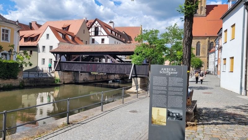
3. The view of the marker along Schiffgasse

Photographed by James Hulse, May 30, 2025
4. A ship traveling along Schiffgasse
Credits. This page was last revised on September 24, 2025. It was originally submitted on June 17, 2025, by James Hulse of Medina, Texas. This page has been viewed 115 times since then and 15 times this year. Photos: 1, 2, 3, 4. submitted on June 18, 2025, by James Hulse of Medina, Texas.
