Near McHenry in Garrett County, Maryland — The American Northeast (Mid-Atlantic)
Sang Run Election House
Sang Run State Park
Photographed by Bradley Owen, June 12, 2025
1. Sang Run Election House Marker
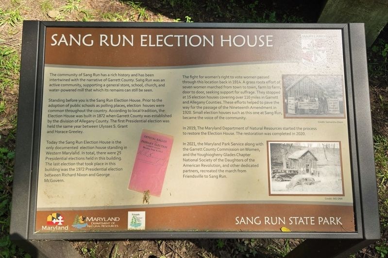
The community of Sang Run has a rich history and has been intertwined with the narrative of Garrett County. Sang Run was an active community, supporting a general store, school, church, and water-powered mill that which its remains can still be seen.
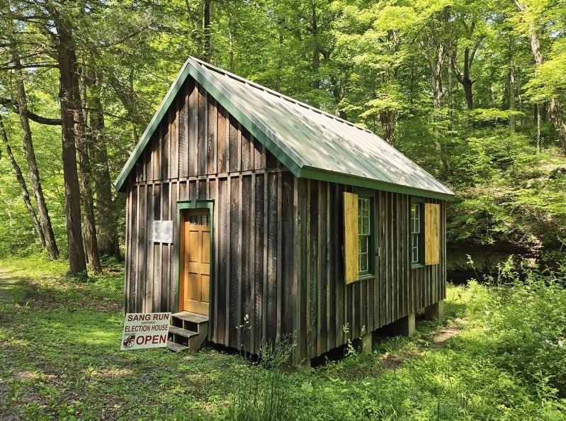
Standing before you is the Sang Run Election House. Prior to the adoption of public schools as polling places, election houses were common throughout the country. According to local tradition, the Election House was built in 1872 when Garrett County was established by the division of Allegany County. The first Presidential election was held the same year between Ulysses S. Grant and Horace Greeley.
Today the Sang Run Election House is the only documented election house standing in Western Maryland. In total, there were 25 Presidential elections held in this building. The last election that took place in this building was the 1972 Presidential election between Richard Nixon and George McGovern.
The fight for women's right to vote women passed through this location back in 1914. A grass roots effort of seven women marched from town to town, farm to farm, door to door,
this page online
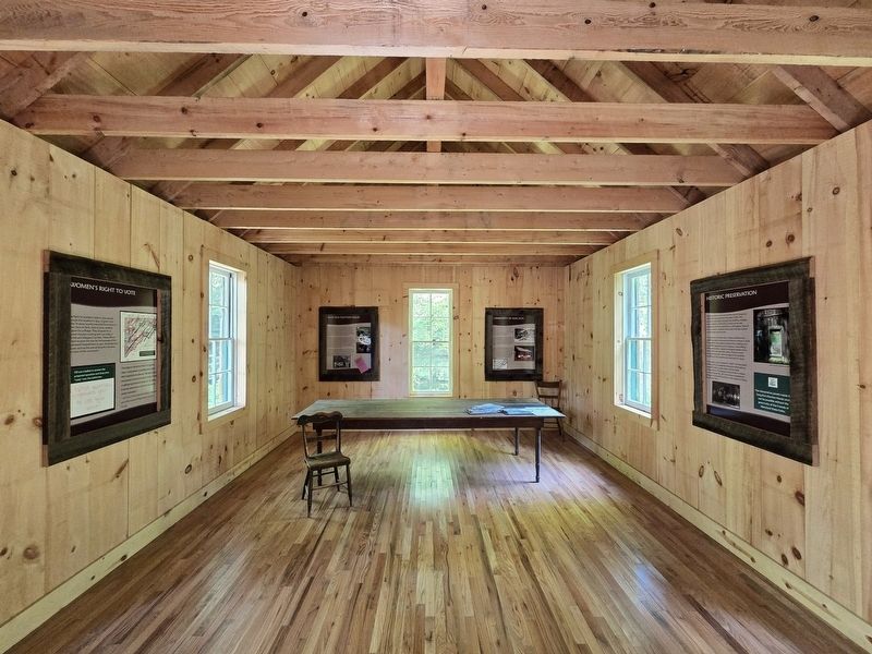
In 2019, The Maryland Department of Natural Resources started the process to restore the Election House. The restoration was completed in 2020.
In 2021, the Maryland Park Service along with the Garrett County Commission on Women, and the Youghiogheny Glades Chapter National Society of the Daughters of the American Revolution, and other dedicated partners, recreated the march from Friendsville to Sang Run.
Erected by Maryland Park Service.
Topics and series. This historical marker is listed in these topic lists: Civil Rights • Government & Politics • Notable Buildings • Women. In addition, it is included in the Former U.S. Presidents: #18 Ulysses S. Grant, and the Former U.S. Presidents: #37 Richard M. Nixon series lists. A significant historical year for this entry is 1872.
Location. 39° 33.98′ N, 79° 25.482′ W. Marker

Photographed by Bradley Owen, June 12, 2025
2. Sang Run Election House and Marker

Regionally, this marker is in Western Maryland. It is also in the American Mid-Atlantic, in Appalachia, and specifically in Northern Appalachia. Globally, it is in North America, the Western Hemisphere, the Western World, and the Anglosphere. Historically, it finds itself in what was once one of the original Thirteen Colonies.
Other nearby markers. At least 8 other markers are within 4 miles of this marker, measured as the crow flies: Sang Run State Park (about 500 feet away, measured in a direct line); Whitewater Boating on the Upper Youghiogheny River (about 600 feet away); The Grave of Meshack Browning (approx. 3.2 miles away); The National Road (approx. 3½ miles away); Western Maryland (approx. 3½ miles away); An Attraction for Visitors (approx. 3½ miles away); Wisp Ski Resort (approx. 4 miles away); Deep Creek Volunteer Fire Company
Photographed by Bradley Owen, June 12, 2025
3. Sang Run Election House
Other markers no longer nearby. Gettysburg Campaign (was approx. 3½ miles away but has been replaced with another marker now near it); a different marker also named The National Road (was approx. 3½ miles away but has been replaced with another marker now near it).
Photographed by Bradley Owen, June 12, 2025
4. Sang Run Election House Interior
Credits. This page was last revised on June 17, 2025. It was originally submitted on June 17, 2025, by Bradley Owen of Morgantown, West Virginia. This page has been viewed 142 times since then and 30 times this year. Photos: 1, 2, 3, 4. submitted on June 17, 2025, by Bradley Owen of Morgantown, West Virginia.
