Woodsdale in Butler County, Ohio — The American Midwest (Great Lakes)
Augspurger Family Cemetery
Photographed by Craig Doda, June 7, 2025
1. Augspurger Family Cemetery Marker
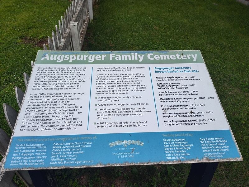
In the 1980s, descendant Rudolf Augspurger erected the more modern granite monument to recognize those graves no longer marked or legible, and to commemorate the legacy of his great grandparent. In 1989, the Cincinnati Gas & Electric Company bought a large tract of land- including the Chrisholm Farm - for a new power plant. Recognizing the historical significance of the 17 acres that included the homestead, farm buildings and this cemetery, the company deeded the land to MetroParks of Butler County with the understanding that the buildings be restored and the site developed as a park.
Friends of Chrisholm was formed in 1995 to oversee this restoration project. The Friends of Chrisholm sought to determine
this page online
A 1989 genealogical study estimated around 20 graves.
A 2006 dowsing suggested over 50 burials.
A sectional surface dig project from the years 2006-2008 confirmed 6 burials in two sections (the other sections were not disturbed).
A 2013 geophysical radar survey found evidence of at least 27 possible burials.
Augspurger ancestors known buried at this site:
Christian Augspurger (1782-1848) Founder of Butler County Amish community
Katharina (Catherine) Hauter Augspurger (1784 - 1847) Wife of Christian Augspurger
Joseph Augspurger (1806 - 1864) Eldest son of Christian and Katharina
Magdalena Kennel Augspurger (1811-1902) Wife of Joseph Augspurger
Christian Augspurger (1813-1845) Son of Christian and Katharina
Barbara Augspurger Jetzi (1811 - 1851) Daughter of Christian and Katharina
Anna Augspurger Kennel (1823-1858) Daughter of Christian and Katharina
Erected by MetroParks of Butler
Photographed by Craig Doda, June 7, 2025
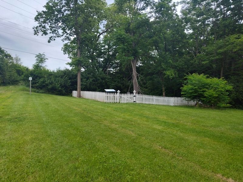
2. Augspurger Family Cemetery Marker
Topics. This historical marker is listed in these topic lists: Cemeteries & Burial Sites • Parks & Recreational Areas. A significant historical year for this entry is 1848.
Location. 39° 26.732′ N, 84° 27.65′ W. Marker is in Woodsdale, Ohio, in Butler County. It can be reached from Woodsdale Road half a mile east of Wayne Madison Road, on the right when traveling west. Touch for map. Marker is at or near this postal address: 2070 Woodsdale Rd, Trenton OH 45067, United States of America. Touch for directions.

Regionally, this marker is in Greater Cincinnati and in the Miami Valley. It is also in the American Midwest. Globally, it is in North America, the Western Hemisphere, the Western World, and the Anglosphere. Historically, it finds itself in what was once the Haudenosaunee (Iroquois) Confederacy, the territory of the Mississippian Culture, and the Northwest Territory.
Other nearby markers. At least 8 other markers are within walking distance of this marker: John Augspurger Portable Fences (about 400 feet away, measured in a direct line); Welcome to the Chrisholm Farmstead (about 400 feet away); Chrisholm Summer Kitchen (about 400 feet away); Chrisholm Cellar (about 500 feet away); Chrisholm Native Pollinator Garden (about 500 feet away); Alsdorf Windmill (about 500 feet away); The Amish Mennonite Settlement (about 500 feet away); Butler County's First Green Restroom (about 700 feet away). Touch for a list and map of all markers in Woodsdale.
Credits. This page was last revised on July 10, 2025. It was originally submitted on June 18, 2025, by Craig Doda of Napoleon, Ohio. This page has been viewed 95 times since then and 31 times this year. Photos: 1, 2. submitted on June 18, 2025, by Craig Doda of Napoleon, Ohio. • Bill Pfingsten was the editor who published this page.
