
Apalachicola in Franklin County, Florida — The American South (South Atlantic)
Apalachicola’s Cotton Era
Photographed by Brandon D Cross, June 17, 2025
1. Apalachicola’s Cotton Era Marker
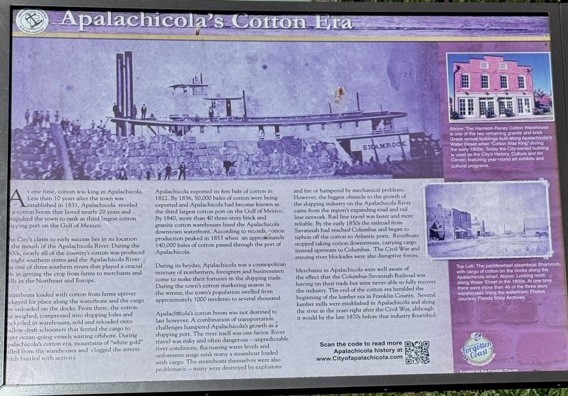
The City's claim to early success lies in its location to the mouth of the Apalachicola River. During the 1800s, nearly all of the country's cotton was produced within eight southern states and the Apalachicola River is one of three southern rivers that played a crucial role in getting the crop from farms to merchants and in the Northeast and Europe.
Steamboats loaded with cotton from farms upriver jockeyed for place along the waterfront as the cargo was unloaded on the docks. From there, the cotton was weighed, compressed into shipping bales and stockpiled in warehouses, sold and reloaded onto shallow-draft schooners that ferried the cargo to larger ocean-going vessels waiting offshore. During Apalachicola's cotton era, mountains of "white gold" filled from the warehouses and clogged the streets which bustled with activity.
Apalachicola exported its
this page online
During its heyday, Apalachicola was a cosmopolitan mixture of northerners, foreigners and businessmen come to make their fortunes in the shipping trade. During the town's cotton marketing season in the winter, the town's population swelled from approximately 1000 residents to several thousand.
Apalachicola's cotton boom was not destined to last however. A combination of transportation challenges hampered Apalachicola's growth as a shipping port. The river itself was one factor. River travel was risky and often dangerous — unpredictable river conditions, fluctuating water levels and unforeseen snags sunk many a steamboat loaded with cargo. The steamboats themselves were also problematic — many were destroyed
Photographed by Brandon D Cross, June 17, 2025
2. Apalachicola’s Cotton Era Marker
Merchants in Apalachicola were well aware of the effect that the Columbus-Savannah Railroad was having on their trade but were never able to fully recover the industry. The end of the cotton era heralded the beginning of the lumber era in Franklin County. Several lumber mills were established in Apalachicola and along the river in the years right after the Civil War, although it would be the late 1870s before that industry flourished.
(captions)
Above: The Harrison-Raney Cotton Warehouse is one of the two remaining granite and brick Greek revival buildings built along Apalachicola's Water Street when "Cotton Was King during the early 1800s. Today the City-owned building is used as the City's History. Culture and Art Center, featuring year-round art exhibits and cultural programs.
Top Left: The paddlewheel steamboat Shamrock with cargo of cotton on the docks along the Apalachicola wharf. Above: Looking north along Water Street in the 1800s. At one time there were more than 40 of the three story warehouses lining the waterfront. Photos courtesy Florida State Archives.
Erected by Franklin County.
Topics. This historical marker is listed in these topic lists: Agriculture • Industry & Commerce • Waterways & Vessels. A significant historical year for this entry is 1822.
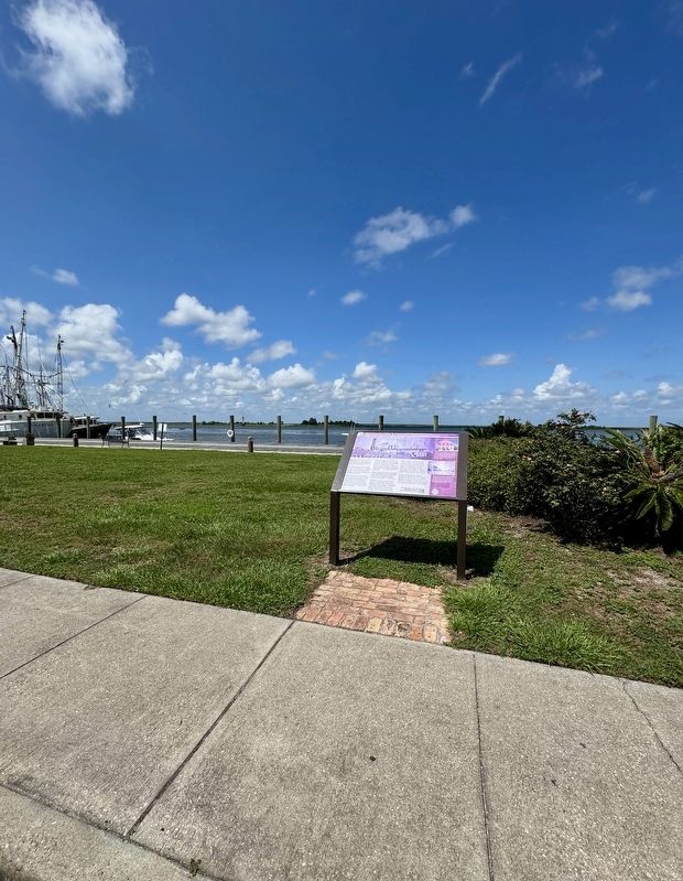
Location. 29° 43.712′ N, 84° 58.995′ W. Marker is in Apalachicola, Florida, in Franklin County. It is on Water Street south of Avenue E, on the left when traveling south. Touch for map. Marker is in this post office area: Apalachicola FL 32320, United States of America. Touch for directions.

Regionally, this marker is on the Florida Panhandle. It is also in the American South, specifically in the Deep South, and on the Gulf Coast. Globally, it is in the North Atlantic Region, North America, a Gulf of Mexico state, the Western Hemisphere, the Western World, and the Anglosphere. Historically, it finds itself in what was once New Spain, the territory of the Mississippian Culture, one of the Confederate States of America, and the Antebellum South.
Other nearby markers. At least 8 other markers are within walking distance of this marker: When the River Was King! (a few steps from this marker); Apalachicola’s Sponge Industry (a few steps from this marker); J.E. Grady & Co. (within shouting distance of this marker); Apalachicola City Hall Warehouse (within shouting distance of this marker); The Sponge Exchange (about 300 feet away, measured in a direct line); The Cook Insurance Building (about 400 feet away); Apalachicola Post Office and Customs House (about 400 feet away); The Cook Building (about 500 feet away). Touch for a list and map of all markers in Apalachicola.
Also see . . . Historic Apalachicola. (Submitted on June 20, 2025, by Brandon D Cross of Flagler Beach, Florida.)
Credits. This page was last revised on June 23, 2025. It was originally submitted on June 20, 2025, by Brandon D Cross of Flagler Beach, Florida. This page has been viewed 131 times since then and 35 times this year. Photos: 1, 2. submitted on June 20, 2025, by Brandon D Cross of Flagler Beach, Florida. • Bernard Fisher was the editor who published this page.
