
Carolina Beach in New Hanover County, North Carolina — The American South (South Atlantic)
The General Beauregard
Photographed by Evan Dwyer, January 24, 2025
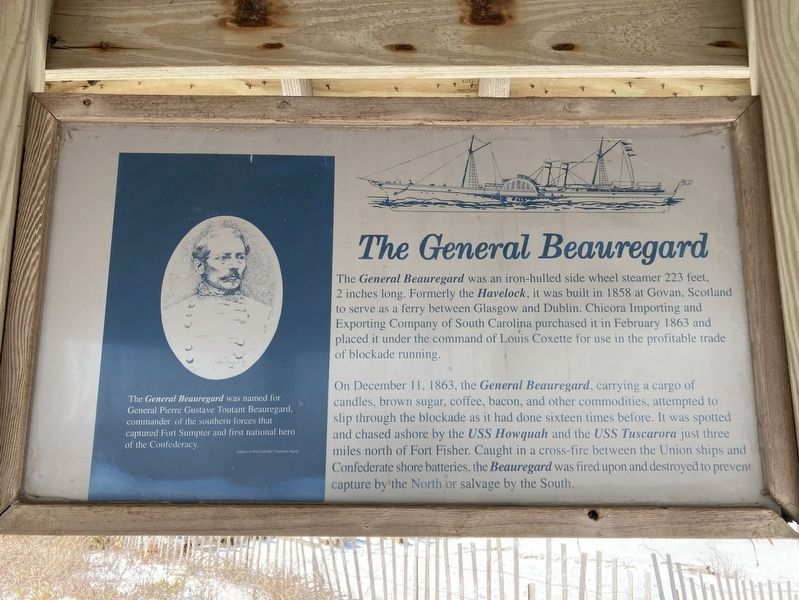
1. The General Beauregard Marker
On December 11, 1863, the General Beauregard, carrying a cargo of candles, brown sugar, coffee, bacon, and other commodities, attempted to slip through the blockade as it had done sixteen times before. It was spotted and chased ashore by the USS Howquah and the USS Tuscarora just three miles north of Fort Fisher. Caught in a cross-fire between the Union ships and Confederate shore batteries, the Beauregard was fired upon and destroyed to prevent capture by the North or salvage by the South.
(caption)
The General Beauregard was named for General Pierre Gustave Toutant Beauregard, commander of the southern forces that captured Fort Sumpter and first national hero of the Confederacy.
Topics. This historical marker is listed in these
this page online
Location. 34° 1.626′ N, 77° 53.67′ W. Marker is in Carolina Beach, North Carolina, in New Hanover County. It can be reached from the intersection of Lake Drive and Carolina Beach Avenue South when traveling east. Touch for map. Marker is at or near this postal address: 701 Carolina Beach Ave S, Carolina Beach NC 28428, United States of America. Touch for directions.

Regionally, this marker is in North Carolina’s Coastal Plain and on the Cape Fear Coast. It is also in the American South, specifically in the Upper South, in the Tidewater, and on the Eastern Seaboard. Globally, it is in the North Atlantic Region, North America, the Western Hemisphere, the Western World, and the Anglosphere. Historically, it finds itself in what was once the territory of the Mississippian Culture, one of the original Thirteen Colonies, one of the Confederate States of America, and the Antebellum South.
Other nearby markers. At least 8 other markers are within 2 miles of this marker, measured as the crow flies: Blockade Running (here,
Photographed by Evan Dwyer, January 25, 2025
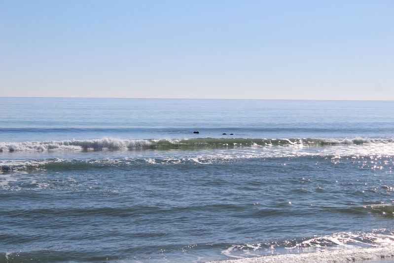
2. General Beauregard Shipwreck
The outer edges are from the sidewheels. This view shot at one of the lower tides of winter 2024-2025.
More about this marker. Marker is one of three mounted in a gazebo located along the Lake Public Beach Access boardwalk.
Regarding The General Beauregard. The wreck of the ship can be seen at low tide when the sidewheels just break the surface beyond the breakers.
Related markers. Click here for a list of markers that are related to this marker. These two other markers combine with this one within the gazebo to add context to the shipwreck off shore.
Photographed by Evan Dwyer, January 25, 2025
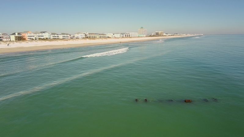
3. General Beauregard Wreck
Proximity to the shoreline at low tide, photographed with a drone.
Photographed by Evan Dwyer, January 25, 2025
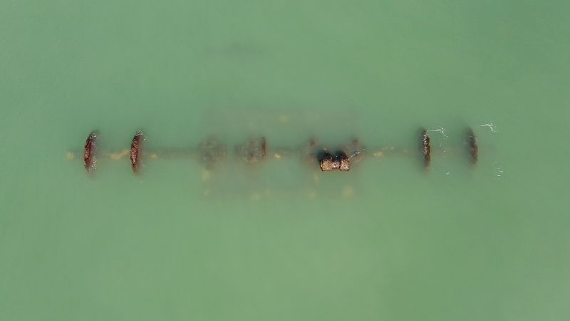
4. General Beauregard Wreck
Drone view of the visible wreckage. This is the shaft that mounted the sidewheels. Not sure what the square is specifically, but its related to the propulsion system. In summary, looking at the ship from this angle, we'd be on the centerline (north-south or bow-stern axis) looking directly down at the amidships area. The width of the ship is indicated by the distance between the two wheels.
Photographed by Evan Dwyer, January 25, 2025
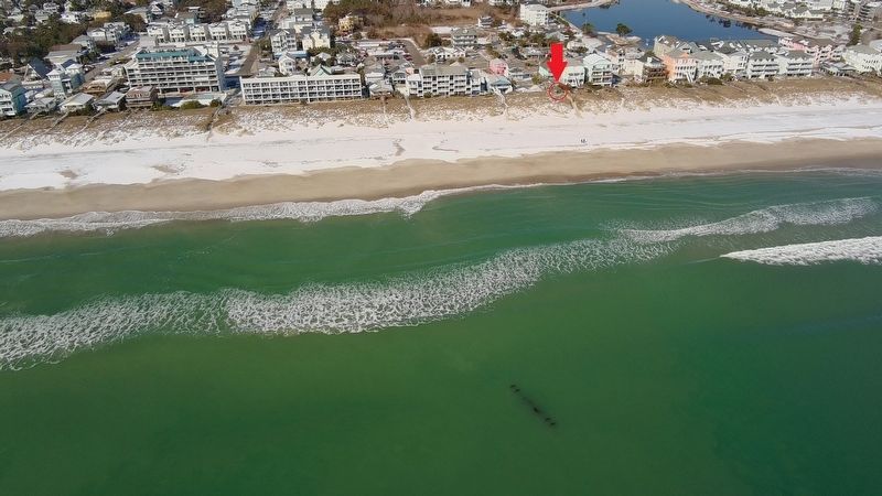
5. Marker Gazebo Proximity to the Wreck
The gazebo, circled in red, is under the red arrow. The marker is in that gazebo with two others about the wreck. The wreck itself is at lower center, illustrating the direction and distance away from the gazebo for those interested in finding it from the shore or with a drone. If on shore, a zoom camera or binoculars is critical - the bits poking above the surface are easy to miss among the waves and reflection of the sky.
Credits. This page was last revised on July 16, 2025. It was originally submitted on June 20, 2025, by Evan Dwyer of Richmond, Virginia. This page has been viewed 468 times since then and 160 times this year. Photos: 1, 2, 3, 4, 5. submitted on June 20, 2025, by Evan Dwyer of Richmond, Virginia. • Bernard Fisher was the editor who published this page.
