North Virginia Beach , Virginia — The American South (Mid-Atlantic)
Beaches on the Move
Shifting Sand, Sinking Land, & Rising Seas
| — | Brainwaves at the Beach | — |
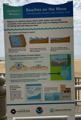
Beaches are dynamic places where wind, waves, and currents constantly move sand and where ocean water is creeping inland due to sinking land and rising sea level.
Why is the beach sand always in motion?
Breaking waves create a long-shore current that moves sand along the beach.
Sand is pulled away from the beach during storms, forming offshore sandbars.
When calm conditions return, gentler waves push sand back to the beach.
Why is the land sinking in Coastal Virginia?
• As glaciers melt, the compressed land underneath rises up, causing land in other areas, like Virginia, to sink.
• 35 million years ago, a meteor strike created a crater in this area that is now covered by more than 800 ft of sediment. As debris in the crater continues to settle, the land above sinks.
• People also have contributed by pumping out millions of gallons of groundwater for drinking and industrial uses.
How do we know sea level is rising?
Tide data illustrates the increase in sea level around the US since 1880. Current data indicates that sea level is continuing to rise.
Local Sea Level Rise: 1970-2020
Sea levels are rising along the East Coast and Gulf of Mexico. The local rate varies depending on both global and local factors, including currents, ocean floor topography, variations in ocean density, and land uplift or subsidence due to geologic processes or human activities.
The upward creep in water level results in more nuisance flooding — flooding that occurs when not expected, even on sunny days.
In 1950, nuisance flooding was infrequent.
Since 2010, it no longer takes a strong storm or hurricane to cause flooding. Today, nuisance flooding is frequent, and it can be caused merely by high tide.
Nuisance flood thresholds vary by location, but are generally 1-2 feet above the high tide level.
Erected by Virginia
this page online
Topics and series. This historical marker is listed in these topic lists: Environment • Industry & Commerce • Waterways & Vessels. In addition, it is included in the National Oceanic and Atmospheric Administration (NOAA) series list. A significant historical year for this entry is 1880.
Location. 36° 50.67′ N, 75° 58.381′ W. Marker is in Virginia Beach, Virginia. It is in North Virginia Beach. It is at the intersection of Virginia Beach Boardwalk and 16th Street, on the right when traveling north on Virginia Beach Boardwalk. Touch for map. Marker is at or near this postal address: 103 16th St, Virginia Beach VA 23451, United States of America. Touch for directions.

Regionally, this marker is in Hampton Roads, specifically in Coastal Virginia, and in the Hampton Roads Metropolitan Area. It is also in the American South, specifically in the Upper South, in the Tidewater, and on the Eastern Seaboard. Globally, it is in the North Atlantic Region, North America, the Western Hemisphere, the
Other nearby markers. At least 8 other markers are within walking distance of this marker: What Are These Things? (within shouting distance of this marker); Dairy Queen in Virginia Beach (about 400 feet away, measured in a direct line); John Wareing (about 400 feet away); Barreled (about 700 feet away); Devon Miller (approx. 0.2 miles away); Grace Sherwood (approx. 0.2 miles away); George Washington (approx. 0.2 miles away); Douglas MacArthur (approx. 0.2 miles away). Touch for a list and map of all markers in Virginia Beach.
Additional commentary.
1. About the marker
While most signs interpreting environmental information do not serve as historical markers, this one does. It shares how the history of human interaction has affected the environment, particularly rising sea levels.
— Submitted June 20, 2025, by Devry Becker Jones of Washington, District of Columbia.
Photographed by Devry Becker Jones (CC0), June 11, 2025
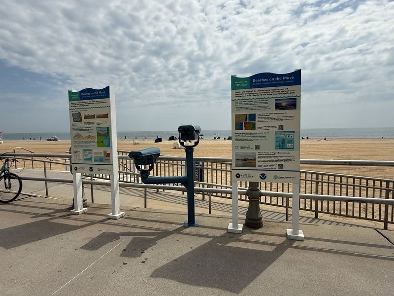
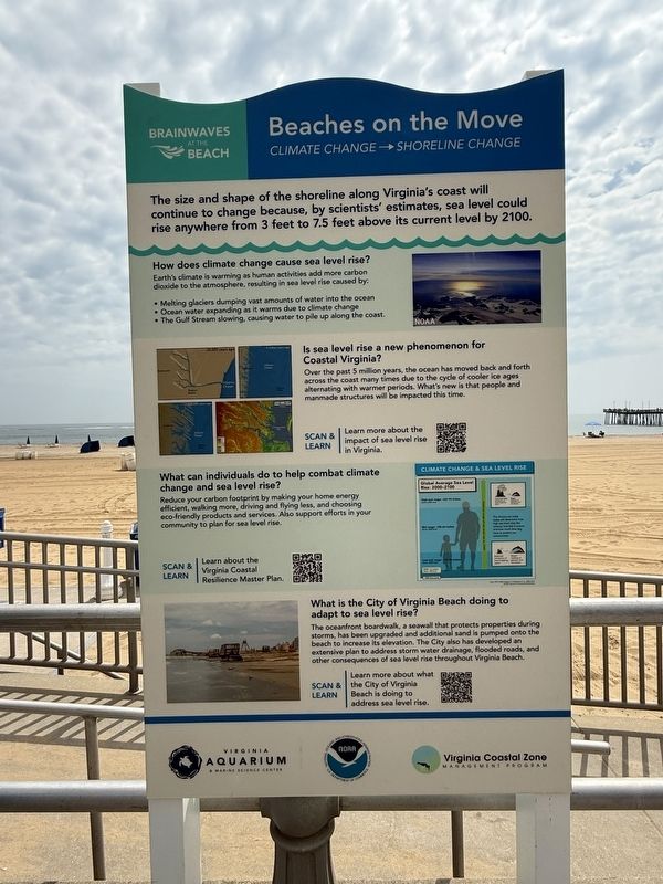
3. Adjacent sign with environmental information
Credits. This page was last revised on October 29, 2025. It was originally submitted on June 20, 2025, by Devry Becker Jones of Washington, District of Columbia. This page has been viewed 96 times since then and 13 times this year. Photos: 1, 2, 3. submitted on June 20, 2025, by Devry Becker Jones of Washington, District of Columbia.
