Near Pickens in Pickens County, South Carolina — The American South (South Atlantic)
Table Rock
Photographed by J. J. Prats, May 18, 2025
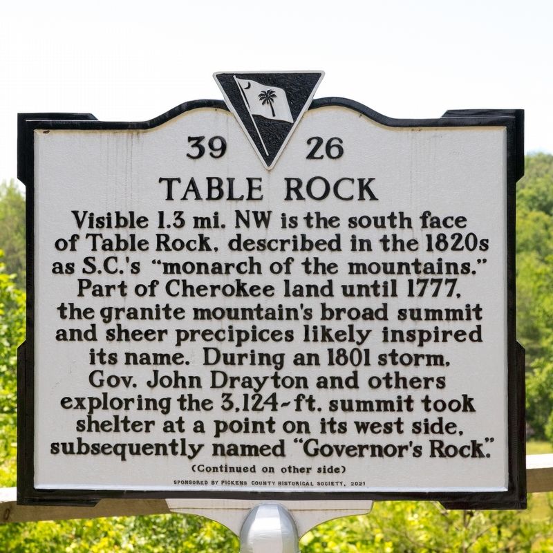
1. Table Rock Marker, Side One
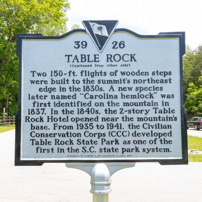
Two 150-ft. flights of wooden steps were built to the summit’s northeast edge in the 1830s. A new species later named “Carolina hemlock” was first identified on the mountain in 1837. In the 1840s, the 2-story Table Rock Hotel opened near the mountain’s base. From 1935 to 1941, the Civilian Conservation Corps (CCC) developed Table Rock State Park as one of the first in the South Carolina state park system.
Erected 2021 by Department of Archives and History. Sponsored by the Pickens County Historical Society. (Marker Number 39-26.)
Topics. This historical marker is listed in these topic lists: Landmarks • Natural Features • Parks & Recreational Areas. A significant historical year for this entry is 1777.
Location. 35° 2.05′ N,
this page online

Regionally, this marker is in South Carolina’s and pstate, in the Foothills, in the Golden Corner. It is also in the American South, specifically in the Deep South, in Appalachia, and specifically in Southern Appalachia. Globally, it is in North America, the Western Hemisphere, the Western World, and the Anglosphere. Historically, it finds itself in what was once the original Cherokee Nation, the territory of the Mississippian Culture, one of the original Thirteen Colonies, one of the Confederate States of America, and the Antebellum South.
Other nearby markers. At least 8 other markers are within 2 miles of this marker, measured as the crow flies: Grandmama’s Legacy of Flowers (a few steps from this marker); Beliefs Set in Stone
Photographed by J. J. Prats, May 18, 2025
2. Table Rock Marker, Side Two

Photographed by J. J. Prats, May 18, 2025
3. Table Rock Marker

Photographed by J. J. Prats, May 18, 2025
4. Table Rock
This view is from Grant Meadow Overlook Park parking lot, near the marker.
Credits. This page was last revised on June 21, 2025. It was originally submitted on June 21, 2025, by J. J. Prats of Powell, Ohio. This page has been viewed 415 times since then and 61 times this year. Photos: 1, 2, 3, 4. submitted on June 21, 2025, by J. J. Prats of Powell, Ohio.
