Elizabeth City in Pasquotank County, North Carolina — The American South (South Atlantic)
Elizabeth City

1. Water St
2. Poindexter St
3. McMorine St
4. Martin St
5. Pool St
6. Elliott St
7. Road St
8. Cobb St
9. Dyer St
10. Colonial Ave
11. Main St
12. Tearing St
13. Church St
Street No. 1 was originally Front Street. Streets 2 through 8 on the map were originally numbered 2nd through 8th Street and later changed.
This area was known as "The Chute" from the 1900's through the 1950's. One side of the street was lined with shops and stores which were frequented on a daily basis by folks seeking various goods.
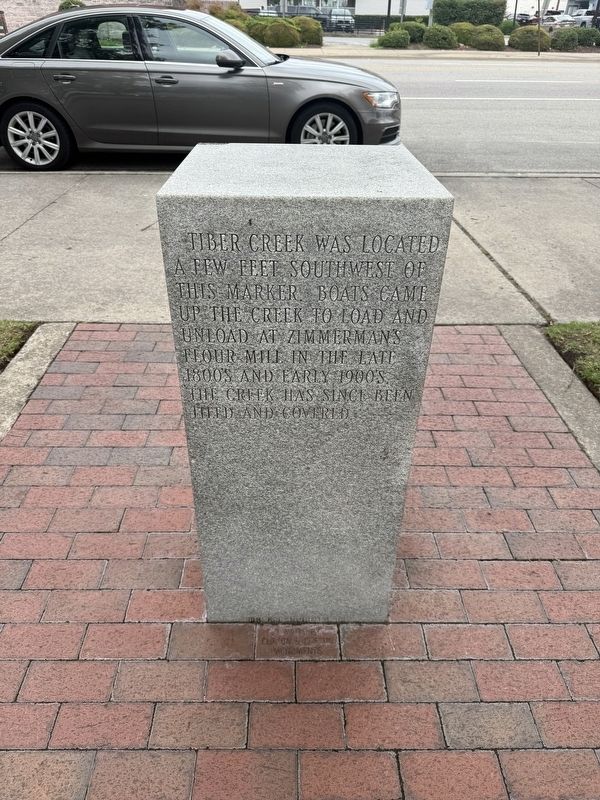
Tiber Creek was located a few feet southwest of this marker. Boats came up the creek to load and unload at Zimmerman's flour mill in the late 1800's and early 1900's. The creek has since been tiled and covered.
The municipal market, planned for a number of years but delayed by World War I, opened on this site in 1921, selling fresh meats and fish to the local popluace.
Topics. This historical marker is listed in these topic lists: Industry & Commerce • Roads & Vehicles • Settlements & Settlers • Waterways & Vessels. A significant historical year for this entry is 1921.
Location. 36° 17.918′ N,
this page online

Regionally, this marker is in North Carolina’s Coastal Plain. It is also in the American South, specifically in the Upper South, in the Tidewater, and on the Eastern Seaboard. Globally, it is in the North Atlantic Region, North America, the Western Hemisphere, the Western World, and the Anglosphere. Historically, it finds itself in what was once the territory of the Mississippian Culture, one of the original Thirteen Colonies, one of the Confederate States of America, and the Antebellum South.
Other nearby markers. At least 8 other markers are within walking distance of this marker: Wright Brothers in the Albemarle (a few steps from this marker); Wild's Raid (a few steps from this marker); Soybean Processing (within shouting distance of this marker); a different marker also named



Credits. This page was last revised on June 22, 2025. It was originally submitted on June 22, 2025, by Devry Becker Jones of Washington, District of Columbia. This page has been viewed 175 times since then and 29 times this year. Photos: 1, 2, 3, 4, 5. submitted on June 22, 2025, by Devry Becker Jones of Washington, District of Columbia.
