Driggs in Teton County, Idaho — The American West (Mountains)
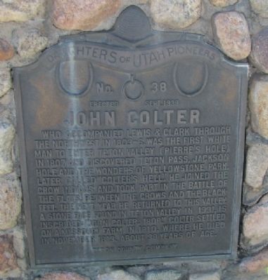
John Colter
Erected Sept. 1938
| — | Teton County Company | — |
Photographed by James R. Murray, June 13, 2015
1. John Coulter Marker
Who accompanied Lewis & Clark through the Northwest in 1803-6, was the first white man to enter Teton Valley (Pierre’s Hole) in 1807 and discovered Teton Pass, Jackson Hole and the wonders of Yellowstone Park. Later called “Colter’s Hell.” He joined the Crow Indians and took part in the Battle of the Flats, between the Crows and the Blackfeet. The next year he returned to this valley. A stone face found in Teton Valley in 1931, is inscribed: “John Coulter, 1808.” Coulter settled on a Missouri Farm in 1810, where he died in November 1813, about 38 years of age.
Erected 1938 by Daughters of the Utah Pioneers. (Marker Number 38.)
Topics and series. This historical marker is listed in these topic lists: Exploration • Indigenous Peoples and Communities • Wars, Non-US. In addition, it is included in the Daughters of Utah Pioneers series list. A significant historical month for this entry is November 1813.
Location. Marker has been reported missing. It was located near 43° 43.463′ N, 111° 6.653′ W. Marker was in Driggs, Idaho, in Teton County. It was at the intersection of Scenic State Highway 33 and East Wallace Avenue,
this page online

Regionally, this marker was in Eastern Idaho and the Yellowstone Fringe. It was also in the American Mountain West. Globally, it was in North America, the Rocky Mountains, the Western Hemisphere, the Western World, and the Anglosphere.
Other nearby markers. At least 7 other markers are within 5 miles of this location, measured as the crow flies: Teton County Veterans Memorial (a few steps from this marker); Pierre's Hole Rendezvous and Battle (approx. 1.2 miles away); Tetonia School Bell (approx. 1.3 miles away); Fordson Tractor (approx. 1.3 miles away); Pierre's Hole (approx. 2.8 miles away); Teton Range (approx. 4.7 miles away); a different marker also named John Colter (approx. 4.7 miles away).
Photographed by James R. Murray, June 13, 2015
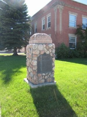
2. John Coulter Marker
Photographed by James R. Murray, June 13, 2015
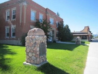
3. John Coulter Marker
View from the street of the Colter marker in the foreground and the Veteran's Memorial in the background
Photographed by Jeremy Snow, June 23, 2025
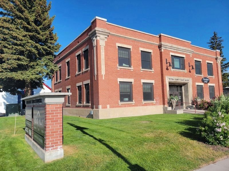
4. John Colter Marker
Photo showing marker has been removed from location by courthouse.
Credits. This page was last revised on June 25, 2025. It was originally submitted on June 13, 2015, by James R. Murray of Elkton, Florida. This page has been viewed 1,975 times since then and 114 times this year. Last updated on June 23, 2025, by Jeremy Snow of Cedar City, Utah. Photos: 1, 2, 3. submitted on June 13, 2015, by James R. Murray of Elkton, Florida. 4. submitted on June 23, 2025, by Jeremy Snow of Cedar City, Utah. • Devry Becker Jones was the editor who published this page.
