Tonawanda in Erie County, New York — The American Northeast (Mid-Atlantic)
The Empire State Trail
at Niawanda Park
Photographed by Bradley Owen, June 24, 2025
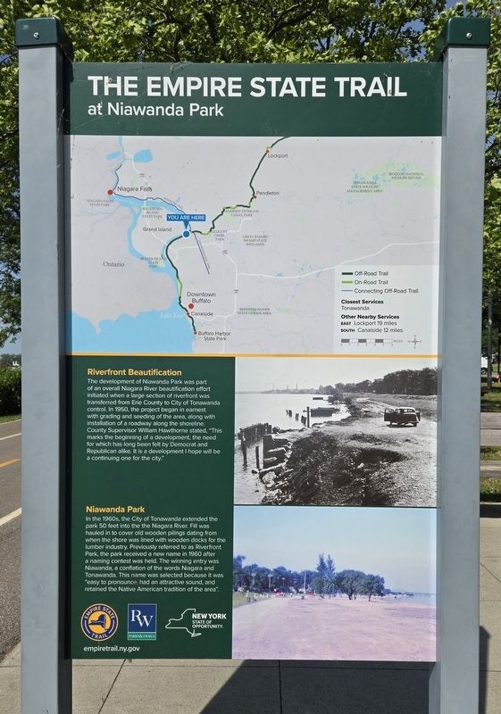
1. The Empire State Trail Marker
Riverfront Beautification
The development of Niawanda Park was part of an overall Niagara River beautification effort initiated when a large section of riverfront was transferred from Erie County to City of Tonawanda control. In 1950, the project began in earnest with grading and seeding of the area, along with installation of a roadway along the shoreline. County Supervisor William Hawthorne stated, "This marks the beginning of a development, the need for which has long been felt by Democrat and Republican alike. It is a development I hope will be a continuing one for the city."
Niawanda Park
In the 1960s, the City of Tonawanda extended the park 50 feet into the the Niagara River. Fill was hauled in to cover old wooden pilings dating from when the shore was lined with wooden docks for the lumber industry. Previously referred to as Riverfront Park, the park received a new name in 1960 after a naming contest was held. The winning entry was Niawanda, a conflation of the words Niagara and Tonawanda. This name was selected because it was "easy to pronounce, had an attractive sound, and retained the Native American
this page online
Erected by Empire State Trail, Riverwalk Parks & Trails and New York State.
Topics. This historical marker is listed in these topic lists: Indigenous Peoples and Communities • Industry & Commerce • Parks & Recreational Areas. A significant historical year for this entry is 1950.
Location. 43° 1.061′ N, 78° 53.389′ W. Marker is in Tonawanda, New York, in Erie County. It is on Niagara Street (New York State Route 266) south of Bouck Street, on the right when traveling south. Marker is located along the walking/biking trail in Niawanda Park. Touch for map. Marker is at or near this postal address: 300 Niagara State, Tonawanda NY 14150, United States of America. Touch for directions.

Regionally, this marker is in Upstate New York, specifically in Western New York, and in the Buffalo Metropolitan Area. It is also in the American Northeast and in the Mid-Atlantic. Globally, it is in North America, on the Great Lakes, in the Western Hemisphere, in the Western World, and in the Anglosphere. Historically, it finds itself in what was once the Viceroyalty of New France, the Haudenosaunee (Iroquois)
Photographed by Bradley Owen, June 24, 2025
2. The Empire State Trail Marker
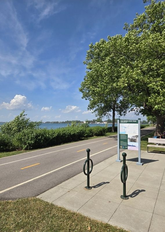
View is looking northeast with the Niagara River at the left of the trail.
Other nearby markers. At least 8 other markers are within walking distance of this marker: Great Ships of the Niagara (approx. 0.2 miles away); Great Escapes (approx. 0.2 miles away); Dedicated to the Memory (approx. 0.2 miles away); To The Glory of God and in Grateful Remembrance (approx. 0.2 miles away); Erie Canal Site (approx. 0.2 miles away); Tonawanda All Heroes Memorial (approx. 0.2 miles away); Grand Island Ferry (approx. 0.4 miles away); Engineering the Erie Canal (approx. 0.4 miles away). Touch for a list and map of all markers in Tonawanda.
Credits. This page was last revised on June 26, 2025. It was originally submitted on June 26, 2025, by Bradley Owen of Morgantown, West Virginia. This page has been viewed 184 times since then and 52 times this year. Photos: 1, 2. submitted on June 26, 2025, by Bradley Owen of Morgantown, West Virginia.
