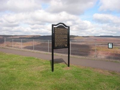
Kelly Lake near Hibbing in Saint Louis County, Minnesota — The American Midwest (Upper Plains)
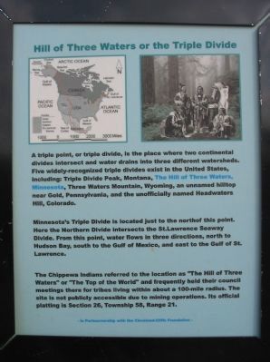
Hill of Three Waters or the Triple Divide
Minnesota's Triple Divide is located just to the north of this point. Here the Northern Divide intersects the St. Lawrence Seaway Divide. From this point, water flows in three directions, north to Hudson Bay, south to the Gulf of Mexico, and east to the Gulf of St. Lawrence.
The Chippewa Indians referred to the location as "The Hill of Three Waters" or "The Top of the World" and frequently held their council meetings there for tribes living within about a 100-mile radius. The site is not publicly accessible due to mining operations. Its official platting is Section 26, Township 58, Range 21.
Topics. This historical marker is listed in these topic lists: Native Americans • Natural Features.
Location. 47° 26.863′ N, 92° 56.8′ W. Marker is near Hibbing, Minnesota, in Saint Louis County. It is in Kelly Lake. Marker can be reached from Greyhound Boulevard/3rd Avenue East, on the left when traveling north. Marker is at the Hull-Rust Mahoning Mine, beyond the mine visitor center/observation building; accessible only when the visitor center is open. Touch for map. Marker is in this post office area: Hibbing MN 55746, United States of America. Touch for directions.
Other nearby markers. At least 8 other markers are within walking distance of this marker. Hull-Rust-Mahoning Mine (here, next to this marker); P & H 2300 Production Shovel Bucket (a few steps from this marker); Marion 1150 Dragline Bucket (within shouting distance of this marker); Mining Haul Truck Engine Module (within shouting distance of this marker); 170 & 240 Ton Production Trucks (within shouting distance of this marker); Haulpak Production Truck Tires (within shouting distance of this marker); Hull-Rust Mahoning Mine Pit Overlook (within shouting distance of this marker); Underground Mining in the Hibbing Area (within shouting distance of this marker). Touch for a list and map of all markers in Hibbing.
Additional keywords. Laurentian Divide
Credits. This page was last revised on February 12, 2023. It was originally submitted on February 19, 2010, by Keith L of Wisconsin Rapids, Wisconsin. This page has been viewed 15,235 times since then and 695 times this year. Photos: 1, 2. submitted on February 19, 2010, by Keith L of Wisconsin Rapids, Wisconsin. • Craig Swain was the editor who published this page.

