Greenwood in Newport News, Virginia — The American South (Mid-Atlantic)
“Every Kind of Obstruction was Skillfully Used”
1862 Peninsula Campaign
Photographed by Bill Coughlin, August 11, 2008
1. "Every Kind of Obstruction was Skillfully Used" Marker
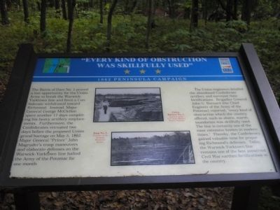
The Battle of Dam No. 1 proved a lost opportunity for the Union Army to break the Warwick-Yorktown line and force a Confederate withdrawal toward Richmond. Instead, Major General George McClellan spent another 17 days completing his heavy artillery emplacements. Furthermore, the Confederates retreated two days before the proposed Union grand barrage on May 5, 1862. Major General “Prince” John Magruder’s troop maneuvers and elaborate defenses on the Warwick-Yorktown line halted the Army of the Potomac for one month.
The Union engineers detailed the abandoned Confederate artillery and surveyed their fortifications. Brigadier General John G. Barnard (the Chief Engineer of the Army of the Potomac) reported, “every kind of obstruction which the country offered, such as abatis, marsh, inundation was skillfully used. The line is certainly one of the most extensive known in modern times.” Thereby, the Confederacy gained valuable time for preparing Richmond’s defenses. Today, the Warwick-Yorktown line remains one of the best preserved Civil War earthen fortifications in the country.
Erected by Virginia Civil War Trails.
Topics and series.
this page online
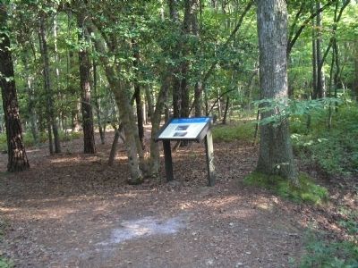
Location. 37° 11.196′ N, 76° 32.248′ W. Marker is in Newport News, Virginia. It is in Greenwood. It can be reached from the intersection of White Oak Trail and Dam #1 Bridge, on the left when traveling east. Marker is located in Newport News Park, on the Twin Forts Walking Trail, on the north side of Lee Hall Reservoir. Touch for map. Marker is in this post office area: Newport News VA 23608, United States of America. Touch for directions.

Regionally, this marker is on Virginia’s Peninsula, in Hampton Roads, in Coastal Virginia, and in the Hampton Roads Metropolitan Area. It is also in the American South, specifically in the Upper South, in the Tidewater, and on the Eastern Seaboard. Globally, it is in the North Atlantic Region, North America, the Western Hemisphere, the Western World, and the Anglosphere. Historically, it finds itself in what was once the territory of the Mississippian Culture,
Photographed by Bill Coughlin, August 11, 2008
2. Marker in Newport News Park
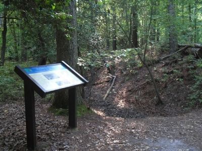
Confederate fortifications can be seen in this photo behind the marker.
Other nearby markers. At least 8 other markers are within walking distance of this marker: “Their Conduct was Worthy of Veterans” (about 500 feet away, measured in a direct line); One-Gun Battery (about 600 feet away); “The Bullets Would Whistle Around my Head” (approx. 0.2 miles away); “Just Like Sap – Boiling, in the Stream” (approx. 0.2 miles away); The "Great Flood" of '99 (approx. ¼ mile away); Berdan’s Sharpshooters (approx. ¼ mile away); Third Regiment Vermont Volunteer Infantry (approx. ¼ mile away); Battle of Lee’s Mill (Dam Number 1) (approx. ¼ mile away). Touch for a list and map of all markers in Newport News.
More about this marker. Two war-time photographs appear in the center of the marker. They are of Union Battery No. 1, Courtesy of the U.S. Army Military History Institute, and Dam No. 1, Courtesy of the Vermont Historical Society.
Related markers. Click here for a list of markers that are related to this marker. This set of markers are on the Two Forts & Discovery Walking Trails in Newport News
Photographed by Bill Coughlin, August 11, 2008
3. Marker on the Two Forts Trail
Photographed by Bill Coughlin, August 11, 2008
4. Confederate Earthworks
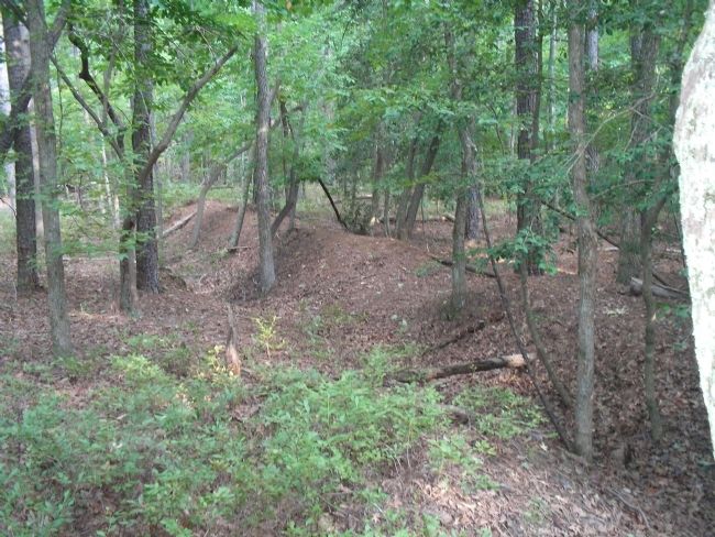
These earthworks, part of the Warwick-Yorktown line, are described on the marker as "one of the best preserved Civil War earthen fortifications in the country." They are found very near the marker, along the walking path.
Credits. This page was last revised on July 2, 2025. It was originally submitted on September 8, 2008, by Bill Coughlin of Woodland Park, New Jersey. This page has been viewed 1,959 times since then and 38 times this year. Last updated on July 2, 2025, by Evan Dwyer of Richmond, Virginia. Photos: 1, 2, 3, 4. submitted on September 8, 2008, by Bill Coughlin of Woodland Park, New Jersey. • Devry Becker Jones was the editor who published this page.
