Logan in Cache County, Utah — The American Mountains (Southwest)
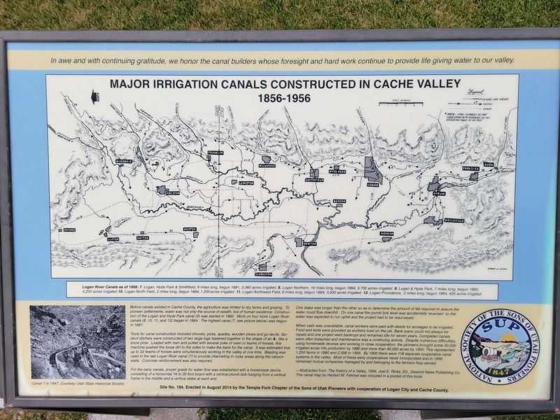
Major Irrigation Canals Constructed in Cache Valley
Photographed by Jeremy Snow, June 22, 2025
1. Major Irrigation Canals Constructed in Cache Valley Marker
In awe and with continuing gratitude, we honor the canal builders whose foresight and hard work continue to provide life giving water to our valley.
(map caption) Logan River Canals as of 1956 7. Logan Hyde Park & Smithfield, 9 miles long, begun 1881, 3,060 acres irrigated 8. Logan Northern, 16 miles long, begun 1864, 3,700 acres irrigated 9. Logan & Hyde Park, 7 miles long, begun 1860, 4,250 acres irrigated 10. Logan North Field, 2 miles long, begun 1864, 1,200 acres irrigated 11. Logan Northwest Field, 8 miles long, begun 1864, 3,000 acres irrigated 12. Logan-Providence, 2 miles long, begun 1864, 420 acres irrigated
Before canals existed in Cache County, the agriculture was limited to dry farms and grazing. To pioneer settlements, water was not only the source of wealth, but of human existence. Construction of the Logan and Hyde Park canal (9) was started in 1860. Work on four more Logan River canals (8, 10, 11, and 12) began in 1864. The highest canal (7, see picture below) was begun in 1881.
Tools for canal construction included shovels, picks, spades, wooden plows and go-devils. Go-devil ditchers were constructed
this page online
For the early canals, proper grade for water flow was established with a homemade device consisting of a horizontal 16 to 20 foot board with a vertical plumb bob hanging from a vertical frame in the middle and vertical stake at each end.
One stake was longer than the other so as to determine the amount of fall required to assure the water could flow downhill. On one canal the plumb bob level was accidentaly reversed so the water was expected to run uphill and the project had to be resurveyed.
When cash was unavaliable, canal workers were paid with deeds for acreages to be irrigated. Food and tents were provided as workers lived on the job. Bank
Photographed by Jeremy Snow, June 22, 2025
2. Major Irrigation Canals Constructed in Cache Valley Marker
Abstracted from The History of a Valley, 1956, Joel E. Ricks, Ed., Deseret News Publishing Co. This canal map by Herbert M Fenmal was included in a pocket of this book
Erected 2014 by Sons of Utah Pioneers. (Marker Number 184.)
Topics and series. This historical marker is listed in these topic lists: Agriculture • Settlements & Settlers • Waterways & Vessels. In addition, it is included in the Sons of Utah Pioneers series list. A significant historical year for this entry is 1860.
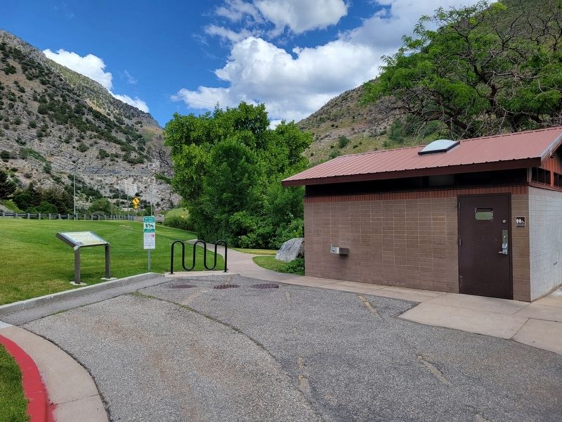
Location. 41° 44.568′ N, 111° 47.266′ W. Marker is in Logan, Utah, in Cache County. It is on U.S. 89, on the right when traveling east. Marker located at the north end of the park near the restroom building. Touch for map. Marker is at or near this postal address: 1765 US-89, Logan UT 84321, United States of America. Touch for directions.

Regionally, this marker is in the Cache Valley. It is also in the American Mountain West and on the Colorado Plateau. Globally, it is in North America, the Rocky Mountains, the Western Hemisphere, the Western World, and the Anglosphere. Historically, it finds itself in what was once New Spain and also Mexico’s Alta California.
Other nearby markers. At least 8 other markers are within 2 miles of this marker, measured as the crow flies: Unknown Pioneers Of Logan (approx. 1.2 miles away); Peter Maughan (approx. 1.2 miles away); Home Economics/Commons Building (approx. 1.3 miles away); Merlin J. Olsen (approx. 1.3 miles away); Old Main Building (approx. 1.4 miles away); The Scotsman (approx. 1.4 miles away); Logan Community Center (approx. 1.9 miles away); Whittier School (approx. 1.9 miles away). Touch for a list and map of all markers in Logan.
Credits. This page was last revised on July 3, 2025. It was originally submitted on July 2, 2025, by Jeremy Snow of Cedar City, Utah. This page has been viewed 221 times since then and 90 times this year. Photos: 1, 2. submitted on July 2, 2025, by Jeremy Snow of Cedar City, Utah. • Andrew Ruppenstein was the editor who published this page.
