Queenston in Niagara-on-the-Lake in Niagara Region, Ontario — Central Canada (North America)
The Niagara Escarpment
L'Escarpment Du Niagara
Photographed by Dale K. Benington, July 27, 2011
1. The Niagara Escarpment Marker
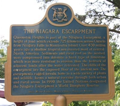
A close-up view of the English text side of the historical marker.

Queenston Heights is part of the Niagara escarpment, a height of land which extends 725 kilometers across Ontario from Niagara Falls to Manitoulin Island. Over 430 million years ago, a shallow tropical sea covered most of central North America. Sediments and coral reef on the seabed were compressed into dolomite, a hard type of limestone which was more resistant to erosion then the bedrock of the adjacent lands after the water retreated. The cliffs of the escarpment are the exposed floor of the ancient sea. The escarpment's rugged terrain, home to a wide variety of plants and wildlife, forms a natural corridor through both urban and rural areas. In 1990, the United Nations designated the Niagara Escarpment a World Biosphere Reserve.
this page online
Erected by Ontario Heritage Foundation, Ministry of Culture, Tourisim and Recreation.
Topics and series. This historical marker is listed in this topic list: Natural Features. In addition, it is included in the Canada, Ontario Heritage Trust series list.
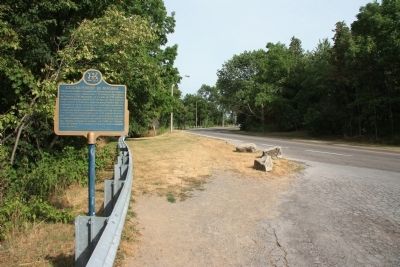
Location. 43° 9.692′ N, 79° 2.994′ W. Marker is in Niagara-on-the-Lake, Ontario, in Niagara Region. It is in Queenston. It is on Niagara River Parkway south of York Street, on the left when traveling south. This historical marker stands along the Canadian side of the Niagara River, along the roadway that snakes its way from the base to the crest of the Niagara Escarpment, in a roadside park that provides a scenic over-view of
Photographed by Dale K. Benington, July 27, 2011
2. The Niagara Escarpment Marker
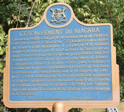
A close-up view of the French text side of the historical marker.

Regionally, this marker is on the Golden Horseshoe and in Niagara Canada. It is also in Central Canada. Globally, it is in North America, on the Great Lakes, in the Western Hemisphere, in the Western World, and in the Anglosphere. Historically, it finds itself in what was once a British colony, the Viceroyalty of New France, the Haudenosaunee (Iroquois) Confederacy, and Rupert’s Land.
Other nearby markers. At least 8 other markers are within walking distance of this marker: Chloe Cooley (within shouting distance of this marker); Site of Redan Battery (within shouting distance of this marker); The Capture of the Redan and the Death of Brock (within shouting distance of this marker); The Treacherous River Cliff / La falaise traîtresse (about 150 meters away, measured in a direct line); Roy Terrace (about 150 meters away); Laura Ingersoll Secord (about 150 meters away); Attack / L'attaque (about 180 meters away); The Decisive Battle / La bataille décisive
Photographed by Dale K. Benington, July 27, 2011
3. The Niagara Escarpment Marker
View of the historical marker looking south along the Niagara Parkway.
Another marker is no longer nearby. The Counter-Offensive Takes Shape / La contre-offensive prend forme (was about 210 meters away but has been confirmed missing).
Photographed by Dale K. Benington, July 27, 2011
4. The Niagara Escarpment Marker
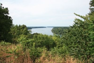
View of the Niagara River as seen from the historical marker's location on the crest of the Niagara Escarpment.
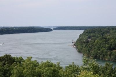
Photographed by Dale K. Benington, July 27, 2011
5. The Niagara Escarpment Marker
Another, more close-up view of the Niagara River as seen from the historical marker's location on the crest of the Niagara Escarpment.
Credits. This page was last revised on July 8, 2025. It was originally submitted on January 14, 2012, by Dale K. Benington of Toledo, Ohio. This page has been viewed 1,033 times since then and 54 times this year. Last updated on July 4, 2025, by Kevin Westell of St. Catharines, Ontario. Photos: 1, 2, 3, 4, 5. submitted on January 14, 2012, by Dale K. Benington of Toledo, Ohio. • Devry Becker Jones was the editor who published this page.
