Webster Station in Dayton in Montgomery County, Ohio — The American Midwest (Great Lakes)
Patterson Commons, 1930s: Patterson Boulevard Construction
| — | Patterson Boulevard Canal Parkway | — |
Photographed by Craig Doda, June 28, 2025
1. Patterson Commons, 1930s: Patterson Boulevard Construction Marker
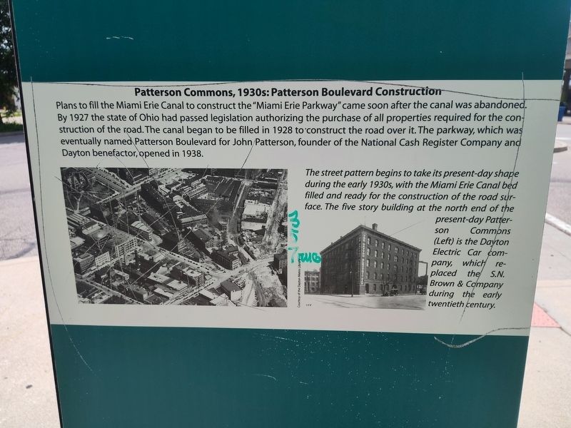
Plans to fill the Miami Erie Canal to construct the "Miami Erie Parkway" came soon after the canal was abandoned. By 1927 the state of Ohio had passed legislation authorizing the purchase of all properties required for the construction of the road. The canal began to be filled in 1928 to construct the road over it. The parkway, which was eventually named Patterson Boulevard for John Patterson, founder of the National Cash Register Company and Dayton benefactor, opened in 1938.
The street pattern begins to take its present-day shape during the early 1930s, with the Miami Erie Canal bed filled and ready for the construction of the road surface. The five story building at the north end of the present-day Patterson Commons (Left) is the Dayton Electric Car company, which replaced the S.N. Brown & Company during the early twentieth century.
Topics. This historical marker is listed in these topic lists: Industry & Commerce • Roads & Vehicles • Waterways & Vessels. A significant historical year for this entry is 1927.
Location. 39° 45.474′ N, 84° 11.251′ W. Marker is in Dayton, Ohio, in Montgomery County. It is in
this page online

Regionally, this marker is in the Miami Valley. It is also in the American Midwest and in the Corn Belt. Globally, it is in North America, the Western Hemisphere, the Western World, and the Anglosphere. Historically, it finds itself in what was once the Haudenosaunee (Iroquois) Confederacy, the territory of the Mississippian Culture, and the Northwest Territory.
Other nearby markers. At least 8 other markers are within walking distance of this marker: Patterson Commons, 1980s-1990s: Claiming Public Space (here, next to this marker); Patterson Commons, 1890s: The Miami Erie Canal Era (here, next to this marker); Patterson Commons: The 1913 Flood and Aftermath (here, next to this marker); Fluid Dynamics (here, next to this marker); Patterson Commons, 1970s: Space for Automobiles (here, next to this marker); Patterson Commons - The Evolution Of An Urban Space

Photographed by Craig Doda, June 28, 2025
2. Patterson Commons, 1930s: Patterson Boulevard Construction Marker
Credits. This page was last revised on July 26, 2025. It was originally submitted on July 4, 2025, by Craig Doda of Napoleon, Ohio. This page has been viewed 80 times since then and 13 times this year. Photos: 1, 2. submitted on July 4, 2025, by Craig Doda of Napoleon, Ohio. • Devry Becker Jones was the editor who published this page.
